California. High Desert Landscapes of Mojave National Preserve
Growing up in southern California, I began visiting what is now Mojave National Preserve (MNP) in the early 1980s. Wedged between U.S. Interstates 40 and 15, the 6,243 square kilometer preserve is in San Bernardino County. Although part of the U.S. National Park System, the MNP isn’t especially well known. Within its boundaries are Providence Mountains State Recreation Area and Kelso Dunes, the largest aeolian sand field within the Mojave Desert. The preserve is named for the Mojave Desert which together with the Great Basin, Chihuahuan, and Sonoran Deserts, form the North American Desert. The Mojave is considered a “high desert” because its elevations lie between 610 and 1,220 meters above sea level. Today, the preserve receives about 425,000 visitors a year.
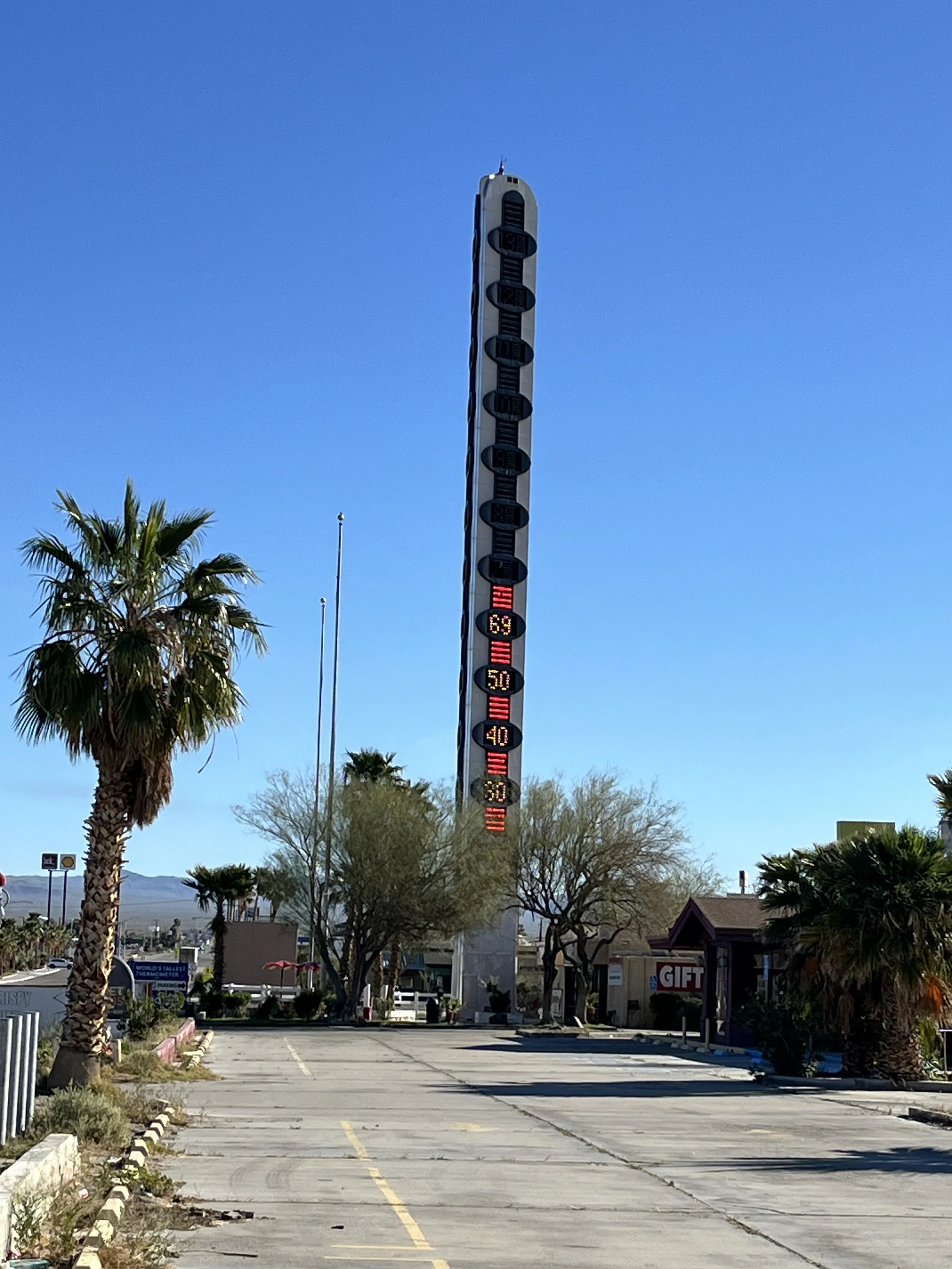
My most recent journey to MNP began in the city of Baker, found along U.S. Interstate 15. After buying fuel, we made a brief stop at the world’s largest thermometer, a 41-meter-high steel sign built by Baker businessman Willis Herron. Herron had the sign constructed next to his restaurant called “Bun Boy.” In 2000 Herron sold the restaurant and in 2012, a new owner switched the sign off after complaining about its US$8,000 per month electricity bill. Two years later Herron’s wife bought back the sign and replaced its incandescent bulbs with LEDs. Departing Baker, we followed Kelbaker Road, a paved two-lane highway that bisects the preserve along a northwest to south transect. After a mile or so we passed a sign warning that no gas is available within the preserve. We continued, passing the Cinder Cone Lava Beds lying to the north. Our route offered views of the Marl Mountains to the northeast and the Kelso Mountains to the southeast.
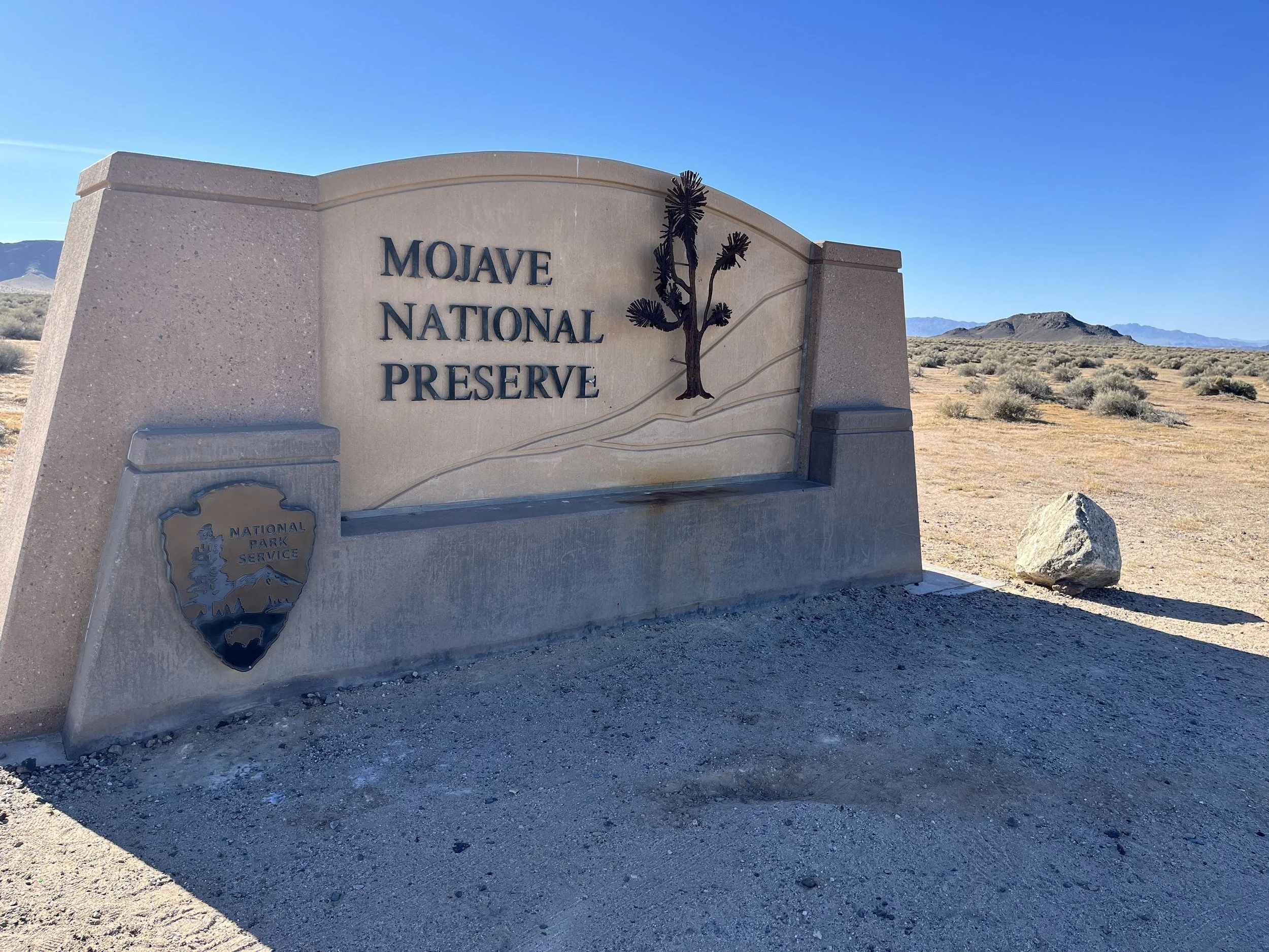
MNP was created through a provision of the 1994 California Desert Protection Act. Among opponents of the act and preserve was U.S. House Ways and Means Committee Chair Jerry Lewis (R-CA) who succeeded in appropriating just one dollar for the preserve’s first year budget. Like other national preserves, MNP’s enabling legislation allows activities normally forbidden in U.S. national parks such as hunting and ranching. The preserve has private inholdings within its borders including the ghost town of Ivanpah and the villages of Zzyzx and Cima. A 281,300-hectare federal wilderness area is also inside the preserve’s boundaries.
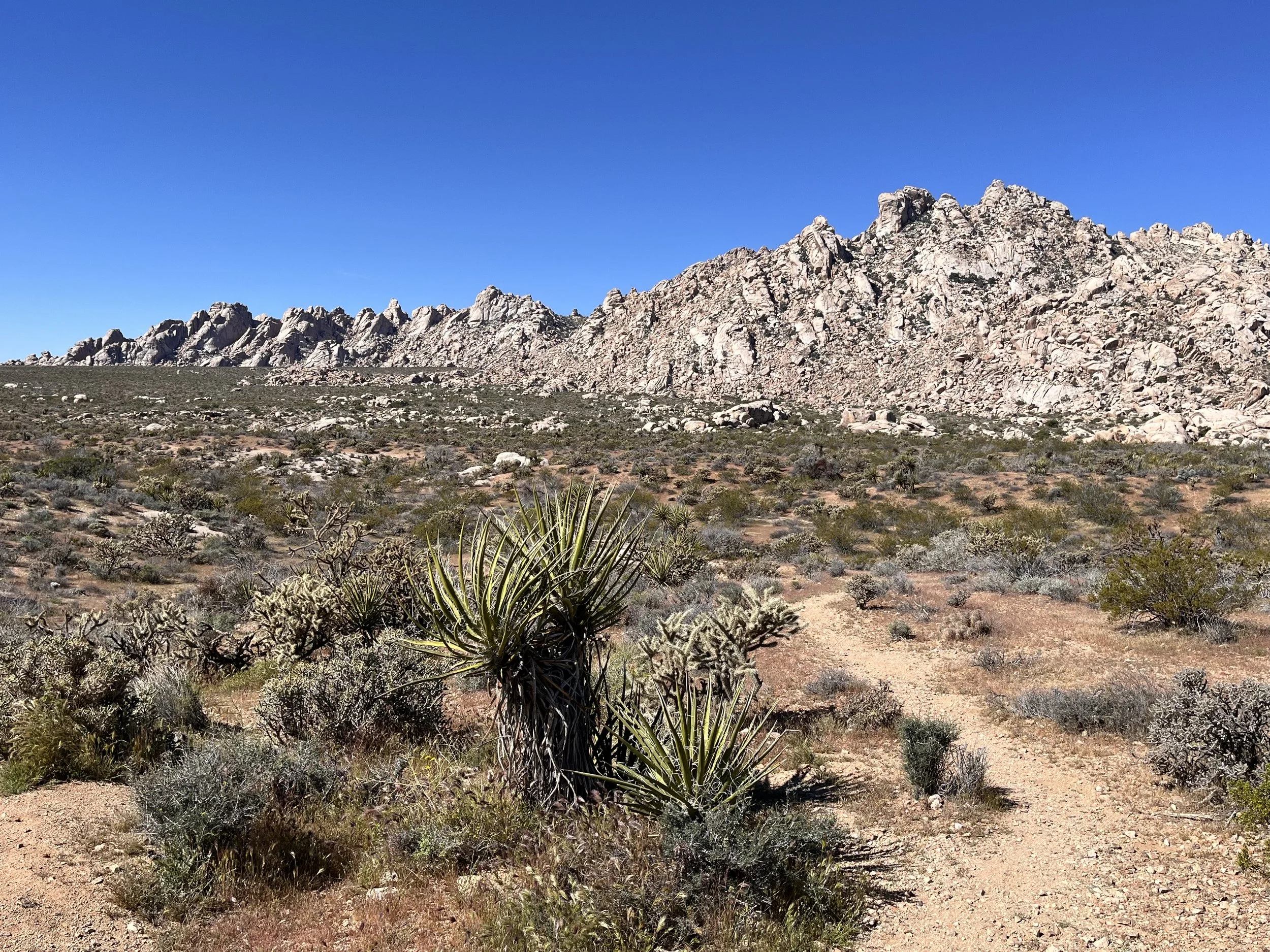
MNP’s geology is characterized by rock formed under shallow waters during the Precambrian era including mudstone, conglomerate, and carbonate rock. The region was submerged again during the Paleozoic era. Subsequently, mountain ranges formed when the Farallon Crustal Plate was pushed under the Pacific Plate within a subduction zone that also produced volcanic eruptions. Today, the Providence and Granite Mountains block prevailing winds, contributing to a rain shadow that limits annual precipitation to 86 millimeters near Baker and 230 millimeters in the mountains.
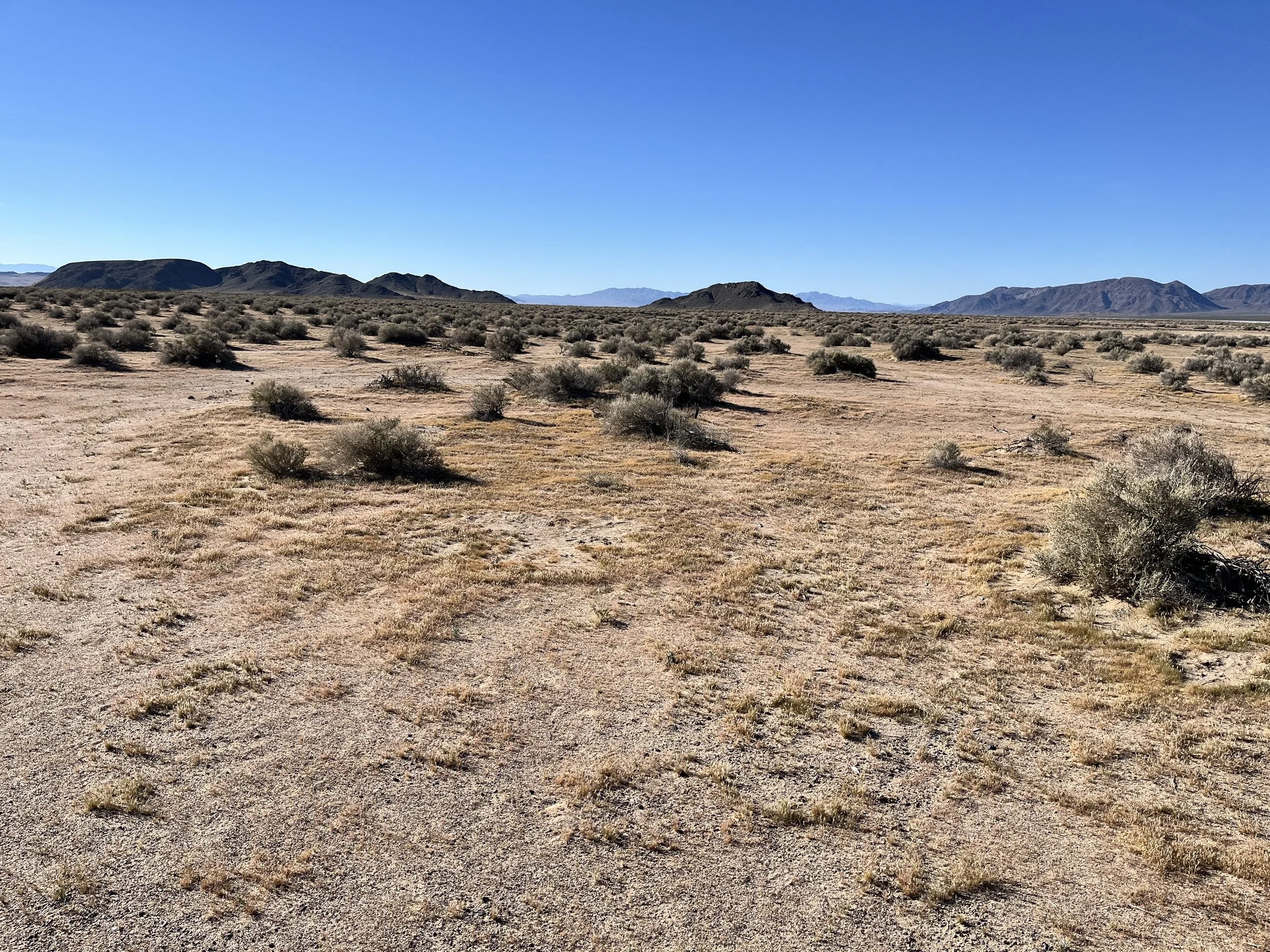
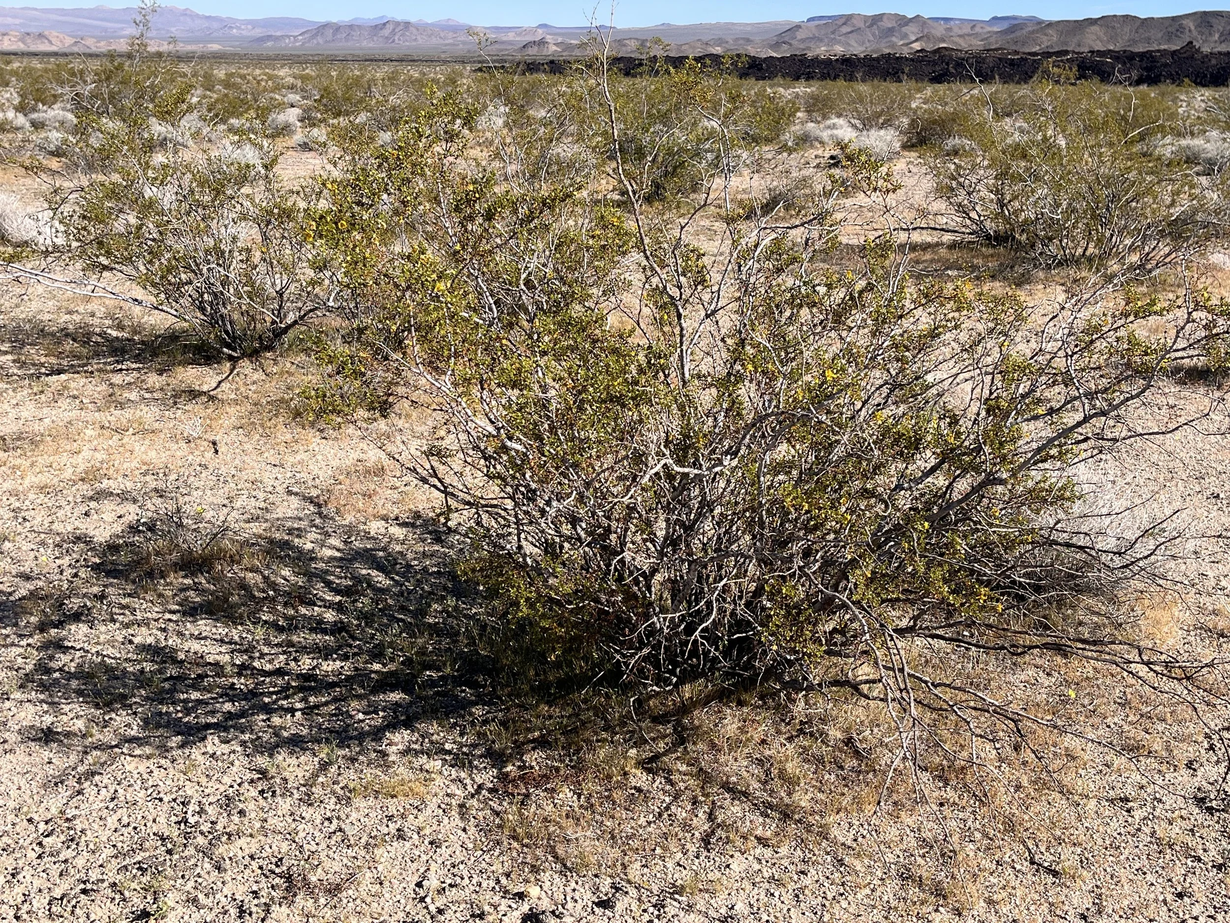
The preserve’s diverse range of plants includes hedgehog cactus, desert mallow, sagebrush, brittlebush, and yucca-like Joshua trees. At higher elevations are vegetative communities such as Pinyon-juniper woodlands. Most abundant is the creosote bush. Widely spaced, creosotes excrete toxins that inhibit the growth of other plants that compete for water. With individual plants estimated to be more than 11,000 years old, creosotes are (arguably) the world’s oldest living organisms. MNP’s animals include sharp-clawed desert tortoises that excavate nests sites in the sandy soil. National Park Service staff recommend that visitors check under vehicles for tortoises before driving. There are also desert bighorn sheep, mountain lions, rattle snakes, and road runners.
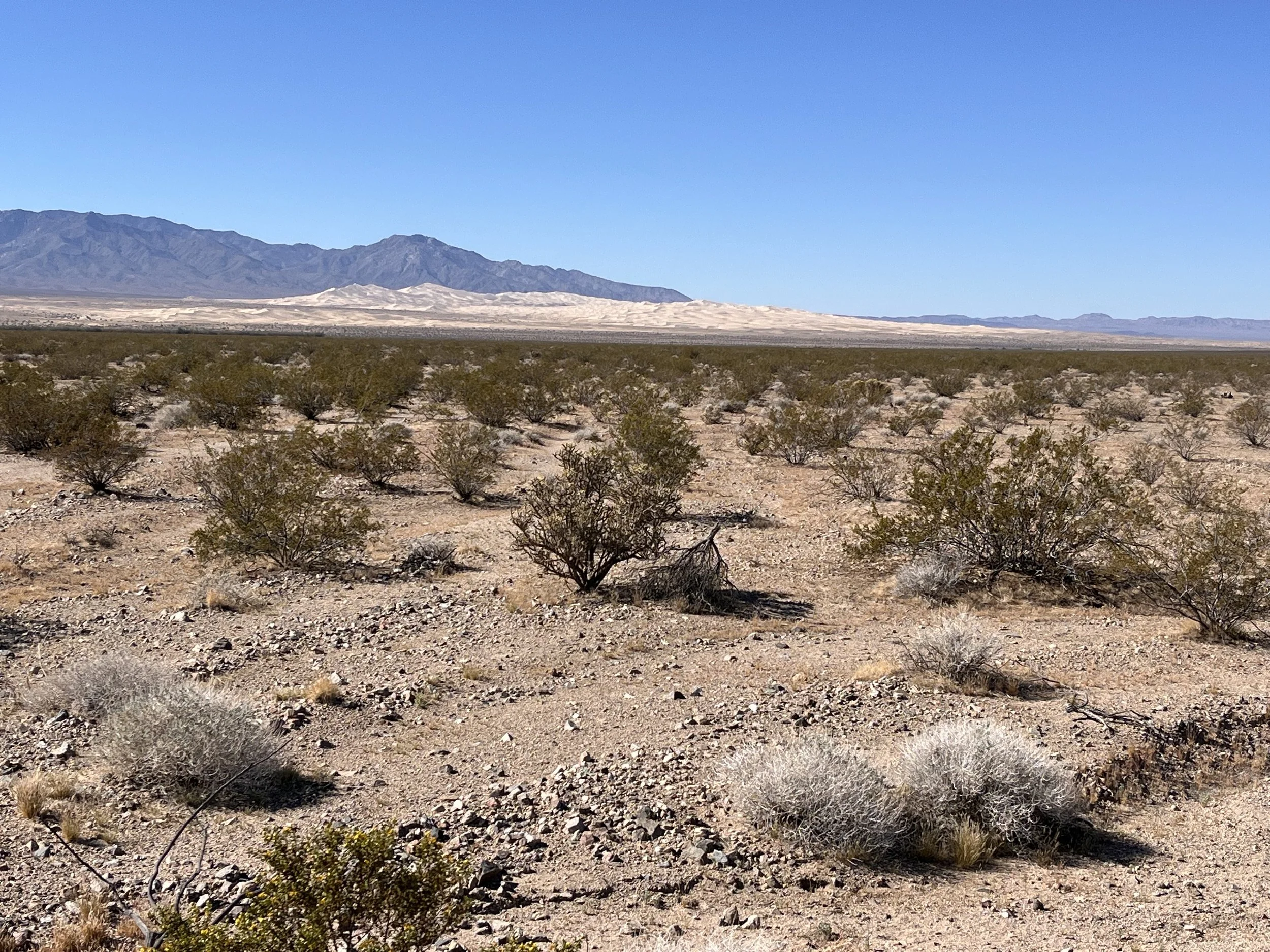
Early European explorers to the area include a Franciscan friar named Francisco Garcés in 1776 and Jedediah Smith who guided an expedition through the region in 1826. Although most grazing leases were retired in the early 2000s, one working ranch is still within the preserve’s boundaries. Other long-abandoned facilities include mines, homesteads, and military outposts from the 1860s. There are also military camps used by General George Patton’s soldiers to train for tank warfare in the years leading up to WWII. A little over half-way through the preserve we reached Kelso Depot and the NPS visitor center. About 20 minutes later we passed the turn-off for Kelso Dunes. Lying to the west, the dunes were created by southwest winds that transport sand from the Mojave River Sink, east of Afton River Canyon, to the base of the Granite Mountains. The area is not a single dune field, but a series of dunes stacked on top of each other. Over time the dunes have grown larger, especially during drier climatic periods when fewer plants were in place to stabilize drifting sands. Passing the Granite Mountains, we continued towards the southern edge of the preserve and U.S. Interstate 40.