New Mexico. Puebloan Cliff Dwellings and a Super Volcano in the Southern Rockies
The U.S. National Park System contains dozens of lesser known “hidden gems.” Two of my favorites are located in northwest New Mexico: Valles (pronounced “va-yes”) Caldera National Preserve and Bandelier National Monument. Positioned 21 kilometers northwest of Los Alamos, Valles Caldera preserves volcanic domes, hot springs, fumaroles, grassy valleys, and forests of Douglas fir, Engelmann spruce, and Ponderosa pine. The 360 square kilometer preserve shares a boundary with Bandelier National Monument (136 square kilometers), located to the southeast within the Jemez Mountains and along the Pajarito Plateau. At Bandelier visitors can see some of the best-preserved adobe cliff structures in the U.S. Southwest. Because of their close proximity, it is possible to visit both national park units in a single day.
Valles Caldera’s central feature is a 22-kilometer-wide caldera (collapsed volcano) with a small lava dome located within its main bowl-shaped valley known as Valle Grande. Valle Grande was formed 1.25 million years ago when volcanic tuff was violently pushed upward in what geologists describe as a super eruption. Following the explosion, the ground subsided, creating circular faults called ring fractures. Today, the caldera is considered dormant, meaning that it is inactive but capable of erupting again. In terms of size, Valles Caldera is small compared to other super volcanoes such as the Yellowstone Caldera in Wyoming (the world’s largest and most active caldera). There is also evidence of a longstanding human presence in the area. Obsidian tools found within the preserve reveal that the area has been occupied by humans for at least 11,000 years. Arriving in the 1500s, Spanish settlers brought sheep and cattle and by the mid-1800s the caldera was being used for ranching and commercial logging. In 1876, the caldera became part of Baca Ranch. Valles Caldera National Preserve was created in 2000 by U.S. President William Clinton.
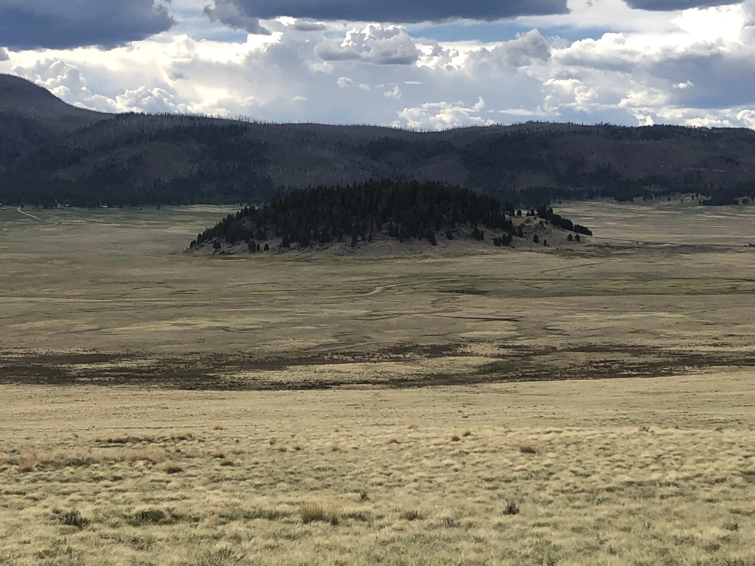
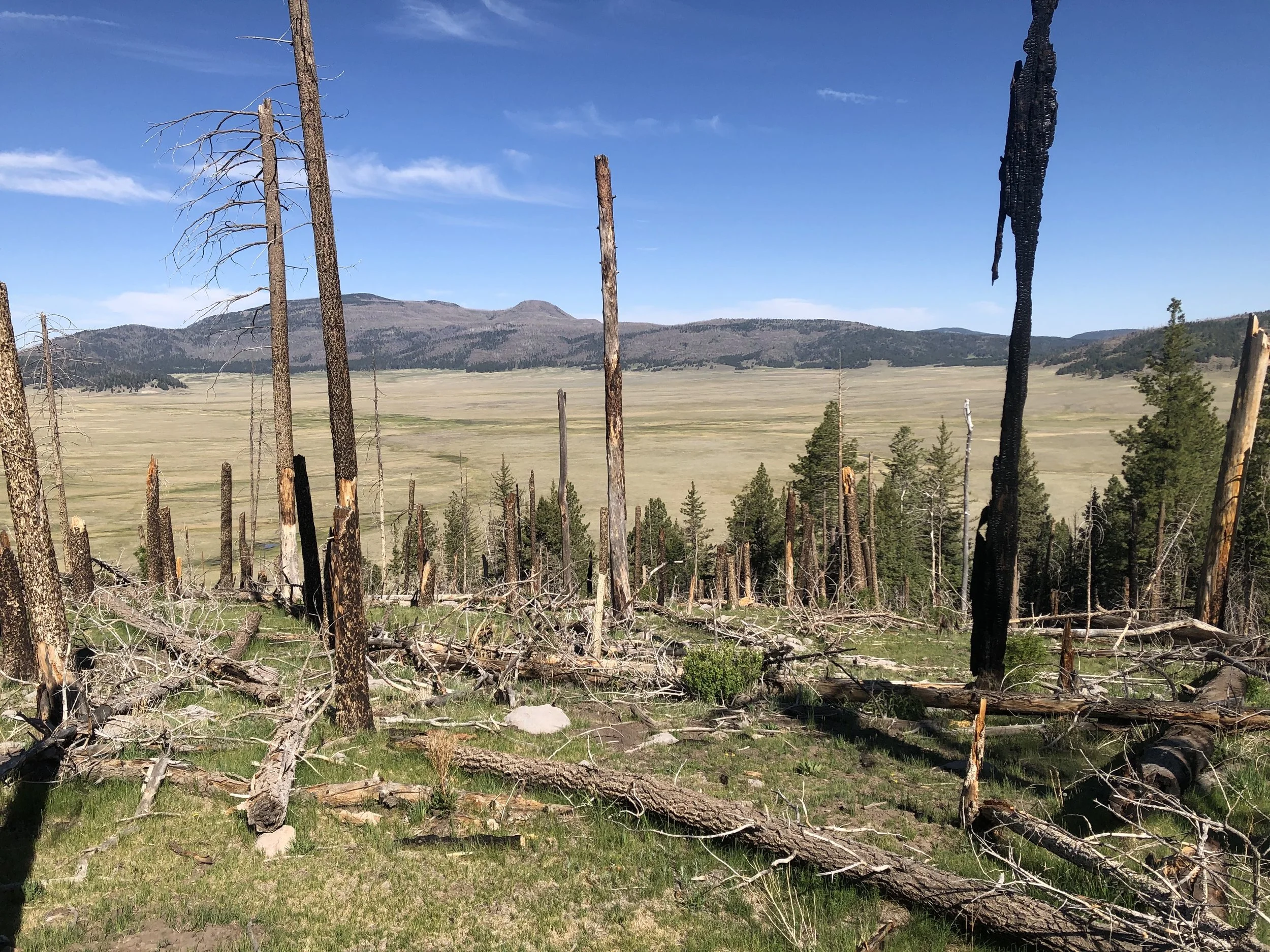
Driving east on New Mexico State Highway 4, we stopped at an overlook above Valle Grande and the small lava dome at its center called Cerro la Jara. A turnoff took us to the National Park Service entrance station which also serves as the preserve’s visitor center. Visitors wishing to drive beyond the entrance station must apply for a backcountry vehicle permit (only 35 are issued each day). With permit in hand, we drove several kilometers on a gravel road. Trees do not grow in the valley because cold air draining into the caldera at night creates freezing conditions that prevent saplings from taking root. Along the forest’s edge we passed the historic Cabin District which contains buildings used during the preserve’s ranching period. Fans of the TV series Longmire (2012-17) may recognize Sheriff Longmire’s log home. The preserve has a diversity of wildlife including elk, coyote, prairie dogs, badgers, mountain lions, black bears, and golden eagles. Returning to the entrance station/visitor center, my companion and I set out on the 2-kilometer Cerro la Jara Loop Trail. Formed 500,000 years ago by high-silica lava, the tree-covered lava dome rises 81 meters above Valle Grande.
We spent the night in Los Alamos before driving south to Bandelier National Monument. Along with forested areas and grasslands, Bandelier protects structures built and occupied by ancestral Puebloans between 1150 and 1600. Named in honor of Swiss-American anthropologist Adolph Bandelier, the monument was created in 1916 by U.S. President Woodrow Wilson. Adolph Bandelier was a self-taught ethnologist and anthropologist who arrived in the New Mexico Territory in 1880. The monument is located within an area that was blanketed by ash from Valles Caldera’s eruption with volcanic tuff deposits overlying Permian sandstone and shale.
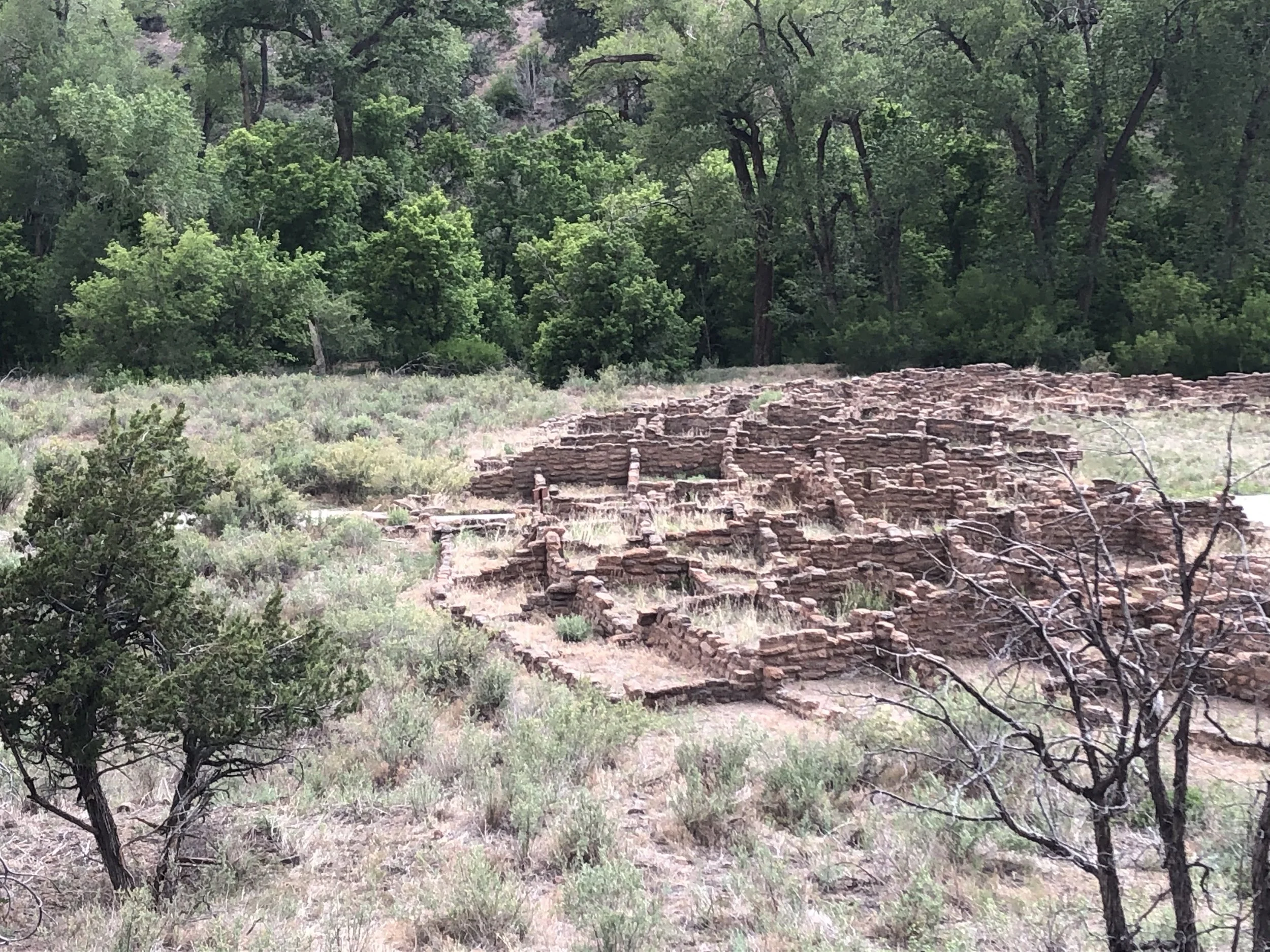
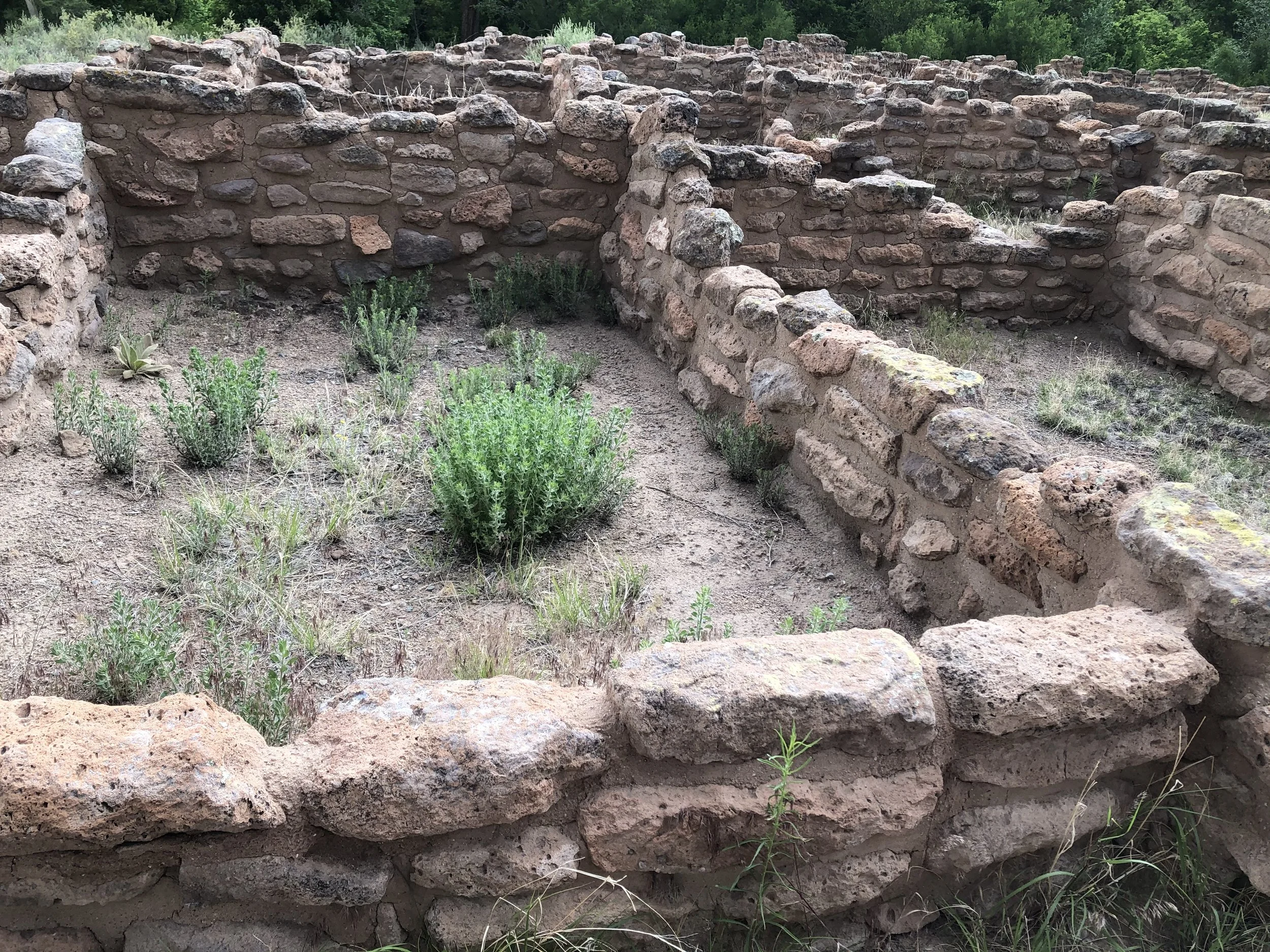
Puebloan peoples who inhabited Bandelier are descendants of hunter-gatherers who arrived in the area 10,000 years ago. Although archaeologists and others often refer to them by the Navajo word “Anasazi” (meaning ancient peoples), modern descendants prefer “ancestral Puebloan people.” Bandelier had two large villages, Tyuonyi and Tsankawi. Stopping at the visitor center, we followed the 1.9-kilometer Pueblo Loop Trail to the Tyuonyi Pueblo, located in Frijoles Canyon. The first structure we passed was Big Kiva. Located on the canyon floor and on each side of the trail, remnants of Tyuonyi are represented by the foundations of several buildings including a three-story round tower. Puebloans planted beans, corn, squash, and gathered native plants. They also hunted dear, squirrels, and rabbits and cultivated cotton that was woven into garments. The ancestral Puebloans made axes, mauls, and arrow points from obsidian rock and obtained turquoise and shells through trading networks that extended southward to Mexico. Spanish ranchers arrived during the 18th century. During the 1920s the Civilian Conservation Corps (CCC) built roads and several buildings to accommodate visitors including a lodge. The monument was closed during WWII while many of its structures were pressed into service to house workers involved in the Manhattan Project.
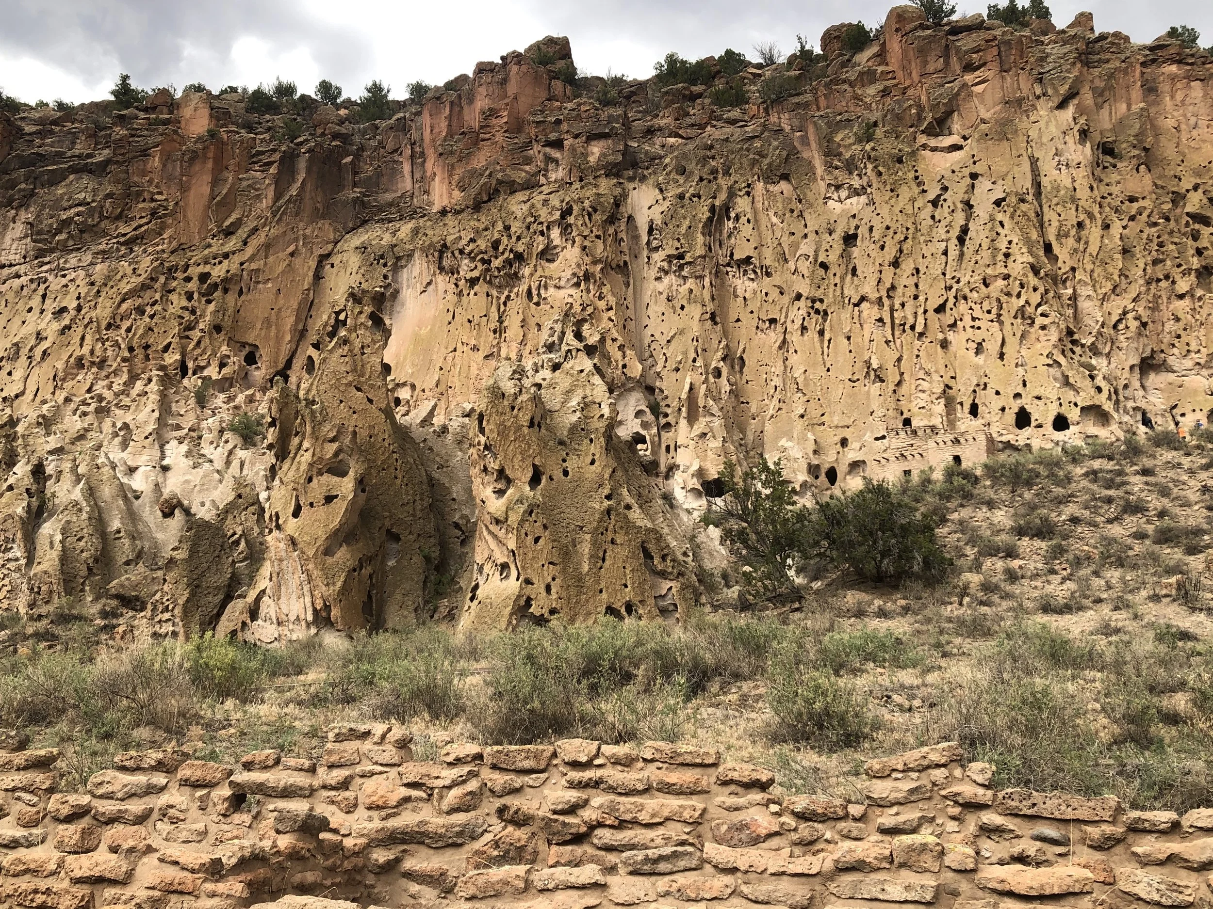
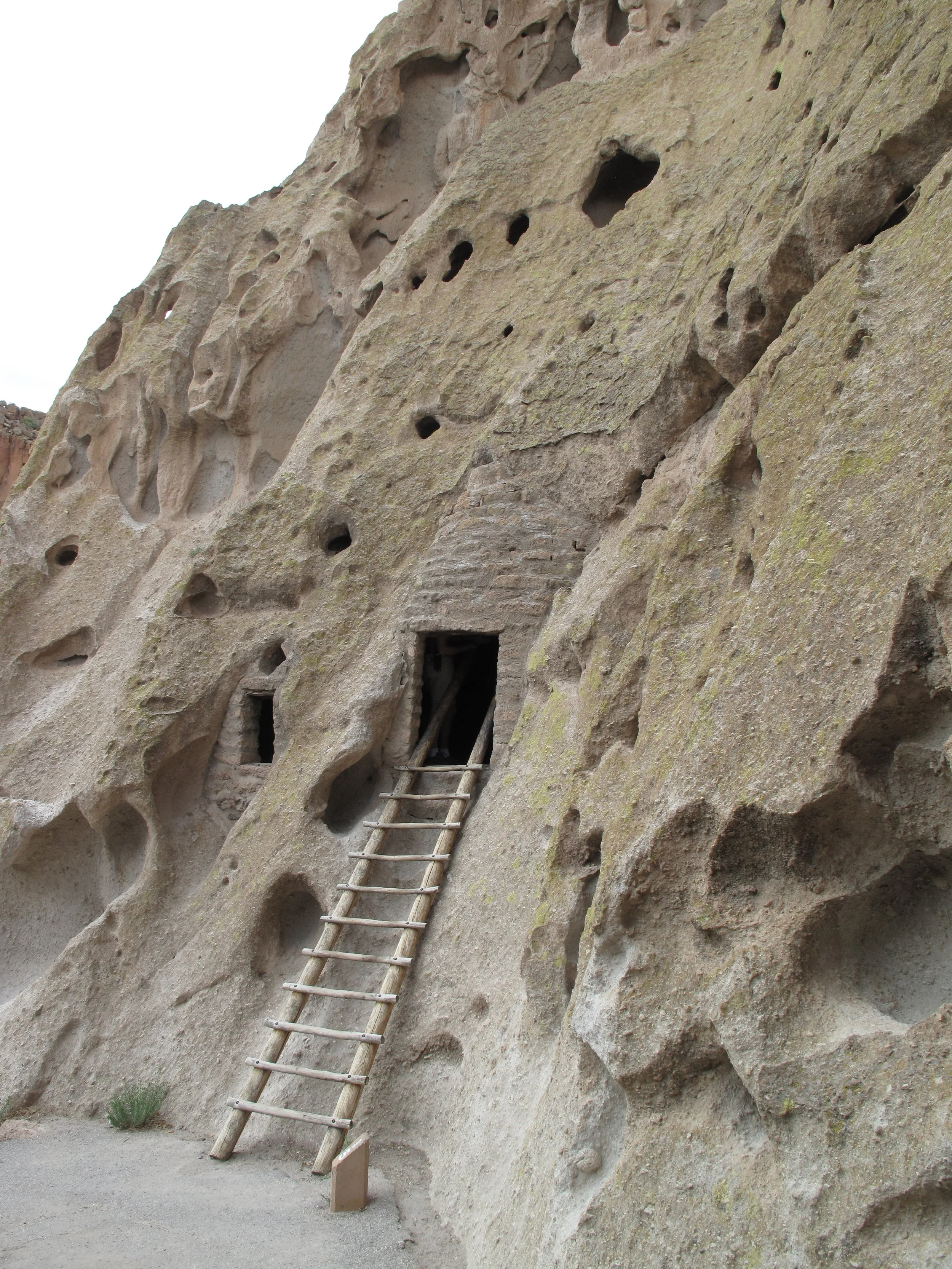
Located in cavates (voids in volcanic tuff) along the canyon’s walls are still intact adobe structures. Among these is Long House, a complex of cliff dwellings that has been made accessible to modern visitors by wooden ladders. Near the base of a rock overhang is a complex of reconstructed buildings called Talus House. More than 3,000 individual sites have been documented at Bandelier. Ancestral Puebloan villages accommodated multiple families with the largest structures having several hundred rooms. Archaeologists believe that pueblos at Bandelier were abandoned in the 1550s following a drought with most residents relocating to places to the east and south along the Rio Grande.