California. Off-the-Grid Landscapes of Southern California’s Salton Basin
The arid Salton Basin is an unlikely place to find California’s largest lake. Hydrologists would confirm that runoff from surrounding lands that include nearby mountain ranges is insufficient to sustain a lake with a surface area (820 square kilometers) larger than New York City. The Salton Sea is the byproduct of an agricultural accident that happened in 1905 when water flowing through an irrigation canal connected to the Colorado River broke through a headgate. For almost two years, the Colorado River poured millions of liters of water into the Salton Basin. In the years since the breach, the Salton Sea would have evaporated and disappeared if not for runoff from agricultural operations associated with the adjacent Coachella and Imperial Valleys. During the 1950s and 1960s the Salton Sea became a popular vacation destination featuring restaurants, marinas, hotels, and second homes. Today, the resorts and vacation homes are gone, in part because of environmental problems such as windblown fertilizer particles and other chemicals that entered the Sea with agricultural runoff.
The Salton Sea has come and gone before. The Colorado River’s course has flowed through the Salton Basin in the past, making it possible for ships to travel as far north as the Coachella Valley. In 1615 Spanish explorer Juan de Iturbe is reported to have sailed north from the Sea of Cortez (aka Gulf of California) to Cahuilla, a prehistoric lake that once filled the Salton Basin. Carrying a cargo of black pearls, his ship ran aground in shallow water. Stories about the lost pearls still circulate. In 1862 a local resident reported seeing the outline of a Spanish galleon in a marsh near the Salton Sea’s north shore and today a few committed treasure hunters continue to search for Iturbe’s valuable cargo.
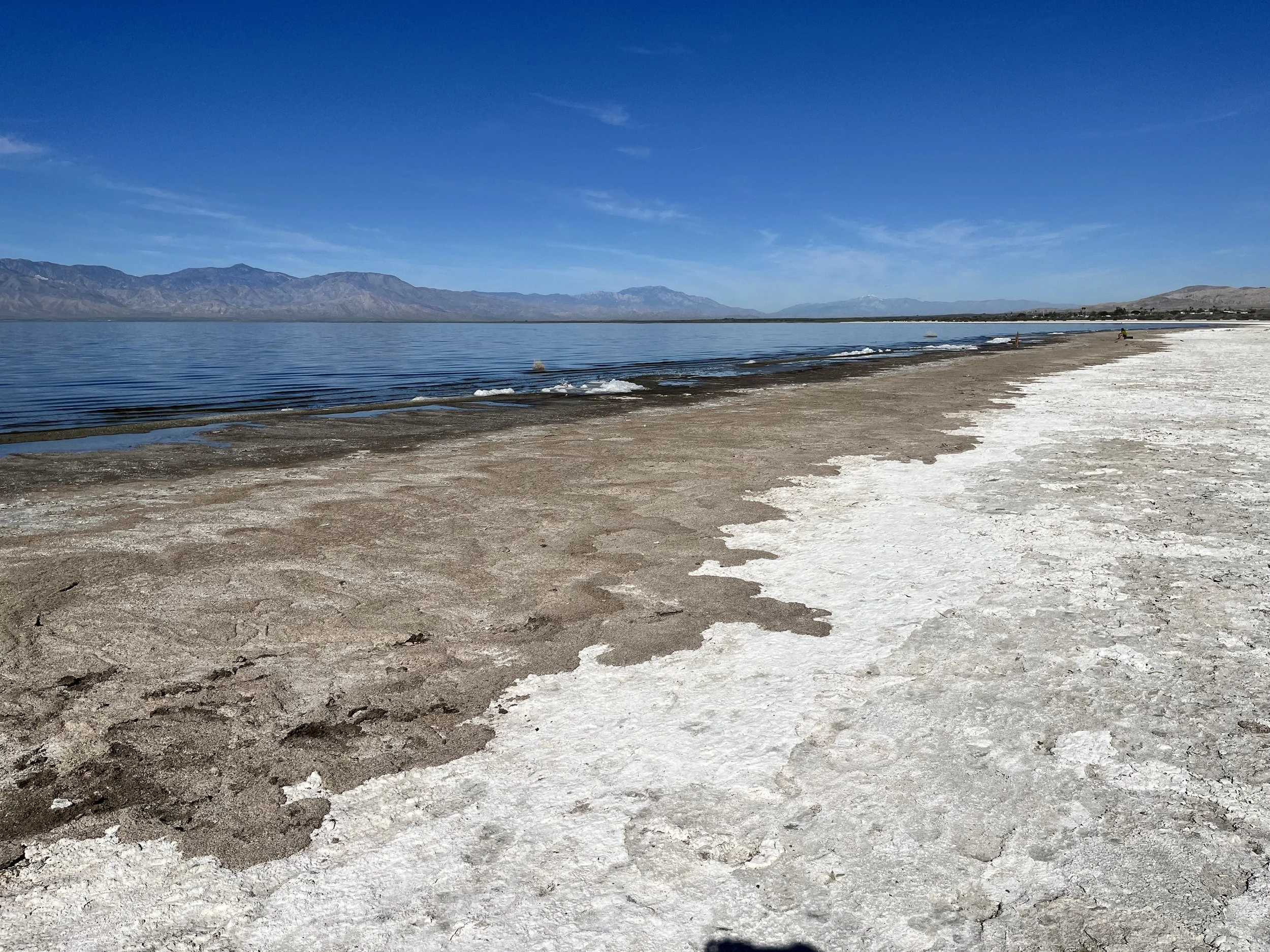
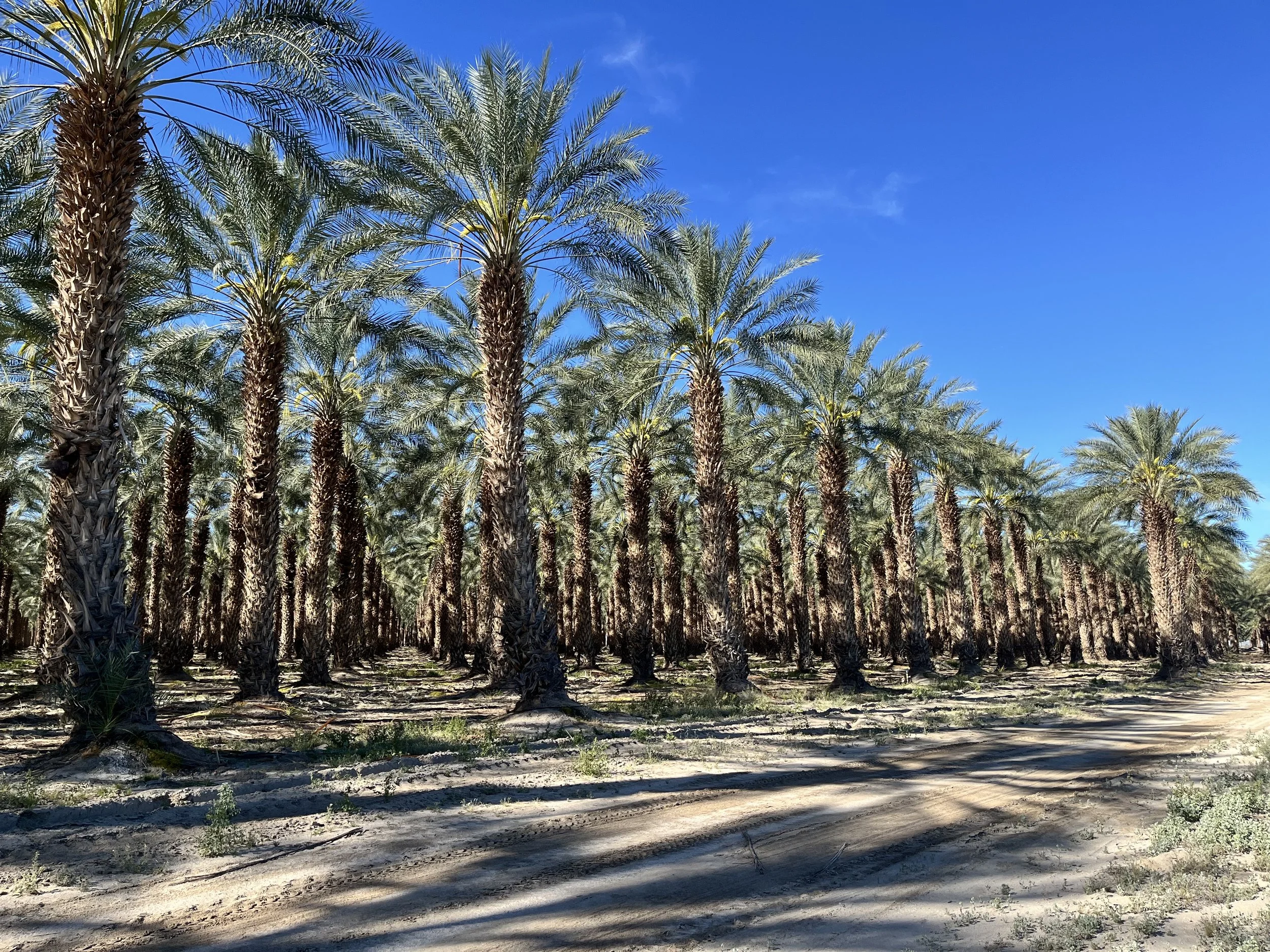
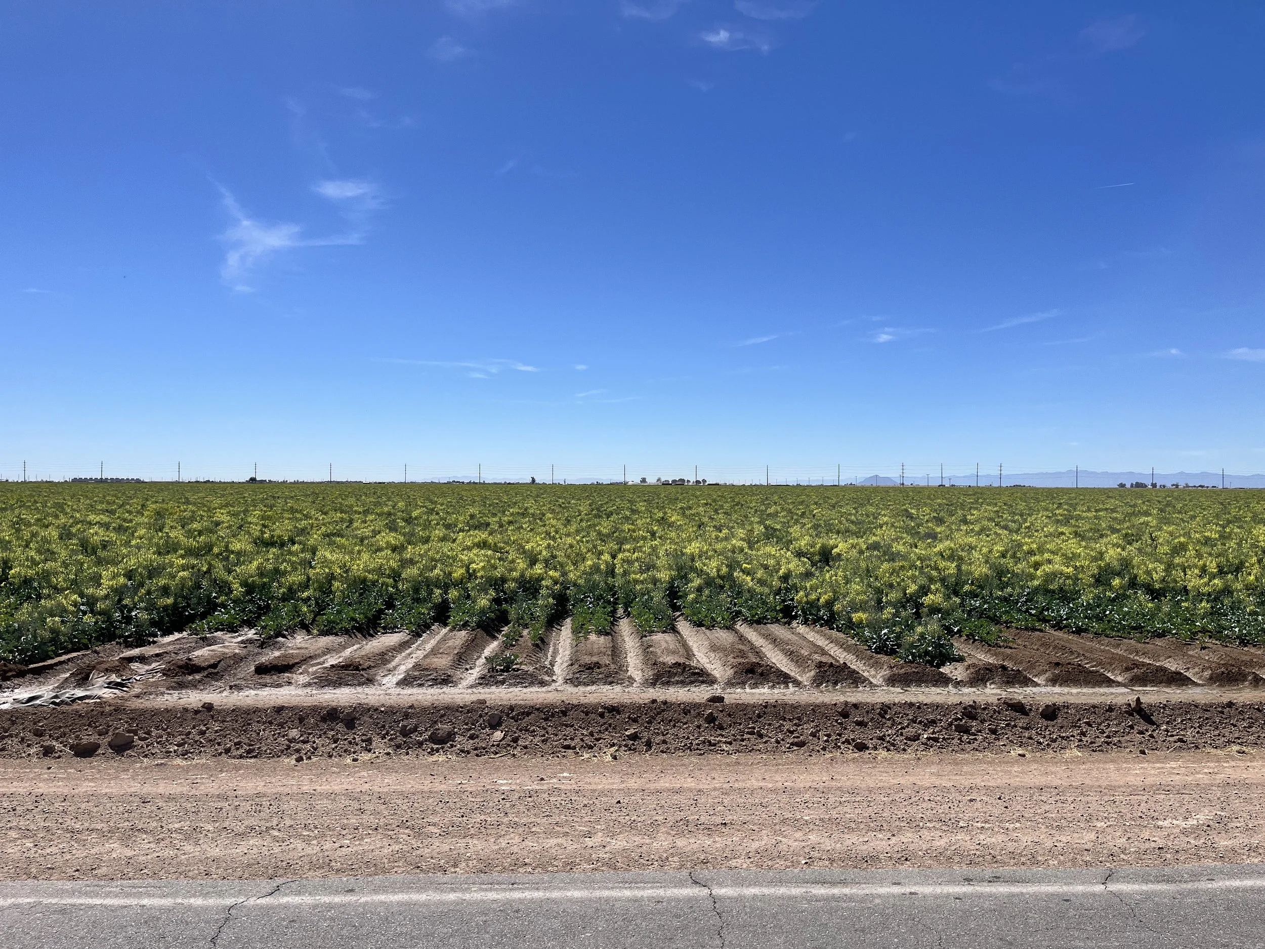
The Salton Sea has been on my “bucket list” for years so I convinced my wife to spend a few days exploring its shoreline on a 2026 trip to Southern California. Driving south, we followed State Route 111 through the Coachella Valley and along the Sea’s north shore. The Coachella is well known for producing asparagus, lettuce, carrots, broccoli, and watermelons and together, the Coachella and Imperial Valleys are responsible for 65% of winter vegetables consumed in the U.S. The eastern Coachella is also known as America’s date capital, producing about 90% of the country’s Medjool and Deglet Nour dates which thrive in the valley’s warm temperatures and low humidity. We continued south along the eastern shore with a stop at Salton Sea State Recreation Area. A short walk from the parking lot took us to the lake’s shoreline that has been receding as farmers have become more efficient in their use of water. With a dirty grey and white appearance, the Sea’s edge is devoid of vegetation because of high salinity. Water in the Salton Sea has 45-60 grams of sodium chloride (salt) per liter, almost double the amount present in the Pacific Ocean. High salt concentrations are due to the Sea’s location within an endorheic basin with no natural outlet (water escaping through seepage or evaporation leaves salt behind).
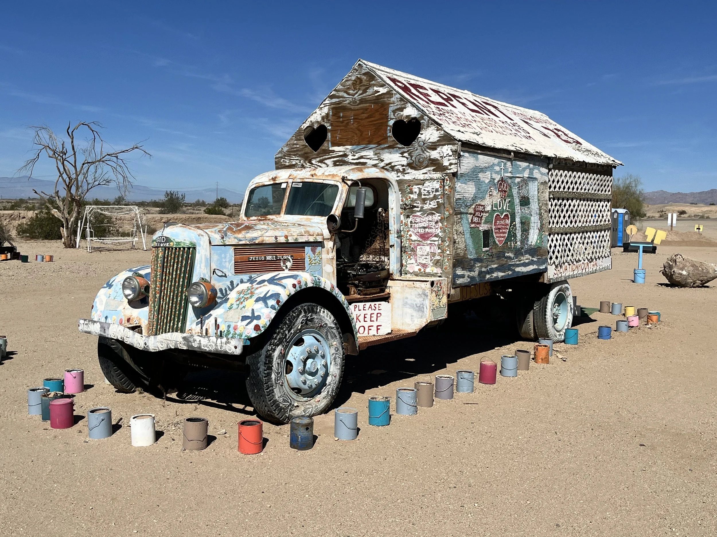
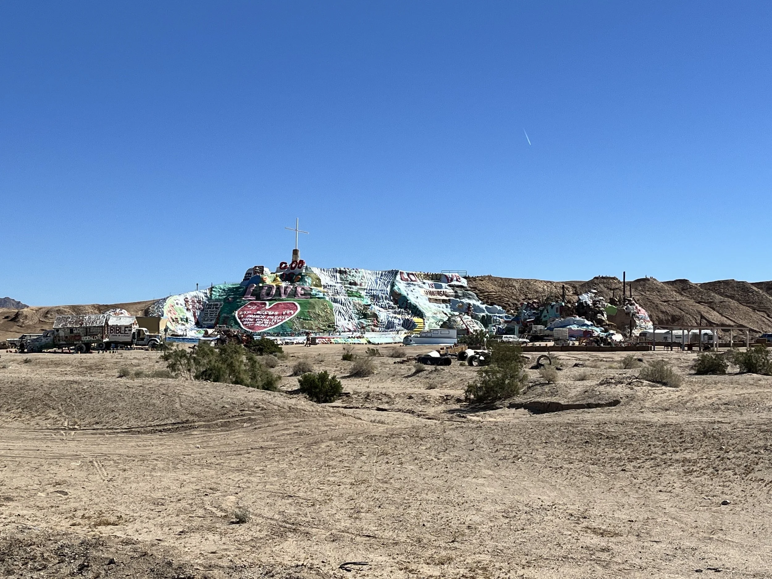
Passing the town of Niland on the Sea’s southeast corner, we departed from our pre-planned route for a visit to Slab City (aka “The Slabs”). Spread out across 2.6 square kilometers within a former U.S. Marine Corps base, Slab City is an unincorporated (squatter) community of artists, anarchists, eccentrics, retirees, and drifters. While 4,000 people live there during winter months, the population declines to 150 in the hot summer. Income received by residents comes from donations, disability payments, social security checks, and unemployment benefits. In the absence of utilities or services, residents must find creative ways to find water and power. Most utilize solar panels or generators for power and obtain fresh water from a tank stored at the community church. We negotiated a dirt road past trailers and dilapidated RVs, some surrounded by rocks meant to mark private outdoor spaces. Near the center of town is Salvation Mountain, a sprawling hilltop artwork made from automobile parts, discarded tires, and adobe bricks. The massive earthen sculpture was created by Leonard Knight (1931-2011). Thousands of gallons of paint covering Knight’s creation form a mosaic of images and text that includes bible verses. We stopped to talk with a woman whose name tag identified her as a docent for the Mountain. After answering a few questions about the Slabs, she mentioned that she had lived in Slab City for seven years.
Turning west, the highway ran along the edge of one of many irrigation canals that crosses the Imperial Valley which extends 80 kilometers southeast of the Salton Sea to the U.S./Mexico border. Subsequently, we joined California State Route 86. Turning west on State Route 78, we passed a large green sign surrounded by open desert. Featuring a raccoon holding an axe and a blazing yellow sun, the marker designates the border of the so-called Republic of Slowjamastan. The 4.48-hectare micronation was founded by San Diego disc jockey Randy Williams in 2021. Although without legal recognition, the Republic issues banknotes and passports that contain quotes from famous hip hop artists. About 19,000 have been granted “citizenship” by completing a form on Slowjamastan’s national website. Continuing a kilometer or so down the road, we passed a submarine conning tower which appeared to be inside the Republic’s boundary.
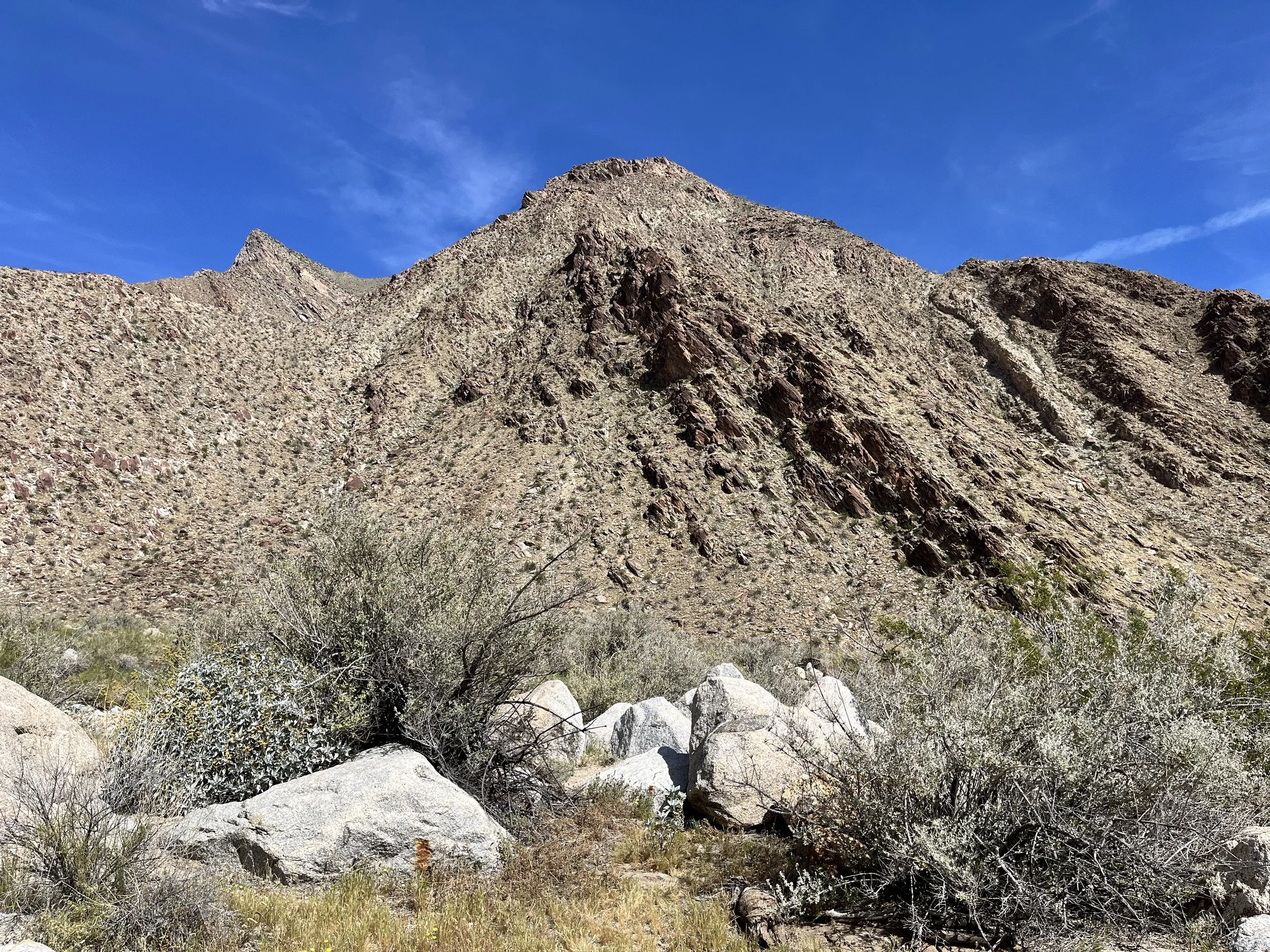
Before departing the Salton Basin, we stopped at Anza Borrego State Park (ABSP). Created in 1932 and named for the Spanish explorer Juan Bautista de Anza, Anza Borrego is California’s largest state park (260,000 hectares). Geographically, it is surrounded by the Vallecito Mountains to the south and the Santa Rosa Mountains to the north. With rugged badlands, clear natural springs, and red and yellow-colored arroyos, the park is home to animals ranging from bighorn sheep to roadrunners, mountain lions, jackrabbits, and golden eagles. Native American groups who once camped nearby include Cupeño, Cahuilla, and Kumeyaay peoples. Feature-length movies filmed in the state park include Andromeda Strain (1971), The Scorpion King (2007), and Into the Wild (2007). We hiked the 5-kilometer (round-trip) Borrego Palm Canyon Trail that leads up to a palm oasis.