Utah. Spectacle of Rock, Cloud, Sky, and Space
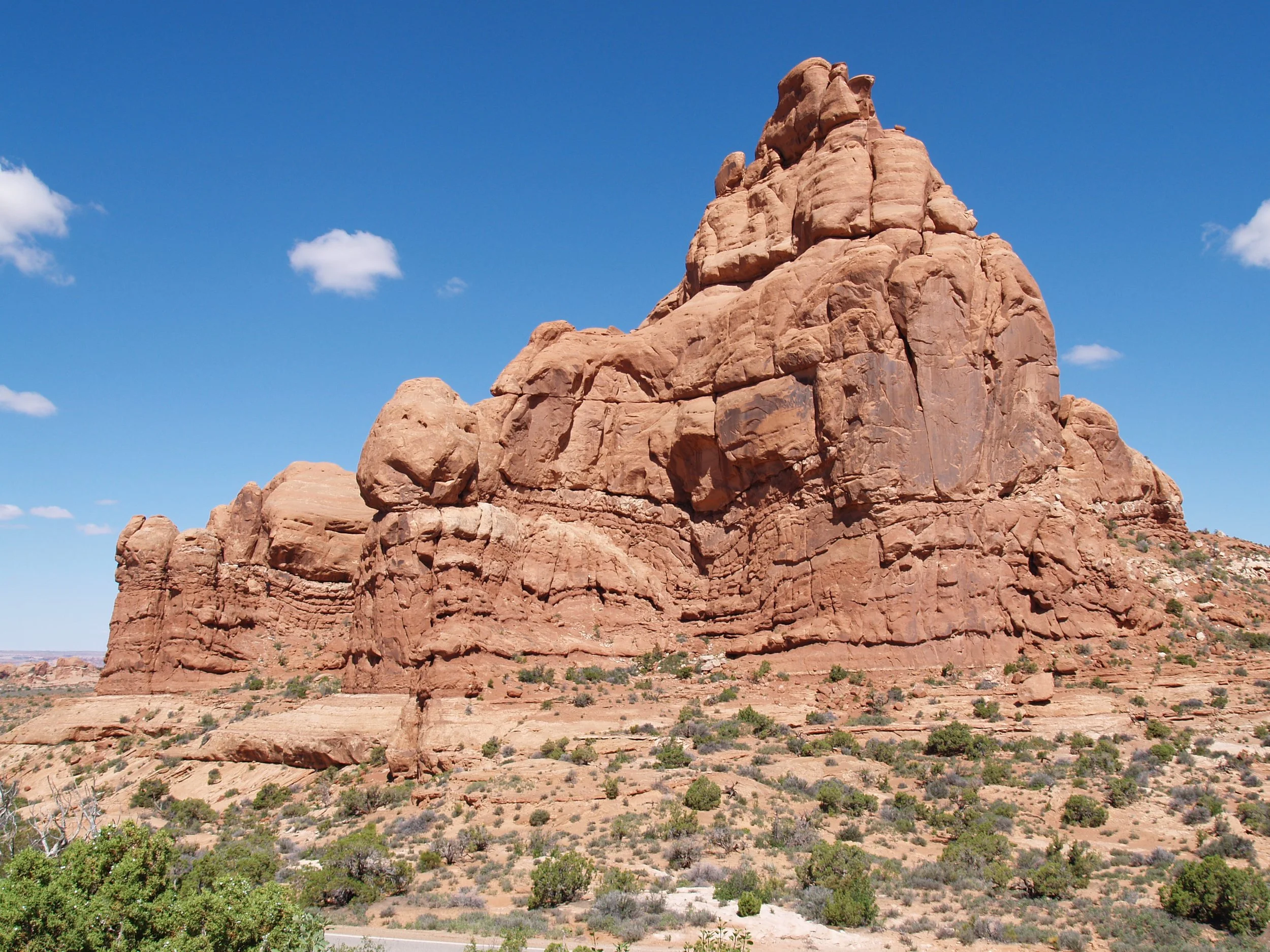
There’s a place in eastern Utah with the world’s largest concentration of naturally formed rock arches. Located in the Colorado Plateau and about six kilometers north of the town of Moab, Arches National Park has more than 2,000 sandstone arches. Before becoming a famous nature writer, Edward Abbey worked at the park as a ranger. In his book, Desert Solitaire (1968), Abbey described his feelings as he looked at the park’s red rocks, "Standing there, gaping at this monstrous and inhumane spectacle of rock and cloud and sky and space, I feel a ridiculous greed and possessiveness come over me. I want to know it all, possess it all, embrace the entire scene intimately, deeply, totally." Along with Bryce Canyon, Zion, Capitol Reef, and Canyonlands, Arches is one of Utah’s “Mighty Five” national parks. Each year the park receives more than 1.5 million visitors. Why are so many sandstone arches located in this arid place? The park’s arches are a product of salt left behind by an ancient sea that covered the region 300 million years ago. As seawater evaporated it left behind large quantities of salt that were subsequently covered by sandy and silty material from the nearby Uncompahgre uplift. Desert conditions during the Jurassic period (200 million years ago) brought windblown sand that hardened into sandstone rock now known as the Navajo Formation. Another layer, called Entrada Sandstone, was added 140 million years ago. Millions of years of erosion removed upper layers and created elongated rock fins in the tan-colored Navajo and pink Entrada sandstones. In some places the fins collapsed while in others, underlying layers were slowly eroded, creating openings that grew into massive holes. In most places the rock is now covered by desert varnish, a thin coating of manganese and iron that is created through the interaction of rock and air.
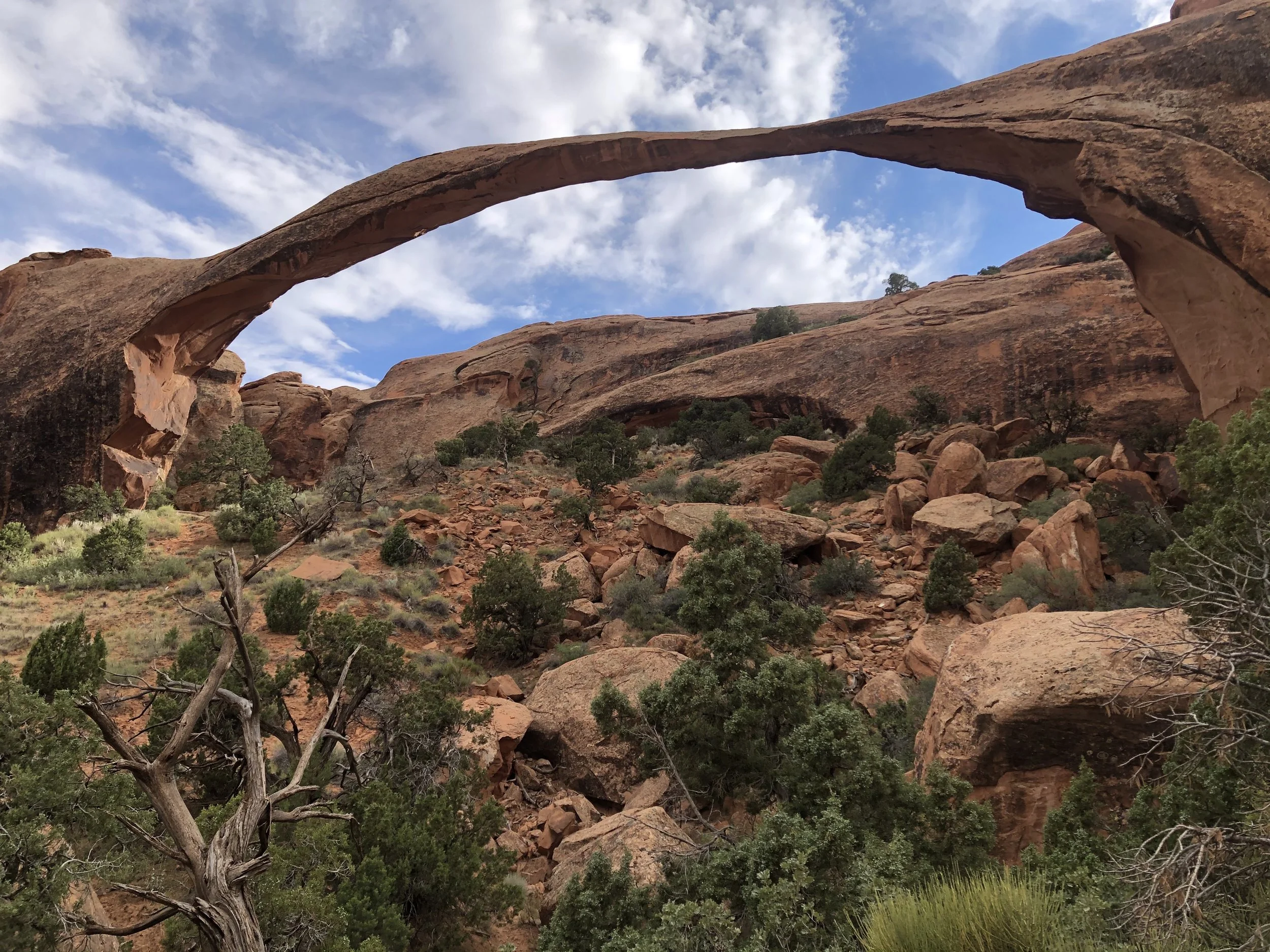
The larger region which includes Arches National Park has been occupied by humans for more than 10,000 years. Indigenous peoples who hunted and camped in and around the present-day park include groups of Navajo, Paiute, Sioux, Zuni, and Southern Ute. Spanish missionaries passed through the area and later farmers, ranchers, and miners. John “Doc” Williams was an early proponent of protecting the area’s balanced rocks, rock fins, pinnacles, and arches. Another was Loren “Bush” Taylor, editor of a Moab newspaper who wrote about marvels of the area’s rocky wonderland. My companion and I drove a few kilometers into the northern section of Arches, leaving our car at a parking lot near Devil’s Garden Trailhead. Traveling on foot, we followed the 2.9 km (roundtrip) trail to Landscape Arch, the world’s fifth longest arch at 88.4 meters.
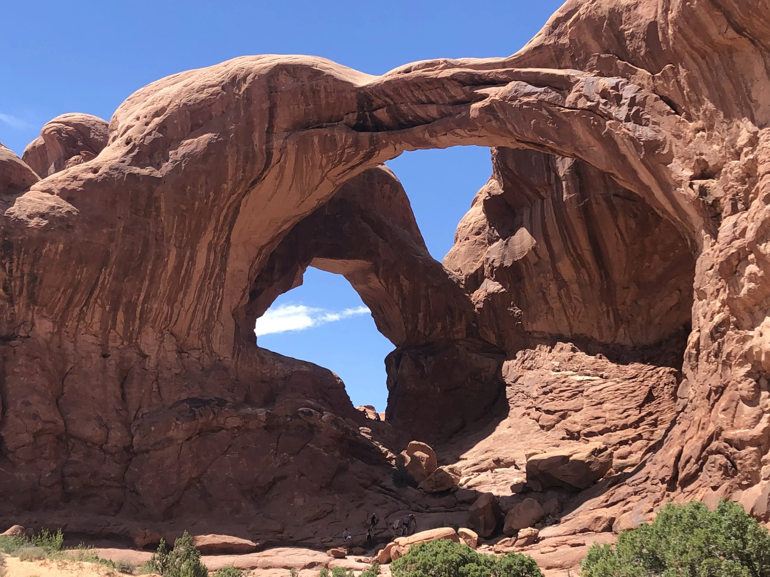
Another road took us to the parking area adjacent to Double Arch (aka “The Spectacles”). Located in the park’s Windows section and at the end of a circle drive, the trail also provides access to Elephant Butte, Ribbon Arch, and Cove Arch. Double Arch is considered a pothole arch, meaning that it was created by erosion from above rather than from the side. Cut from the same sandstone fin, its two arches share a foundation. Oddly, Double Arch doesn’t seem especially large when viewed from the parking lot. However, the largest of its two openings is 45 meters long and 32 meters high. The arch may be recognizable as a backdrop for the 1989 movie, Indiana Jones and the Last Crusade.
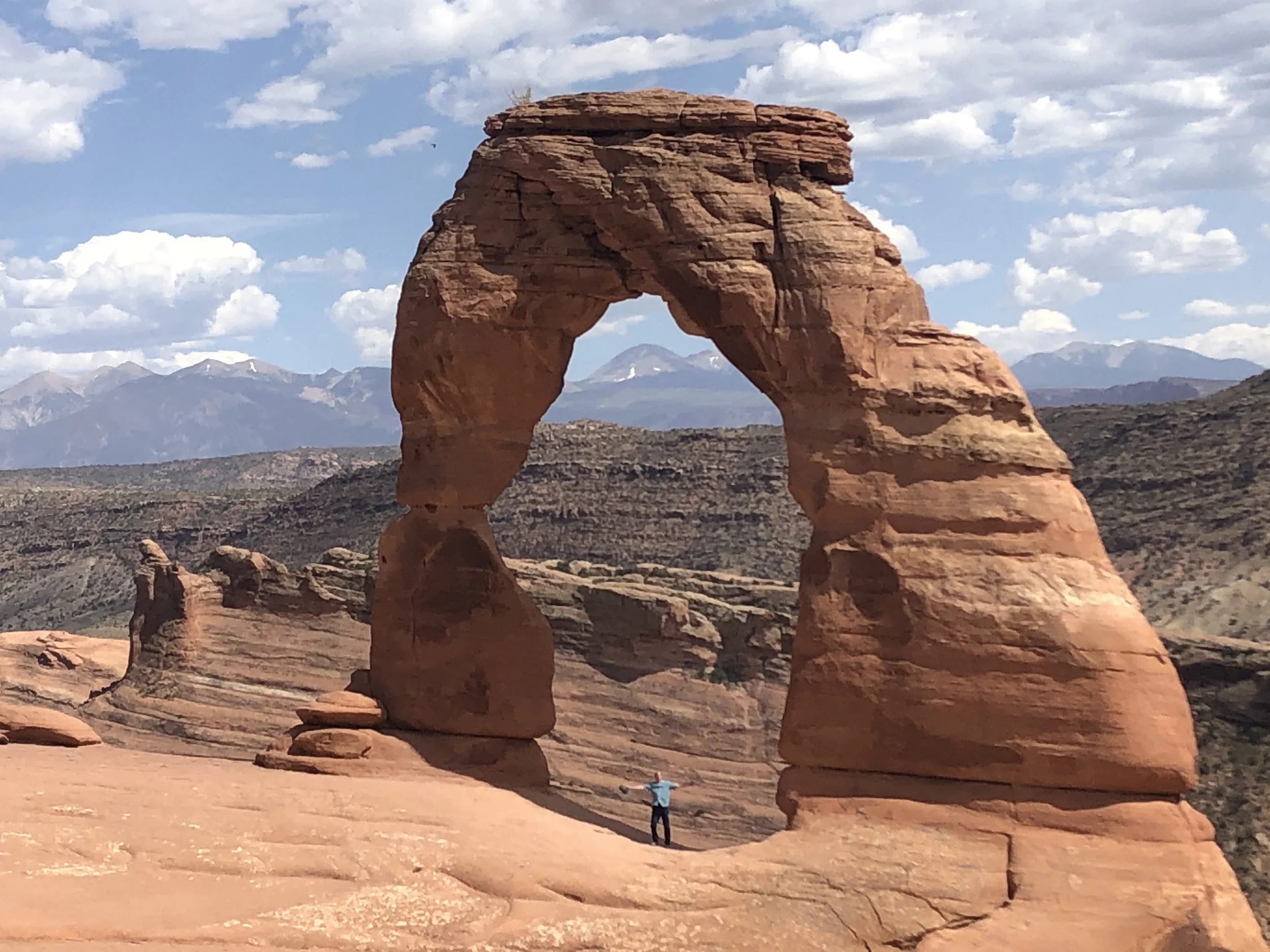
The park’s best known sandstone feature is Delicate Arch, a 16-meter-tall freestanding arch that has been depicted on the Utah license plate. Also known as “Schoolmarm’s Bloomers” and “Salt Wash Arch,” it was named by Frank Beckwith, an explorer who passed through the area in 1934. The arch is the remains of a fin made from Entrada sandstone. Behind the arch and in the distance are the La Sal Mountains. The round-trip hike that begins at the parking lot is about five kilometers and involves walking across barren rock and on high rock ledges. A short distance from Delicate Arch is Wolfe Ranch, settled by a disabled Civil War veteran and occupied between 1888 and 1910.
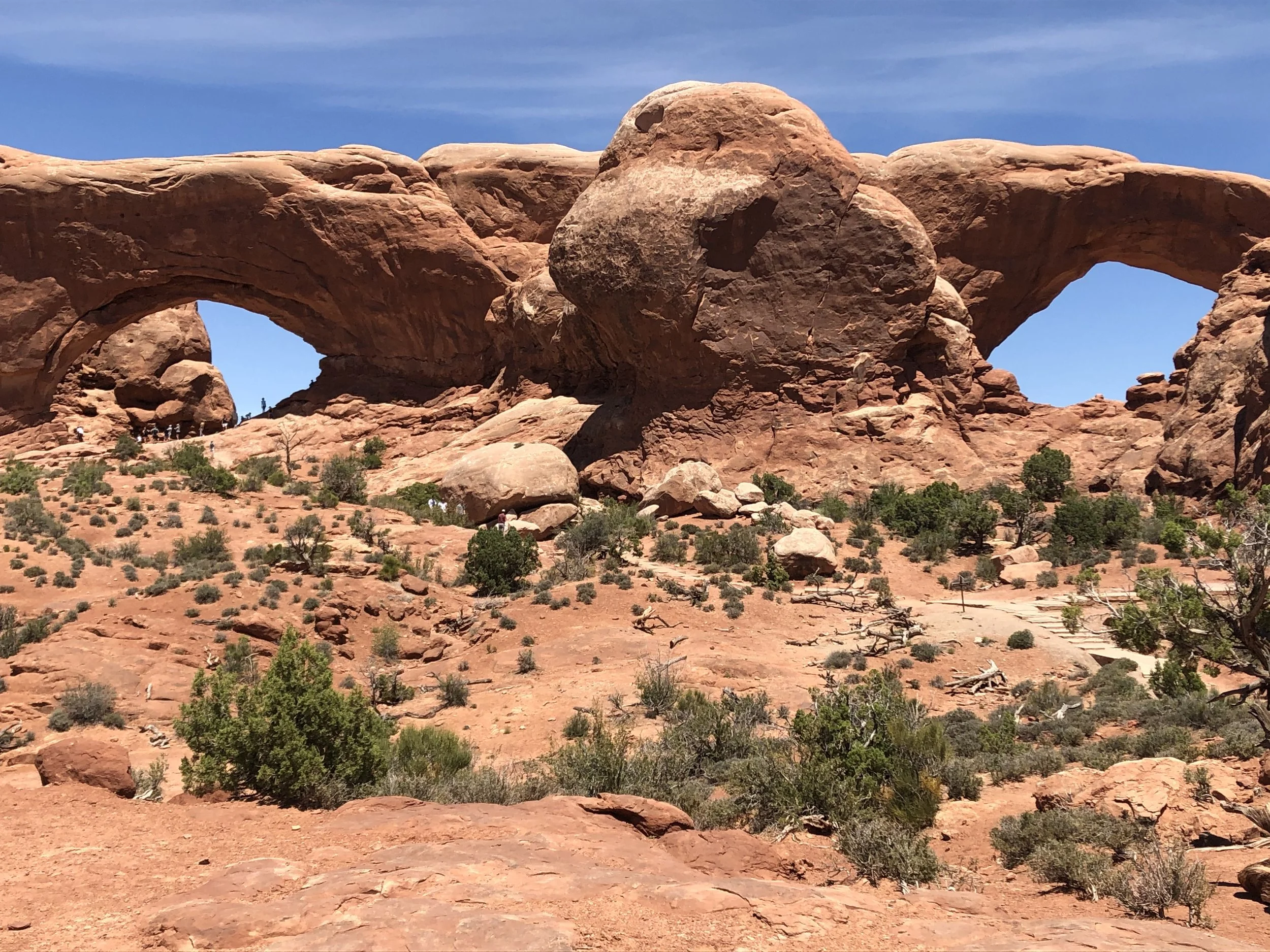
The Windows Loop Trail (1.2km) passes by North and South Window Arches that formed on each end of the same sandstone fin. Measuring 32 meters long by 20 meters high, South Window is the park’s third largest arch. It is linked to North Arch by a section of rock known as the “Nose Bridge.” It’s possible for hikers to stand directly below North Arch. Nearby is Turret Arch which has the look of a stone castle.
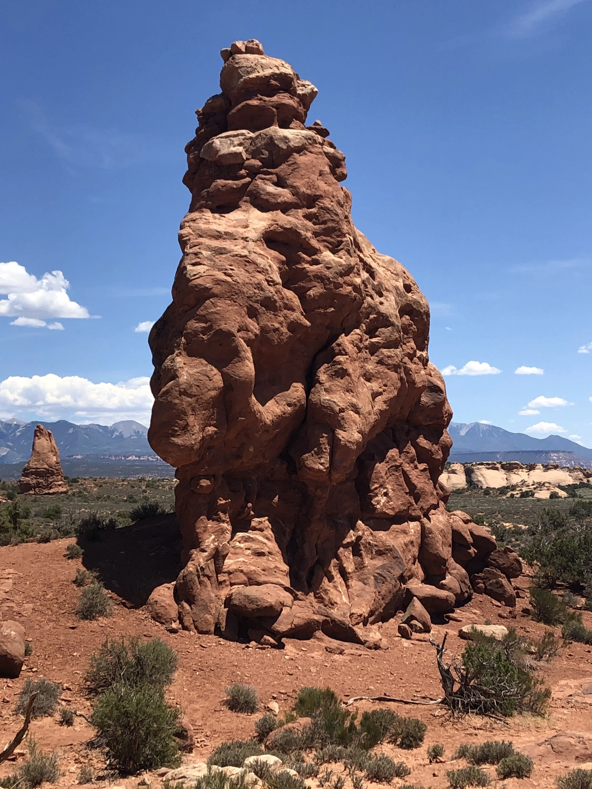
Hoodoos (aka “fair chimneys” or “tent rocks”) are another feature associated with differential erosion. Created by frost wedging (where water that seeps into cracks freezes), hoodoos look like rocky totem poles. Along with its unusual sandstone formations, the park has a diverse range of flora and fauna that includes 480 species of plants, 52 species of mammals, and 186 species of birds. Visitors may see mule deer, kangaroo rats, and desert bighorn sheep. Larger vegetation found within the park includes cottonwood, elder, and Russian olive trees. There is also salt-tolerant tamarisk interspersed with pinyon pine, juniper, yucca, and prickly pear cactus. In some places scientists have documented living soil crusts made up of lichen, cyanobacteria, moss, algae, and fungi.