Oklahoma. Dark Skies and Solitude in the Oklahoma Panhandle
Black Mesa is an obscure place. Known to Oklahomans because it is the state’s highest point (1,597 meters), the mesa is located in isolated Cimarron County and at the western end of a region known as the Panhandle. With fewer than 2,300 people, Cimarron is Oklahoma’s least populated county and the only one in the U.S. that borders four states (New Mexico, Colorado, Kansas, and Texas).
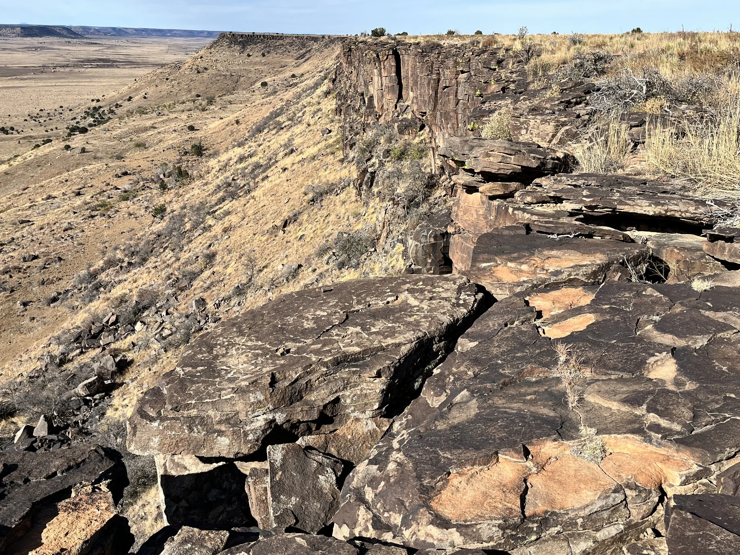
Extending forty-five kilometers in a southeastern direction from Colorado, Black Mesa is within a transition zone between the Rocky Mountains to the west and the Southern High Plains to the north, east, and south. The mesa terminates at a 61-meter-high escarpment near the Oklahoma town of Kenton. Geologically, Black Mesa is considered an “inverted valley” formed by the erosion of softer sedimentary rock that wasn’t covered by more resistant Raton basalt that emerged from a volcanic vent 3-5 million years ago. The same eruption created the Raton-Clayton volcanic field that presently covers parts of southeastern Colorado and northeastern New Mexico. The cap of volcanic rock forming the mesa is 180 meters thick and 89 kilometers long and covers older sedimentary rocks including Cretaceous period Dakota sandstone and Morrison formation rocks formed during the Jurassic period. Jurassic fossils have been discovered near the mesa including the bones of Camptosaurus, Stegosaurs, and Edmontosaurus. In 1931, road workers clearing a path through Kenton unearthed a 1.5-meter dinosaur rib belonging to an Apatosaur. University of Oklahoma geologist J. Willis Stovall was sent to investigate and between 1935 and 1942, crews unearthed 30,000 fossil specimens.
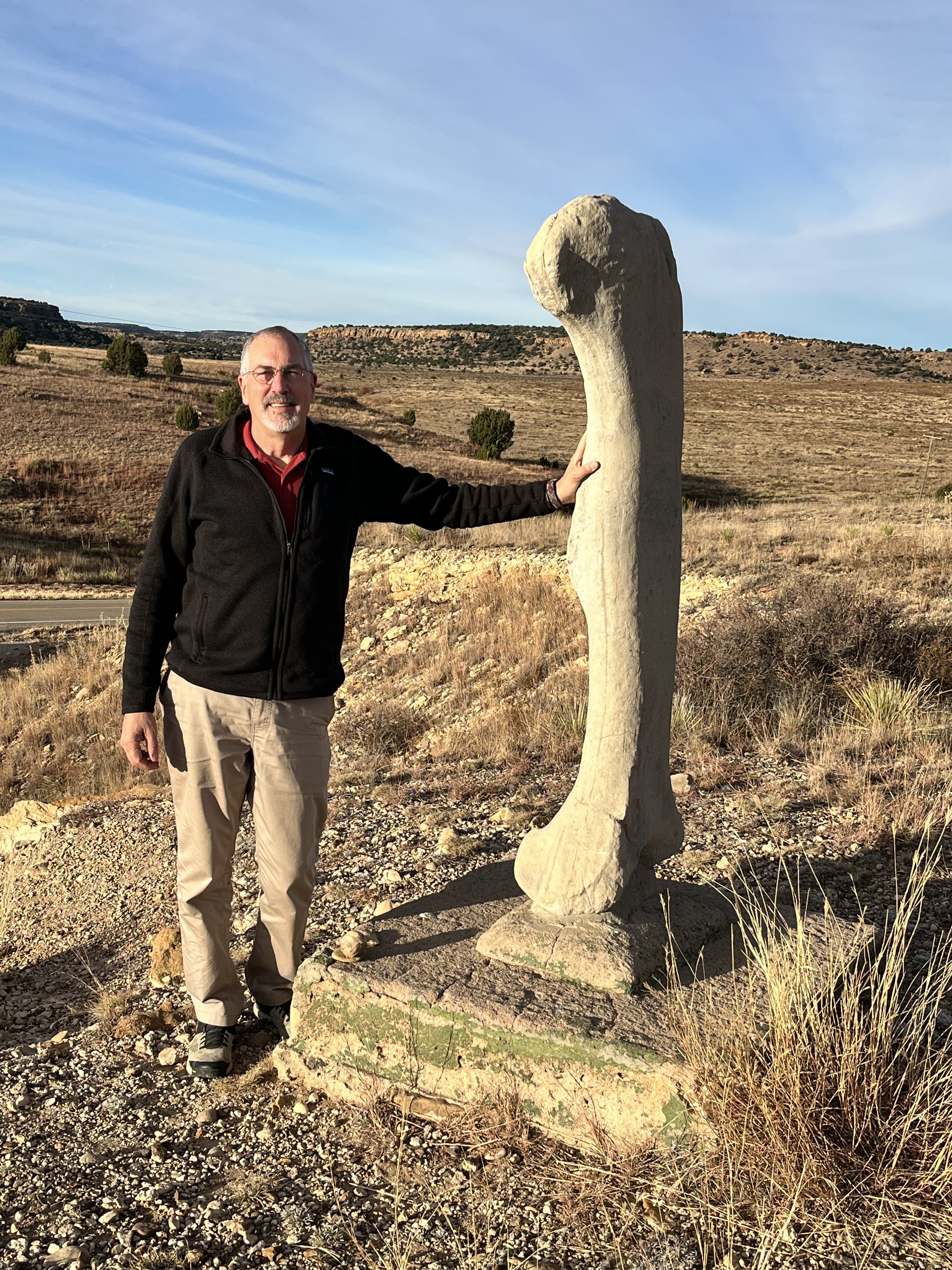
We departed west from Boise City on State Highway 325. Boise City, along with Clayton, New Mexico, were the only places within our driving range where we could find gas, so we filled our car before leaving. A few kilometers after the road turned north, we passed a monument marking the Cimarron (northern) cutoff of the Old Santa Fe Trail that was used in the 1820s. Nearby is a road leading west to Black Mesa State Park. We stopped briefly near a low ridge by the road to photograph the replica of a brontosaurus femur that is strangely mounted on a concrete pad without explanation. We turned north again on Black Mesa Road before reaching the town of Kenton. Kenton is the only Oklahoma community that recognizes Mountain instead of Central Time. The road makes a gentle curve around the western side of Black Mesa. Rounding a bend, we surprised a male bighorn sheep accompanied by two ewes near a driveway leading to the Mesa Valley Guesthouse.
Black Mesa was once used for hunting by nomadic tribes. During the early 19th century, settlers passed nearby on their way to destinations in the western U.S. What is today the Oklahoma Panhandle was added to the U.S. in 1845 when Texas was admitted into the Union as a slave state. However, land north of 36° 30’ latitude was prohibited from being used for slavery by the Missouri Compromise so the Panhandle was excluded from the new state of Texas. Without a government or law enforcement of any kind, the region became a no man’s land and hideout for outlaws such as Black Jack Ketchum and Belle Starr. Arriving in 1865, the notorious Captain William Coe and his outlaw gang established Robber’s Roost as a base for raids aimed at rustling cattle, sheep, and horses from nearby ranches. Located on the edge of a small butte just east of Black Mesa, the Roost had a blacksmith shop, bar, gun ports for protection, and even a piano. Cimarron County was without a school until 1890. At that time there were just two towns: Mineral City and Carrizo. Carrizo had 83 residents, a general store, and three saloons. Eventually, Carrizo’s general store was moved 1.2 kilometers east to the town of Florence (renamed Kenton). Growing to 350 residents, Kenton eventually had a hardware store, blacksmith shop, seed mill, two car dealerships, and two newspapers. Today, Carrizo is gone while Kenton’s population has dwindled to less than twenty.
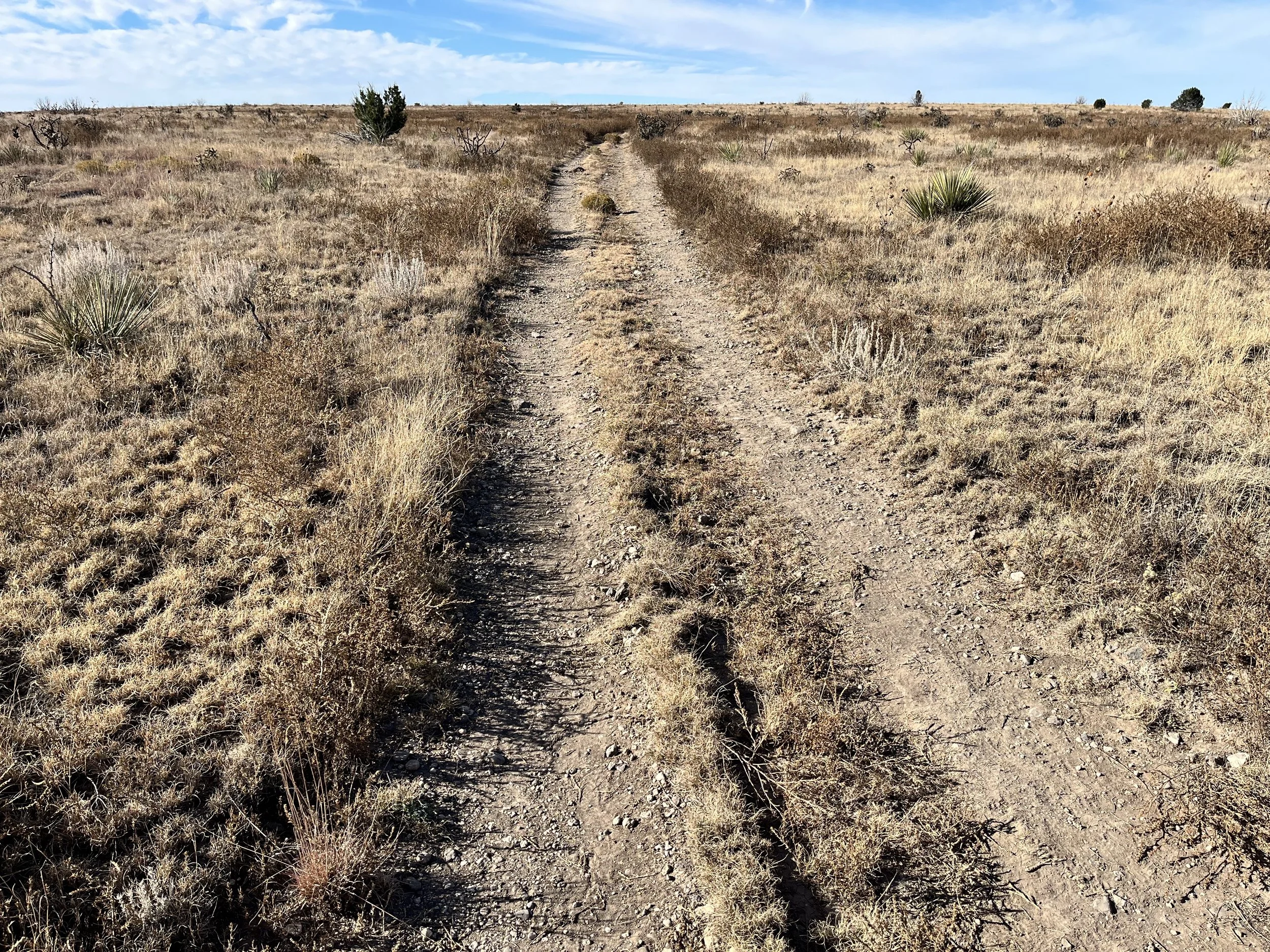
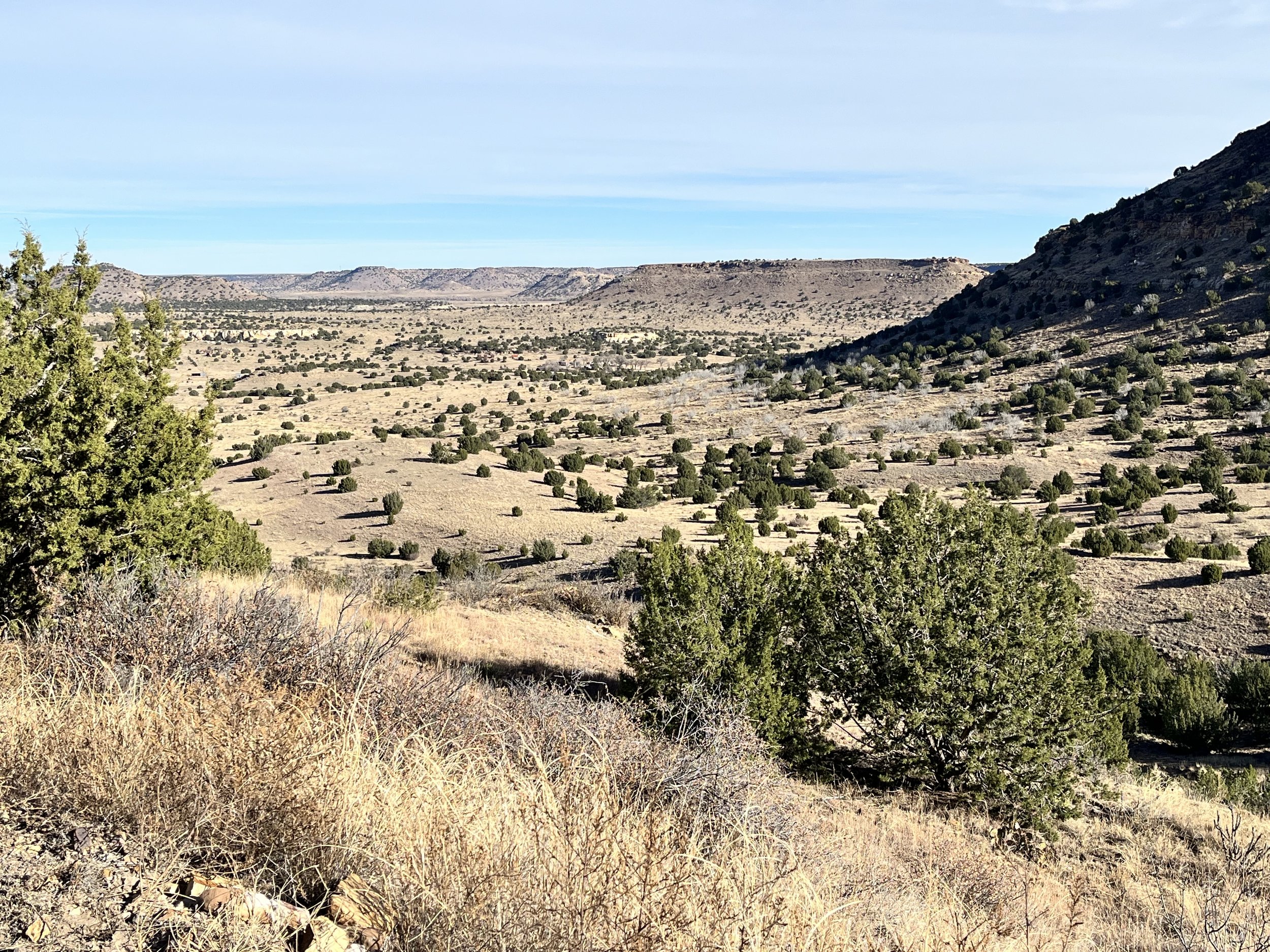
We parked near a trailhead located just inside Black Mesa Natural Preserve. Surrounded by private ranch land, the preserve was established in 1991 by the Oklahoma Nature Conservancy and covers 6.5 square kilometers. Grassland vegetation within the preserve includes Bluestem-grama shortgrass and a scattering of juniper trees and cholla cactus. Although we didn’t see other wildlife, the mesa also has coyote, mountain lion, prairie dogs, and golden eagles.
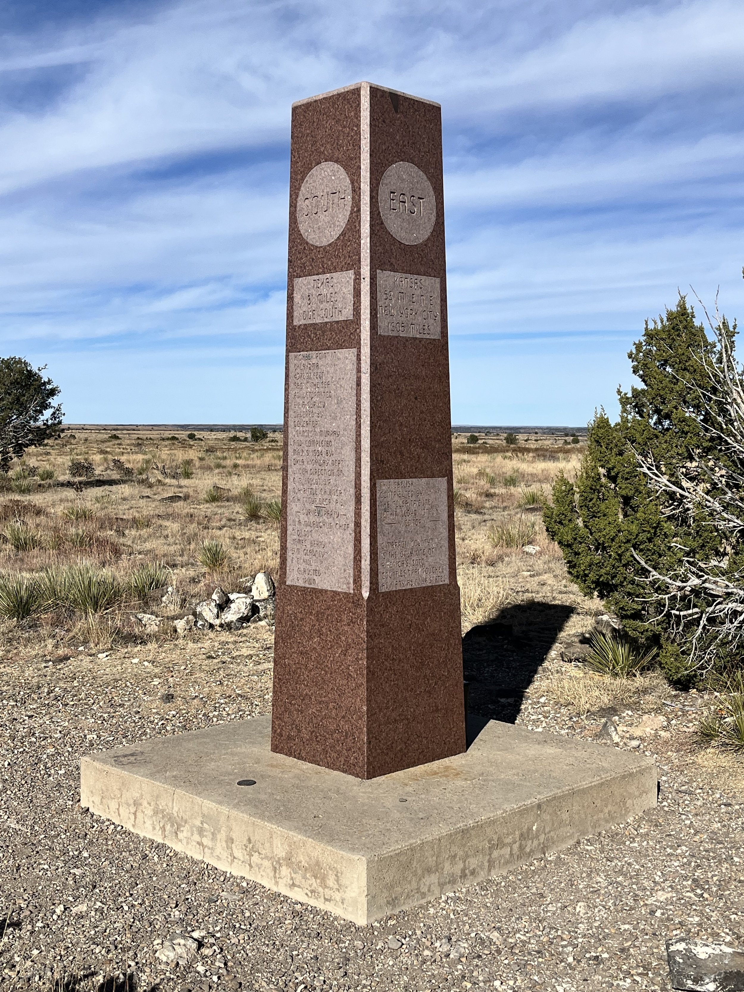
We followed the 6.8-kilometer trail that leads to the top of the mesa and a granite monument marking the highest point in Oklahoma. Two-hundred and forty meters above the level of the surrounding plains, the mesa’s edge is a place of solitude and serenity. Looking west we could see Rabbit Ears (1,848m), Sierra Grande Peak (2,657m) and Capulin Mountain (2,494m) in the distance. Because of its location far from a city, the mesa has become popular among astronomers with star gazers who come each September for the Okie-Tex Star Party.