Canada and Montana. A King-size Swiss Chalet and a Highway to the Sun
My first trip to Montana’s Glacier National Park and Canada’s Waterton Lakes National Park was in the late 1990s while I was teaching a summer field course. I’d been hoping to see and explore these two parks again, so my wife and I rented a car in Calgary for the drive south. Located in Alberta along the U.S./Canadian border, Waterton was founded as Kootenay Lakes Forest Reserve in 1895 and subsequently redesignated as a national park to honor conservationist Charles Waterton. Covering 4,100 square kilometers, Glacier National Park is considerably larger than Waterton Lake’s 505 square kilometers.
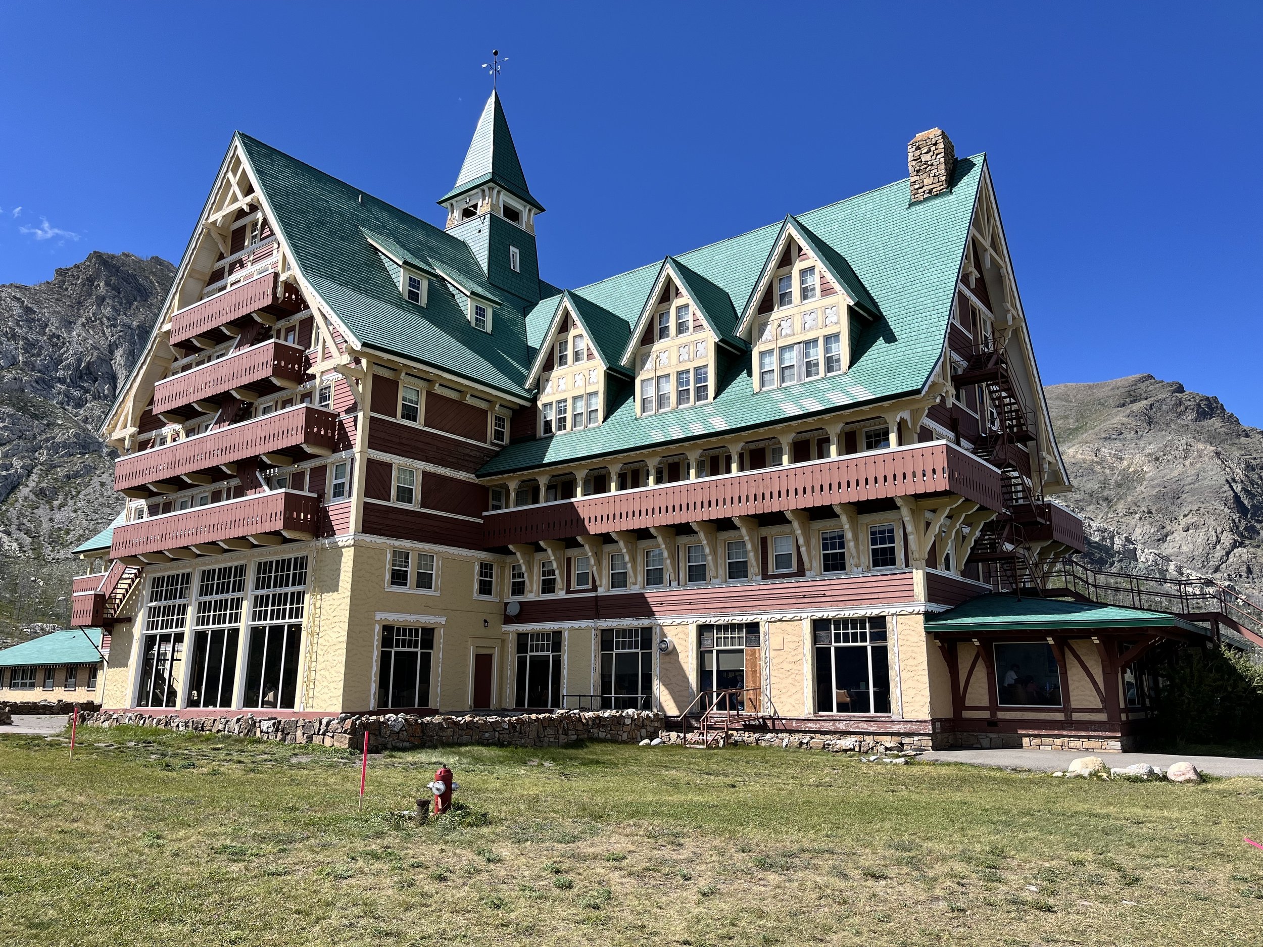
Sitting on a hill overlooking Upper Waterton Lake is the park’s stately Prince of Wales Hotel. Designed in the Rustic architectural style, it channels the look of an enormous Swiss Chalet with balconies, a steep gable roof, and numerous dormers. The structure is almost entirely built of wood with many hand-carved beams made from Douglas fir. Completed in 1927, the seven-story hotel was built with the hope of attracting American tourists during the Prohibition years. The hotel’s name was selected to entice Edward VIII, then Prince of Wales, to stay there while he was on a tour of Canada in 1927. The hotel’s lobby is perpendicular to its length. From the lobby’s wide window, it’s possible to see nearby peaks including Mount Boswell, Mount Alderson, and Mount Crandell. After a few hours in the town of Waterton, we returned for dinner in the hotel’s Royal Stewart Dining Hall.
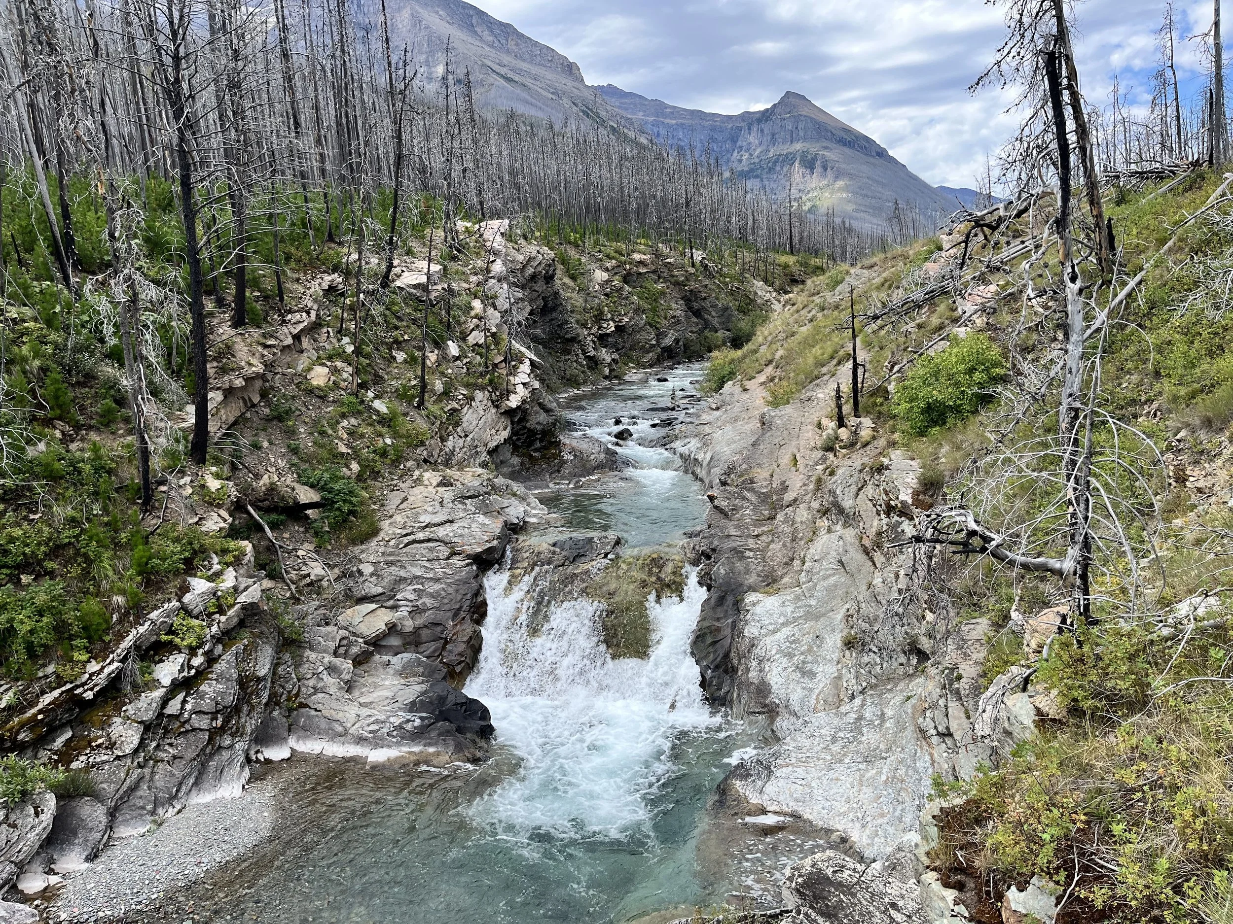
Our second day was devoted to exploring Waterton Lakes by car and on foot. With majestic peaks and blue-tinted lakes, the park has been described as being, “where the prairies meet the plains.” We passed charred trees from a 2017 fire that burned 200 square kilometers and destroyed the park’s visitor center but spared the town and Prince of Wales Hotel. The park’s dolomite, limestone, and igneous rocks are more than 1.5 billion years old. Although there are many glacially carved features such as cirques, eskers, and hanging valleys, the park has no active glaciers. Waterton’s wildlife includes bobcats, lynx, moose, bighorn sheep, grizzlies, black bears, and bald eagles. In 1932, Waterton Lakes National Park and Montana’s Glacier National Park were designated as an International Peace Park. Waterton became Canada’s second Biosphere Reserve in 1979 and a UNESCO World Heritage Site in 1995.

Montana’s Glacier National Park contains two mountain ranges. The park has more than 200 waterfalls and of its 700 lakes, only 131 have been named. The park’s sedimentary rock was deposited 1.6 billion years ago by a shallow sea and its mountains created 170 million years ago when older rocks were pushed eastward over younger strata. Subsequently, glaciers carved jagged mountaintop horns, U-shaped valleys, and other features. Moraines comprised of rock debris left behind by retreating glaciers created natural impoundments that covered valleys, forming alpine lakes. Global warming has impacted the park’s glaciers in significant ways. During the mid-19th century, the park had 150 glaciers measuring more than twenty-five hectares in size. Today there are fewer than twelve and it is estimated that all of the park’s permanent ice will be gone by 2030. The park’s coniferous forests contain Douglas fir, Engelmann spruce, and limber pine while areas above the tree line have alpine tundra vegetation. With over 1,100 kilometers of backcountry trails, the park has been described as a paradise for photography.
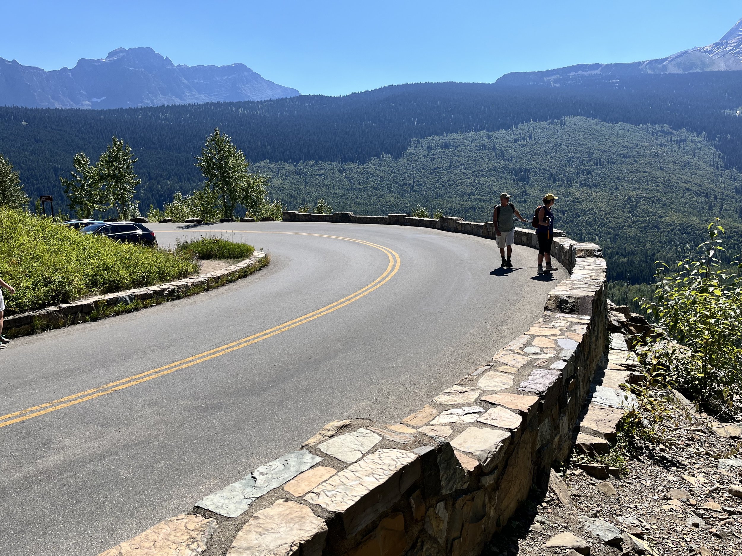
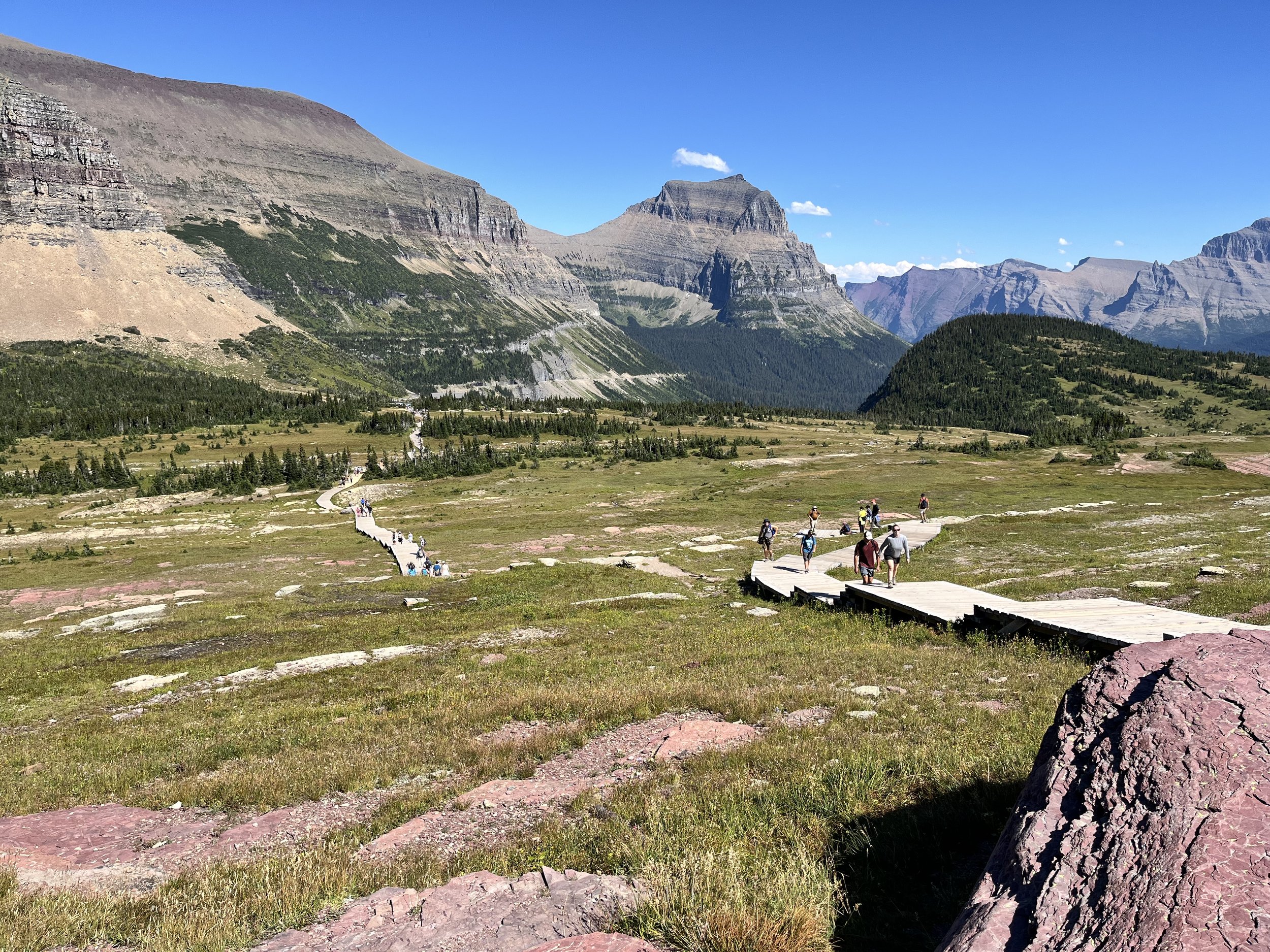
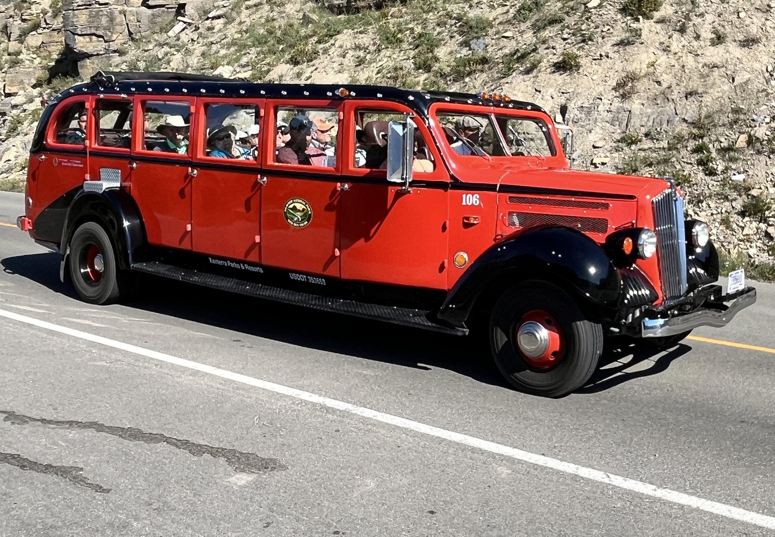
The region containing Glacier National Park was occupied by native tribes including groups of Flathead in the west and Blackfeet in the east. During a 1901 visit to the area, anthropologist and historian George B. Grinnell remarked, “…hidden from view by clustering mountain peaks, lies an unmapped corner – the crown of the continent.” Soon after, the Great Northern Railway began promoting the area to attract riders. At the urging of railroad lobbyists, the U.S. Congress designated the area a forest reserve. This was followed by efforts by Grinnell and members of the Boone and Crockett Club to reclassify the reserve as a national park. Established in May 1910, Glacier National Park was promoted as “America’s Switzerland.” Another major change took place with the arrival of automobiles and a demand for roads within the park. In 1923 park officials opened the Going-to-the-Sun Highway, a rugged two-lane road that bisects the park. At its half-way point is the 2,026-meter-high Logan Pass, named after William R. Logan, the park’s first superintendent. Given the road’s narrowness and sharp bends, vehicles traveling on Going-to-the-Sun Highway can be no longer than 6.4 meters in length. Two private tour companies offer a chance to travel Going-to-the-Sun Highway for visitors not wishing or able to drive in their own vehicle. It should be noted that the highway is closed during much of the year because of snow that can accumulate to heights of more than 20 meters.
Our drive began on the park’s northeastern side where we passed through the St. Mary’s entrance station. From there Going-to-the-Sun Highway follows the north shore of St. Mary’s Lake. The lake is sixteen kilometers long and ninety-one meters deep. We passed a section of road with a “weeping wall,” where spring water emerging from the rock above pours onto the roadway. To the south we could see Mahtotopa Mountain (2,640m) and Little Chief Mountain (2,910m). Positioned in the Lewis Range, Chief Mountain is comprised by sedimentary rock laid down during and after the Permian Era. Subsequently, the Lewis Overthrust pushed older sedimentary rock over younger rocks from the Cretaceous Period. We crossed Haystack Creek before negotiating a hairpin curve known as “The Loop.” Logan Pass lies between Pigeon Mountain and Mount Oberlin. Stopping at the NPS visitor center at Logan Pass, we made an attempt to find a parking place but gave up after hunting for more than twenty minutes. Returning to the road, we continued northward and then southwestward. Going-to-the-Sun Highway passes Red Rock Point and Lake McDonald before reaching the West Glacier entrance station. On our return drive to the St. Mary’s entrance (and our hotel in Waterton Lakes National Park), we were successful in finding a parking place at the pass. After a brief tour of the visitor center, we set out on the popular Highline Trail which crosses an alpine meadow before extending upward. A wooden boardwalk was added to portions of the trail due to high traffic and the potential for damage to tundra ecology.