Canada. Banff and Jasper: From a Triple Continental Divide to the Hall of Gods
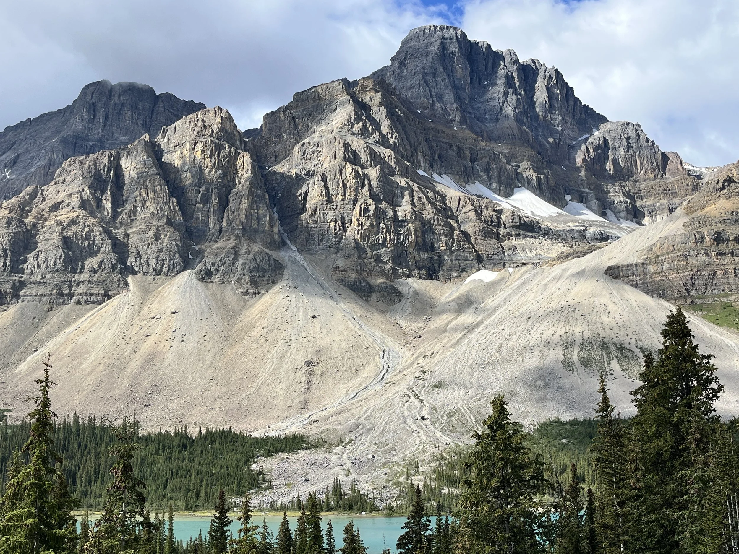
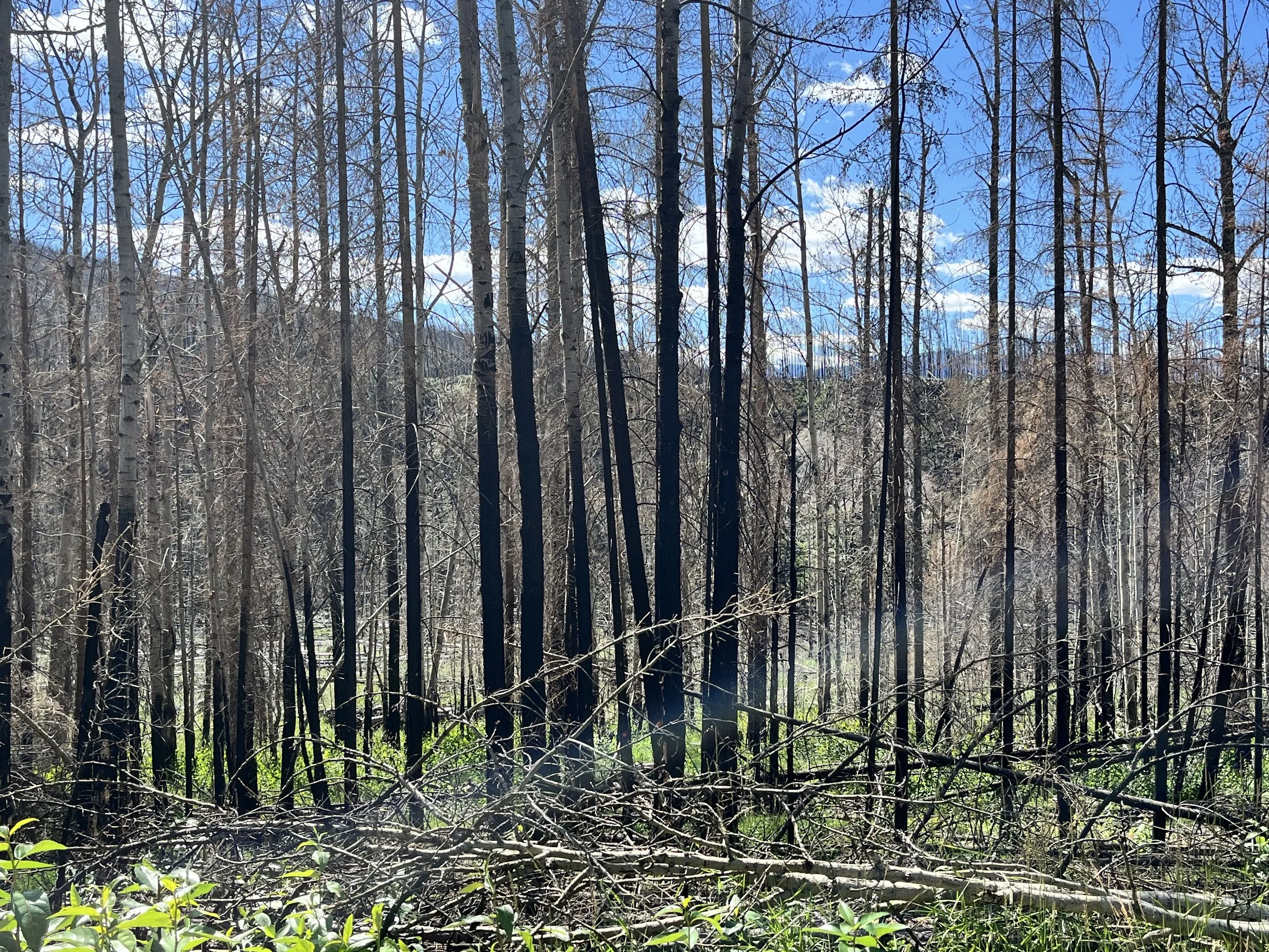
The Canadian Rockies have a different look and feel compared to the Rocky Mountains of New Mexico, Colorado, and Wyoming. Whereas mountains in the lower U.S. states often have a high tree line with tundra and rock only at the highest elevations, peaks of Alberta’s Rockies are more visually imposing with ridgelines of ragged rock and steep cliffs flanked by sloping talus aprons. The Canadian Rockies were formed through uplift and erosion over more than 70 million years. They are composed of sedimentary rock, mostly sandstone, shale, and dolomite, from the Precambrian through the Cretaceous periods (600 million to 66 million years ago). The distinctive look of the Canadian Rockies can also be attributed to a 40 to 60° dip in layers of sedimentary strata that forms sawbacks and dogtooth features. Subsequent reshaping by glacial action has left cirques (ragged ridgelines), arêtes (sharp peaks), and U-shaped valleys.
My wife and I rented a car in Calgary for the 130-kilometer drive to Banff National Park. Covering 6,641 square kilometers, Banff is part of the Parks (aka Main) Range, a region that has been occupied by indigenous peoples such as the Piikani, Ktunaxa, and Plains Cree for more than 10,000 years. First protected as Banff Hot Springs Reserve, Banff became Canada’s first national park in 1885. That same year the Canadian government completed a transcontinental railroad passing through the park. Hoping to attract riders, the Canadian Pacific Railway built the Banff Springs Hotel and the Lake Louise Chalet. New automobile roads into the park were commissioned in 1911 and today the Trans-Canada Highway connects Calgary to Banff and other western locations. Banff’s climate is categorized as Köppen subarctic. The park’s diverse wildlife ranges from grizzly bears and lynx to wolves, marmots, caribou, and bighorn sheep. Banff is also home to 300 bird species and 800 species of plants. Annual tourist visitation is about three million per year.
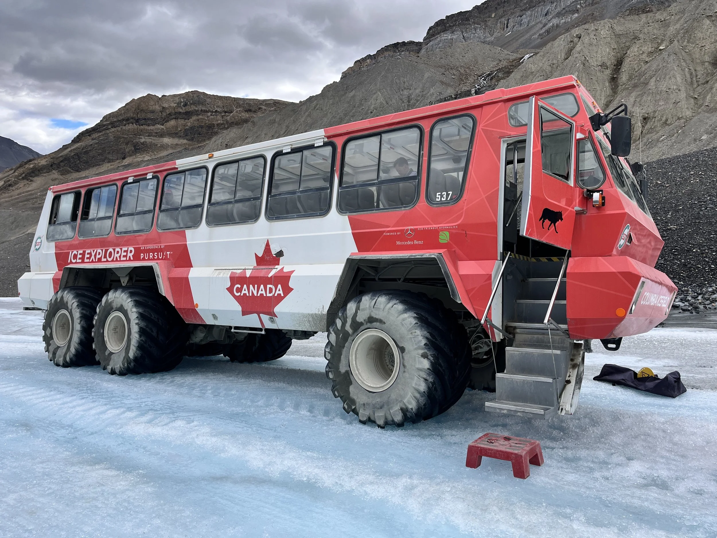
The highlight of our visit was the Columbia Icefield. Stretching across parts of Banff and the adjacent Jasper National Park, the 240,000-year-old icefield is a remnant of an ice sheet that once covered much of western Canada. With glacial ice up to 365 meters thick (the height of New York City’s Empire State Building), the icefield’s central dome is one of two triple continental divides in the world. Triple divide status means that water originating from the dome’s melting snow and ice flows into three oceans: the Atlantic, Pacific, and Arctic. Surrounded by eleven of Canada’s twenty-two highest peaks, the Columbia Icefield is also a UNESCO World Heritage Site. Our first stop was the icefield visitor center. Across a valley we could see the Athabasca Glacier flowing towards us and downslope from the icefield. Located in the Sunwapta Valley, the glacier is about six kilometers long and covers a surface area of six square kilometers. Climate change has reduced the geographic dimensions of both the icefield and glacier. We took seats in a bus for the short drive to a parking area where we boarded an all-terrain “Ice Explorer” with space for fifty riders. Equipped with a 250 horsepower Detroit diesel engine, the vehicle has a specially designed suspension and low-pressure tires for improved traction. The section of road leading to the glacier has some of the steepest grades in the world. At 32° it is slightly less steep than Baldwin Street (35°) in Dunedin, New Zealand. The route has other hazards. In 2020 three people were killed and 24 injured when an Ice Explorer was struck by a rockslide. Our route took us over 10,000-year-old glacial ice. Arriving at a relatively level place on the glacier, we were permitted to disembark for a short walk after receiving instructions to exercise caution and avoid crevasses in the ice. For our return trip a squirrel ascended steps into the Ice Explorer and quickly disappeared under the seats. Our driver explained that such stowaways are relatively common.
Knowing that the parking lot at Lake Louise is small and often full by 7am, we departed our hotel in the city of Banff just after 5:30am. Positioned at an elevation of 1,600 meters, Lake Louise offers stunning views of Mount Victoria. The alpine lake isn’t especially large, measuring just two kilometers in length and 0.5 kilometers in width. In the indigenous language the lake is called Num-Nay which means “lake of little fishes.” Although an early European surveyor dubbed it Emerald Lake, the lake was formally named after the wife of the Governor-general of Alberta, Princess Louise. The lake’s water temperature never rises above 4°C while its surface remains frozen during winter months. It was raining so we visited a coffee shop on one end of the Chateau Lake Louise Hotel. Although most of the hotel isn’t open to the public, we were able to walk through part of the lobby.
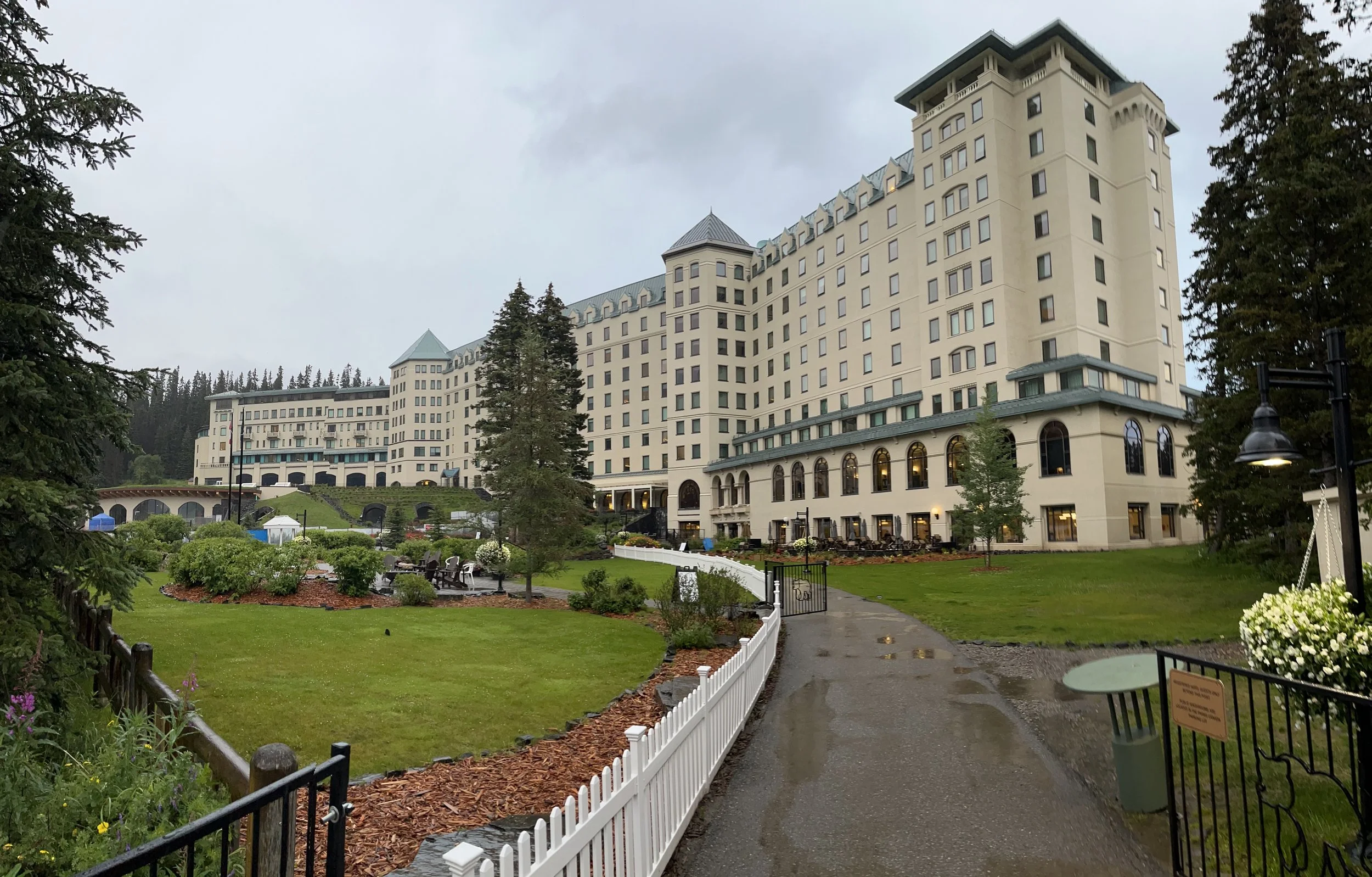
On our return to the city of Banff we stopped at Banff Springs Hotel, also known as the Fairmont Banff Springs. Constructed in 1888 along the Spray River, the original five-story hotel overlooking Mt. Rundle could accommodate 280 guests. Damaged by fire, the hotel was rebuilt in 1914 with fourteen stories. A north wing was added in 1927 and a south wing in 1928. The building blends Scottish baronial and châteauesque architectural styles with oak beams, terrazzo flooring, stained glasswork, and wooden carvings of animals. British King George IV visited the hotel in 1939. Today, the hotel has space for up to 757 guests. Before departing we enjoyed a wonderful lunch at Rundle Bar, located on the ground floor and adjacent to a patio.
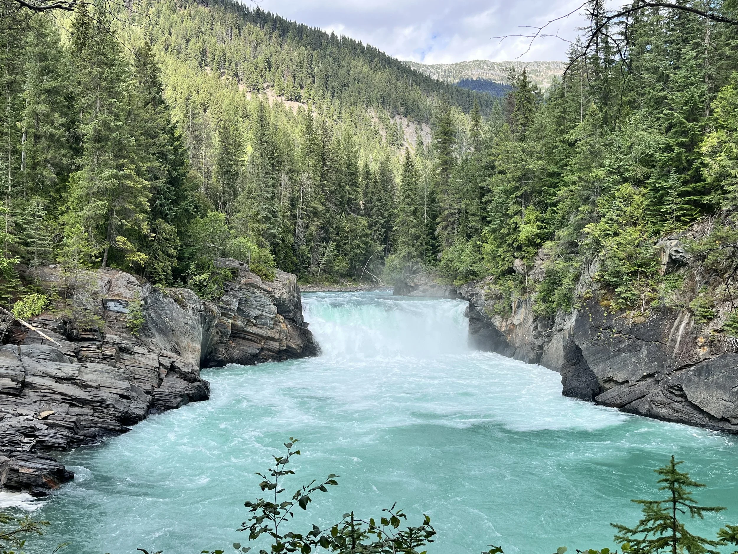
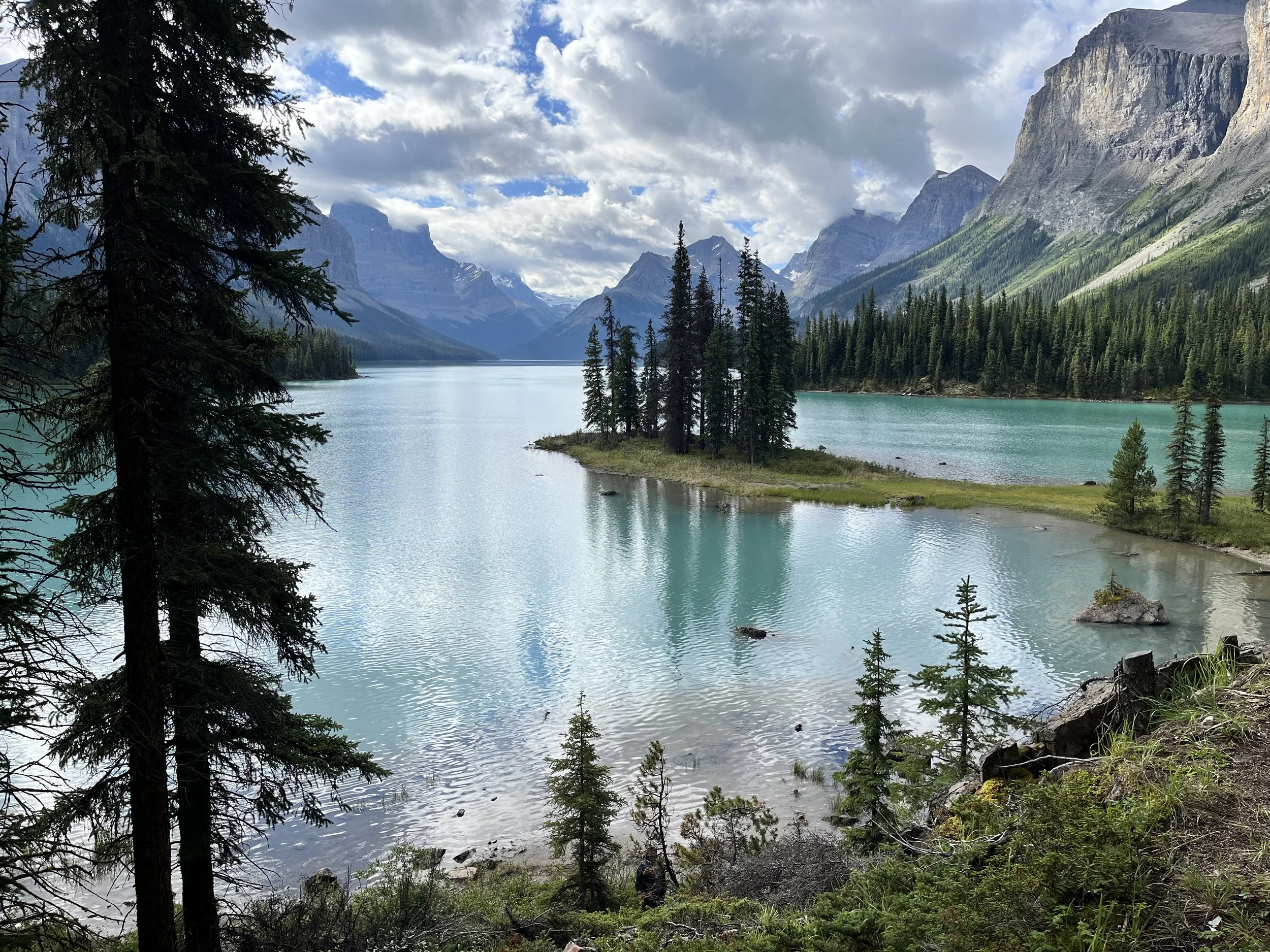
West of Banff is the 10,878 square kilometer Jasper National Park. First designated Jasper Forest Park in 1907, the area became a national park in 1930. The park includes an area within the Brazeau and Athabasca River Valleys and sections of Canada’s Front Ranges. Hoping for panoramic views, we took the Jasper Skytrain to the top of Whistler’s Mountain (elevation 2,260 meters). Traveling in a gondola, the journey took eight minutes. We hoped to complete the two-kilometer hike to the summit but had to return to the gondola complex because of high, gusty winds. Eventually, the gondola paused operations too. We bided our time waiting for winds to subside over lunch at the Summit Café. Maligne Lake is a must-see for anyone visiting Jasper. My wife and I booked tickets in advance for a two-hour lake cruise. Fourteen kilometers long, Maligne is the largest natural lake in the Canadian Rockies. With waters tinted azure by glacial flour, it is surrounded by lodgepole pine and spruce. We motored southeast between Samson Peak and the Queen Elizabeth Ranges. Meltwater from the Coronet Glacier flows into the southeastern corner of the lake. Our boat docked near Spirit Island (aka Chaba Imne, meaning “Beaver Lake”). The majestic towering mountains that surround the island have been dubbed “Hall of Gods.” Just 1.2 hectares in size, the picturesque island is connected to the mainland by a grassy isthmus. The artist Mary Schäffer was the first European to see Spirit Island in 1907.