Utah. Bryce Canyon: “It’s a helluva place to lose a cow”
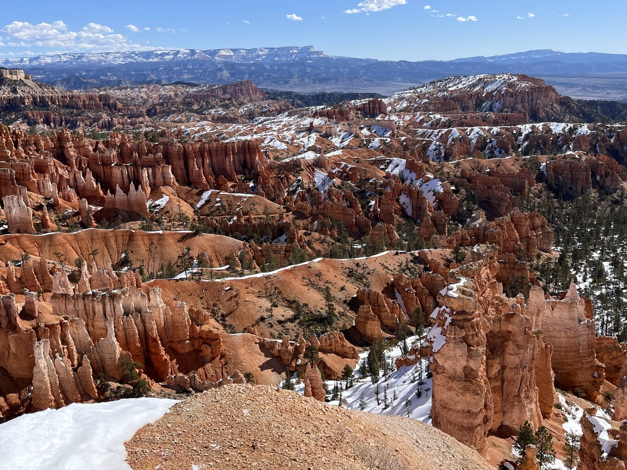
For a medium-sized state, Utah has an exceptionally large number of national parks (five). If you haven’t been there, consider adding Bryce Canyon National Park to your “must see” list. Located in south-central Utah, the 155 square kilometer park is 80 kilometers northeast of Zion National Park. It may come as a surprise that Bryce Canyon isn’t a canyon. Geographically speaking, it is a group of dissected amphitheaters carved from the edge of Utah’s Paunsaugunt Plateau. Unlike Arizona’s Grand Canyon or Colorado’s Black Canyon of the Gunnison, river downcutting didn’t create the plateau’s rugged white, orange, and red cliffs or its peculiar rock pedestals known as hoodoos. The principal agents responsible for carving the massive amphitheaters and associated features are weathering (the fracturing of solid rock) and headward erosion (the downslope movement of water immediately after rainfall).
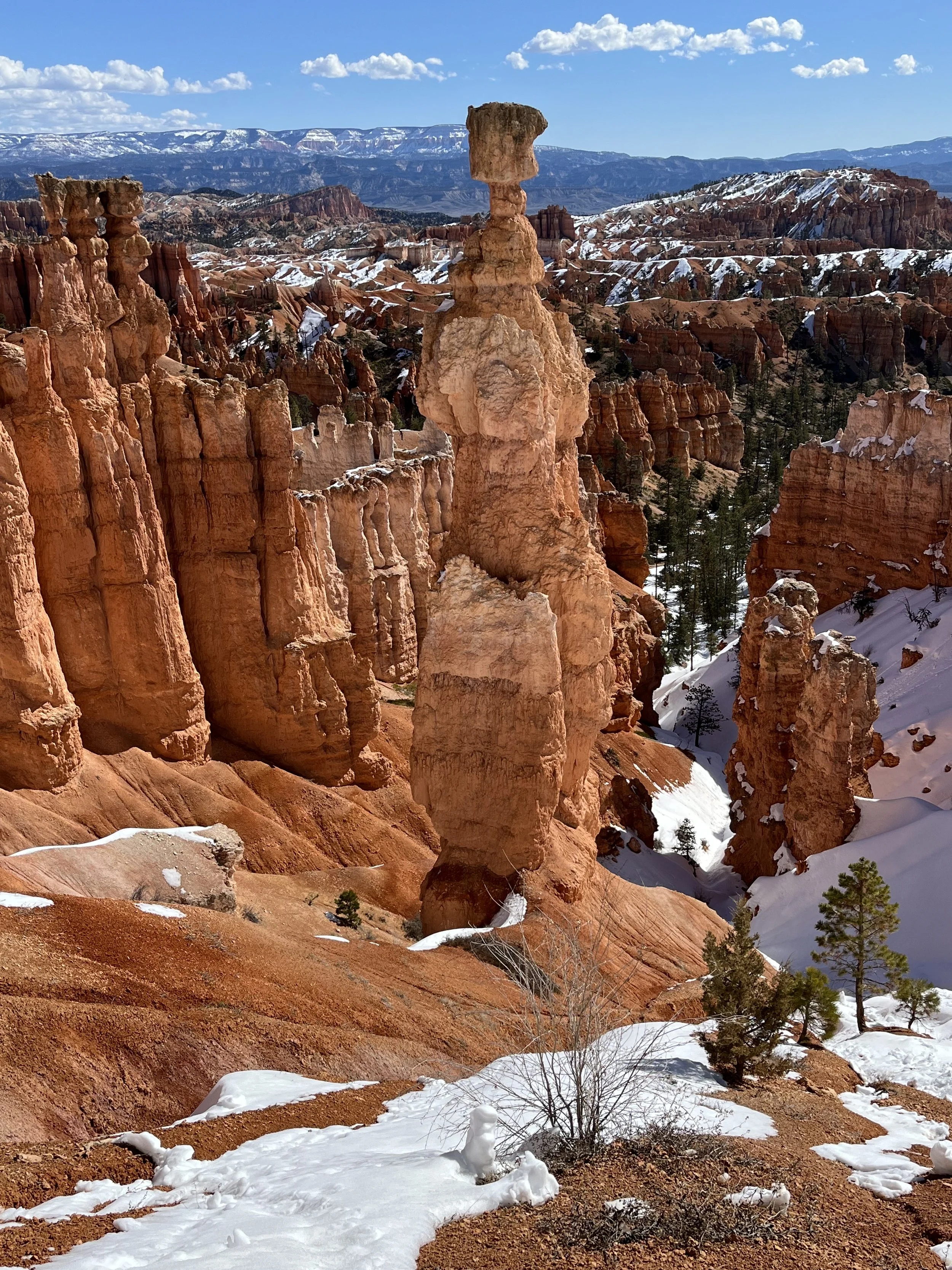
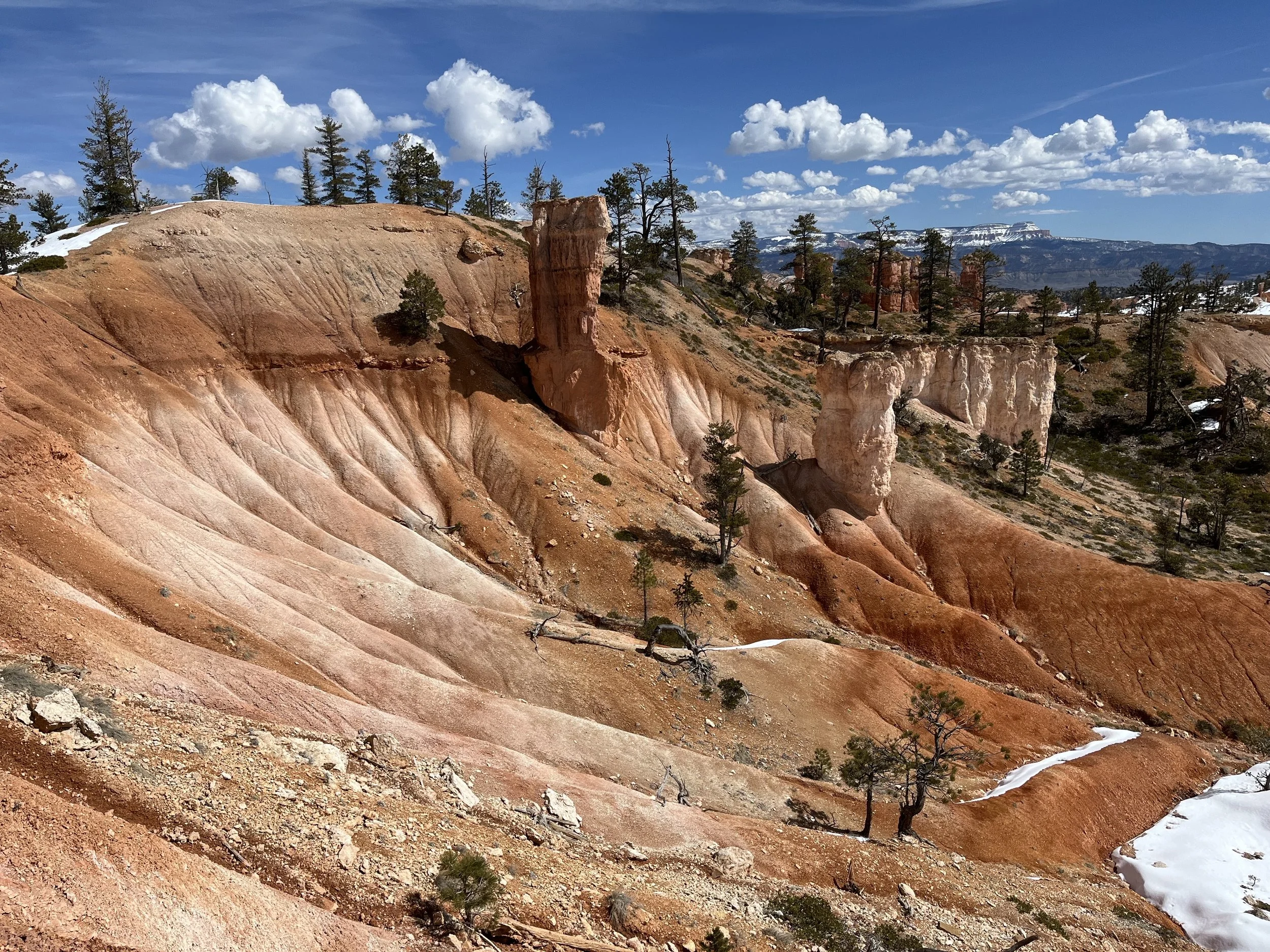
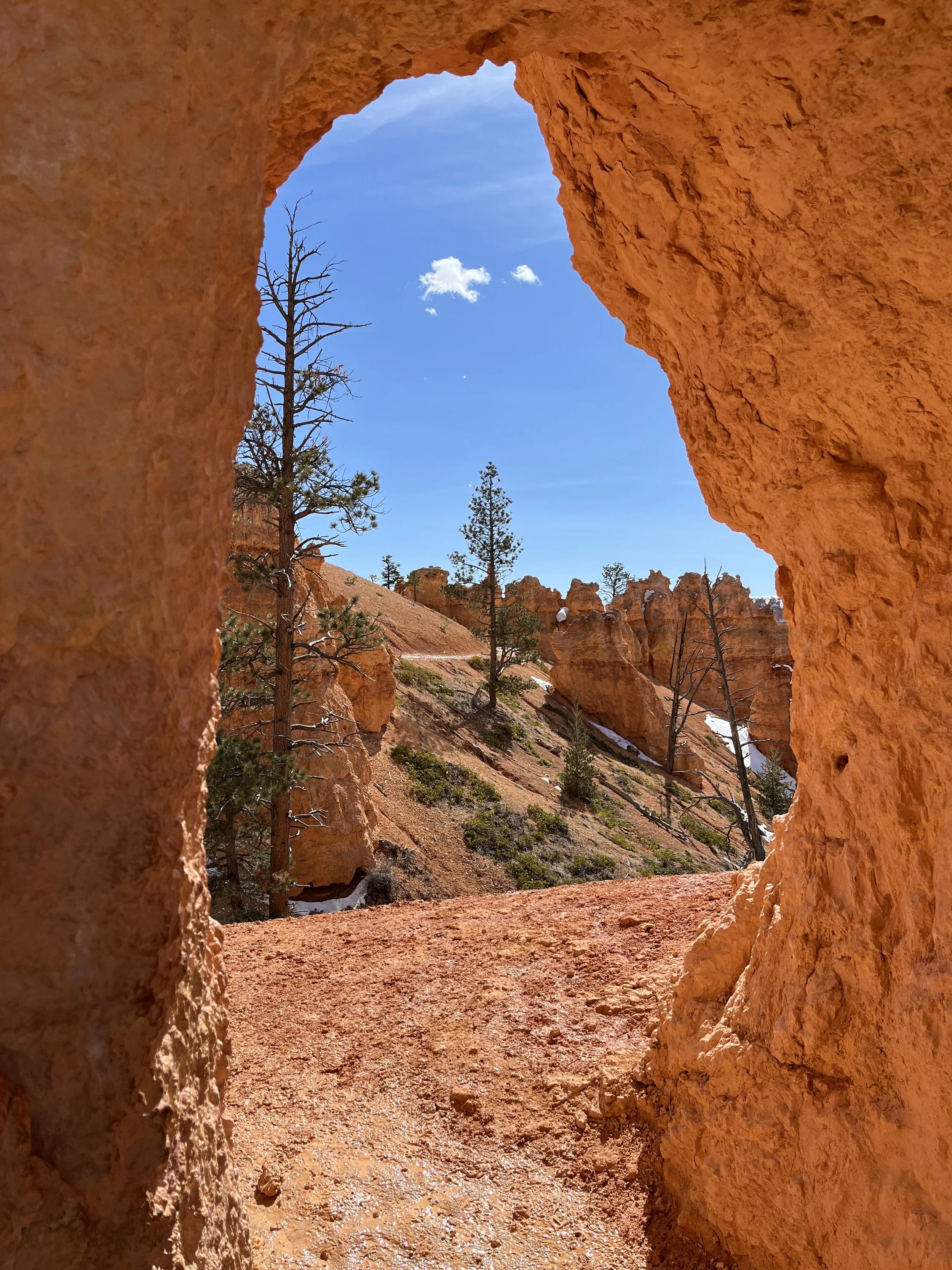
Appearing like narrow vertical spires, hoodoos are remnants of cliffs. The spires are abandoned as the plateau is slowly pushed back. The process begins with rain that seeps into joints and freezes at night. The ice thaws the following day creating a night/day cycle that repeats itself. Contributing to the bizarre appearance of isolated rock spires and cliff faces is an uneven rate of weathering and erosion where softer rocks are removed more rapidly than more resistant ones. The precise number of hoodoos at Bryce isn’t known but estimates suggest that there are a thousand or more.
The region around Bryce experienced geological and climatic changes that transformed it from an inland sea into a floodplain, and later, a desert. During periods of flooding, fine-grained sediments washing into low lying areas formed thick layers that later hardened into rock. When the water receded, dolostone, limestone, and sandstone rock were subjected to weathering and erosion. Today, the youngest layers of Bryce Canyon are pink and white limestones formed during the Tertiary period. These overlie grey and white rock layers created during the Cretaceous period.
Humans have lived in the area surrounding Bryce Canyon for more than 10,000 years. According to a Paiute legend, before Indians lived in the area there were the To-when-an-ung-wa (the Legend People) who were turned into stone by an old trickster coyote named Sinawava as punishment for their bad deeds. The region surrounding Bryce Canyon National Park was settled by Mormon pioneers beginning in the 1850s. Among them was Ebenezer Bryce who homesteaded the area in 1874 and built a house just below the largest amphitheater. In 1872, a scientific expedition led by Major John Wesley Powell was launched to survey the Virgin and Sevier Rivers. Soon after, magazine and newspaper articles written about the area’s strange landforms began attracting visitors. Recognizing growing interest, Union Pacific Railroad executives extended passenger service into southern Utah. By the 1920s, unchecked tourism, coupled with an expansion in logging and grazing operations, prompted the Utah State Legislature to recommend that the area receive federal protection. In June 1923, U.S. President Warren G. Harding signed an executive order creating Bryce Canyon National Monument and five years later Congress designated the area a national park. Soon after, improvements were made to the park’s infrastructure with Bryce Canyon Lodge completed in 1925 and the Rim Road scenic drive in 1934.
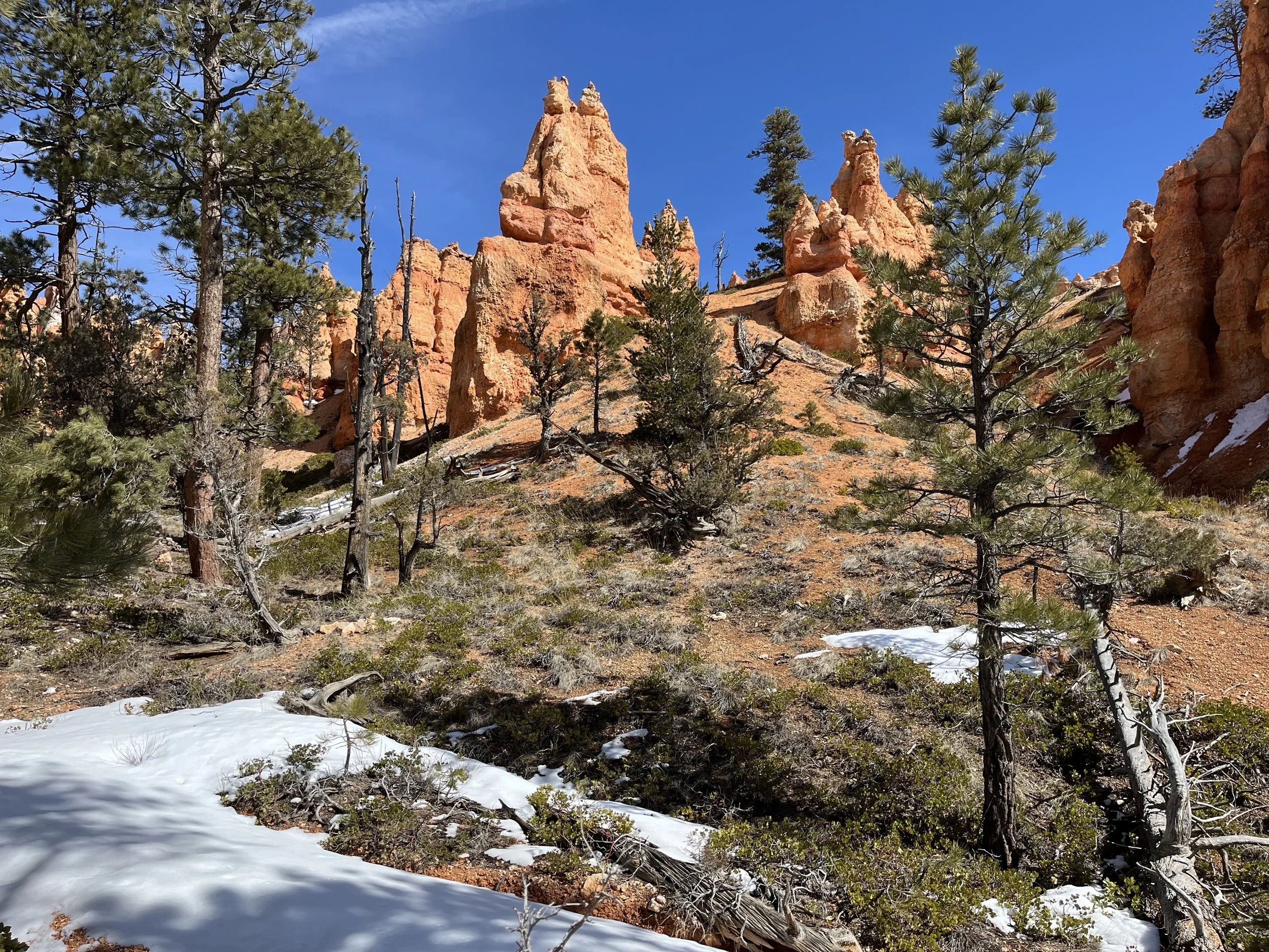
Today, the park has a rich assemblage of vegetation with more than 400 native plant species. At lower elevations hikers can find juniper, manzanita, pinyon pine, and antelope bitterbrush while middle elevations have blue spruce, Douglas fir, and Ponderosa pine. At the top of the plateau are Engelmann spruce, White fur, and Douglas fir. The park’s fauna includes black bears, badgers, elk, and porcupine. Visitors have the option of driving their vehicles along the Rim Road or using the park’s hop-on, hop-off shuttle system. In part because of its remote location, the park’s visitation (about two million per year) is modest compared to Grand Canyon or Zion National Parks.
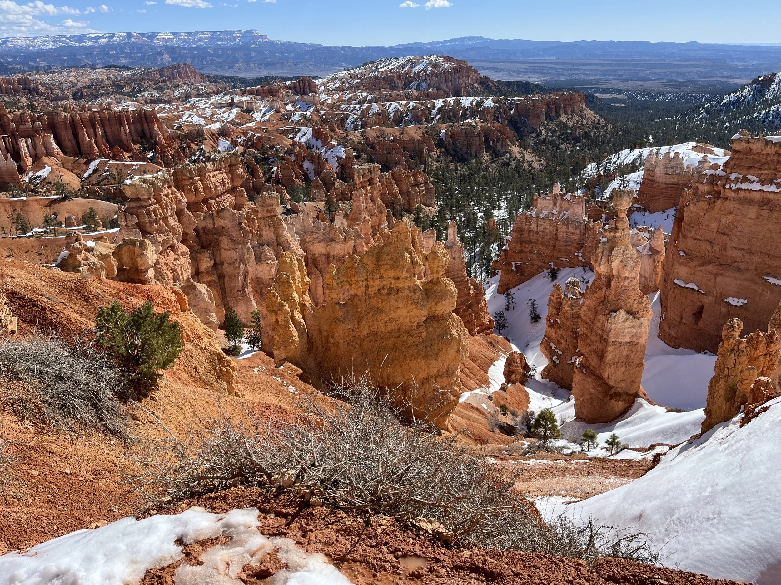
Our route to reach the park followed Highway 12 west from Zion National Park and then south on Highway 63 to the entrance station. After a brief stop at the visitor center, we drove the 29-kilometer Rim Road, pausing at most of the park’s thirteen overlooks including Rainbow Point, the park’s highest location (2,775m). Parking near Sunset Point, we set out to complete a segment of trail offering views of Bryce Amphitheater that would take us below the rim and along a loop that terminated at Sunrise Point. Nineteen kilometers long and 250 meters deep, Bryce Amphitheater is the park’s largest feature. We followed two out-and-back trails, Navajo Loop and Queen’s Garden. The initial descent into Bryce Amphitheater is a series of steep switchbacks. I slipped on sections of the trail still covered by patches of winter snow and ice. At the second switchback we stopped to photograph Thor’s Hammer, one of the park’s most iconic hoodoos that is formed by a rock column topped by a chunk of caprock. The route continued past rock formations carved by differential weathering including the “Gossips,” “Organ Grinder’s Monkey,” and “Queen Victoria.” Our final kilometer involved a climb back to the rim.