Minnesota and Louisiana. Exploring the Headwaters and Delta of America’s River
Traveling across the country, most Americans pass over the mighty Mississippi River without much thought. The Mississippi has been a vital commercial artery for hundreds of years. It is the longest (6,275 km) river in the U.S. and the fourth longest in the world after the Nile, Amazon, and Yangtze. Together with its tributaries, the Mississippi drains all or parts of thirty-two U.S. states and two Canadian provinces, an area of more than 2.9 million square kilometers. Major tributaries of the Mississippi include the Missouri, Ohio, Arkansas, Illinois, and Red Rivers. Known as “America’s River,” because it flows through the country’s heartland, the Mississippi facilitates the transportation of cargo with an annual value of more than $400 billion. Having seen bits and pieces of the Mississippi on coast-to-coast flights, I’d always wanted to see where the river begins and ends. For context, it may be helpful to understand a few things about the history of people and the Mississippi. Native Americans have lived along the Mississippi River and its tributaries since at least 4000 BC. When Europeans first visited, the region was occupied by Sac and Fox, Quapaw, Osage, Natchez, Choctaw, Chickasaw, Pottawatomie, Winnebago and other tribes. The U.S. gained control over most of the river’s watershed in 1803. Like other rivers, the Mississippi has experienced devastating floods. After a flood in 1927, the federal government constructed levees and initiated dredging and diking projects on some sections of the river.
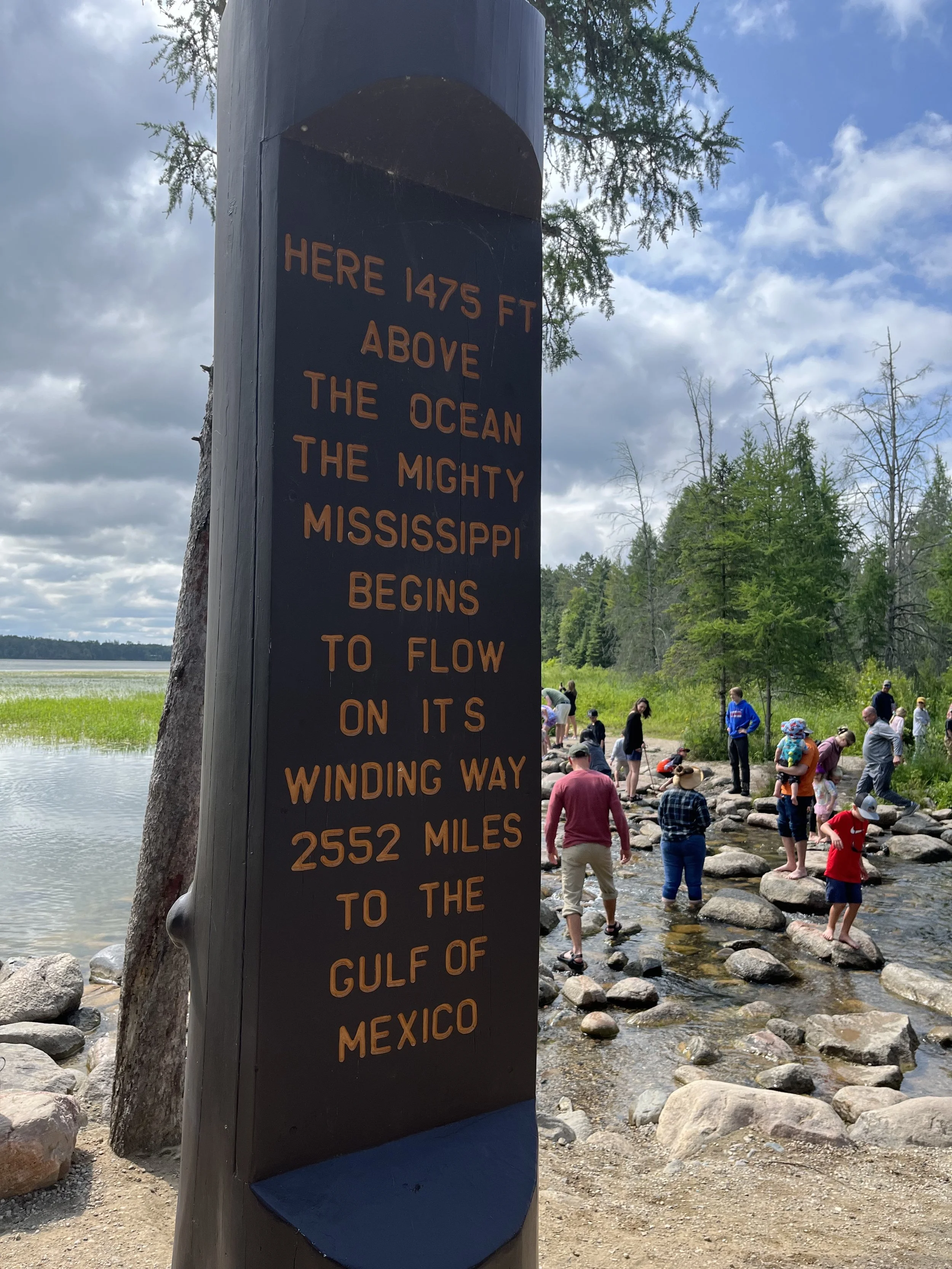
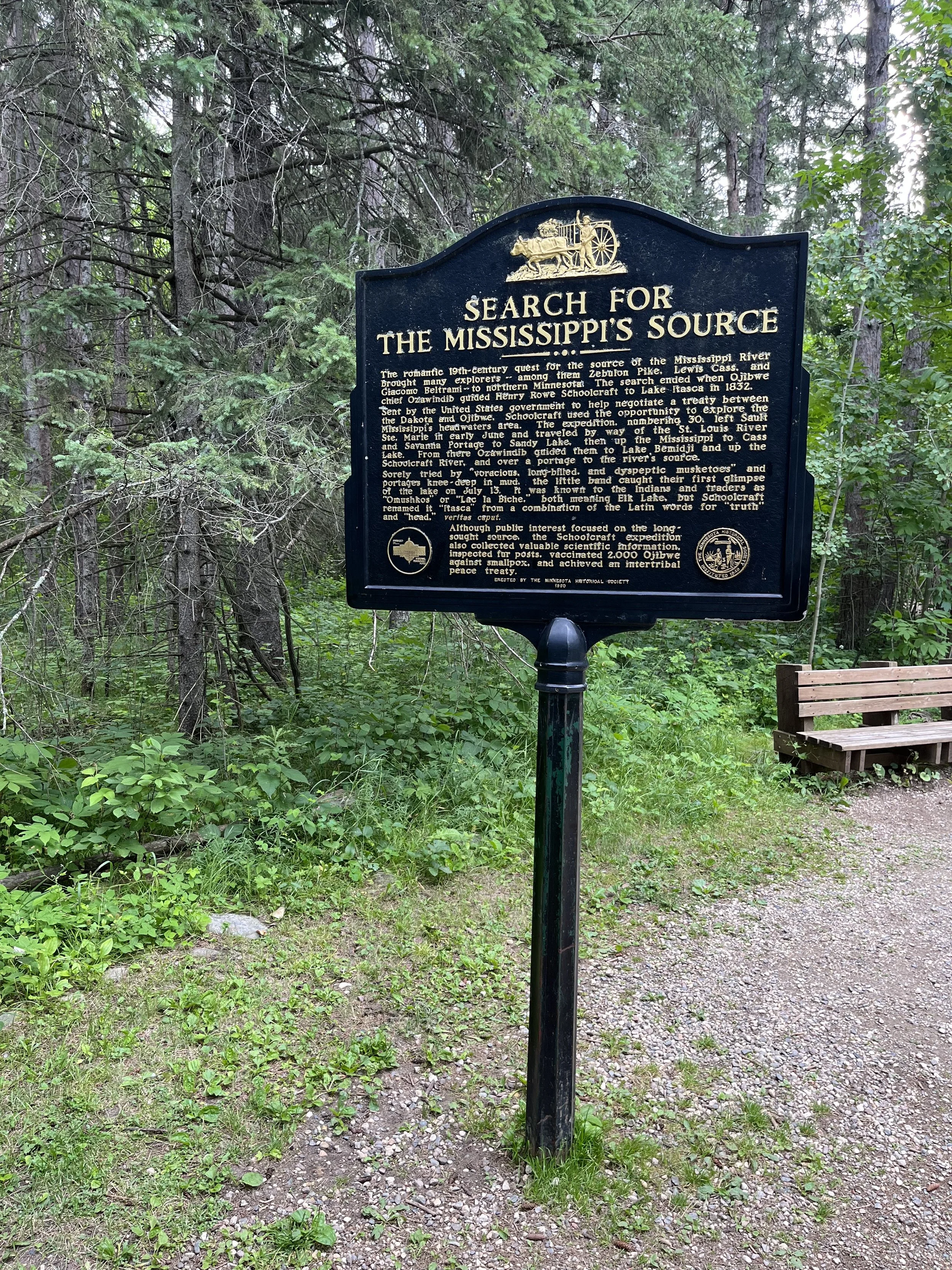
The term “headwaters” refers to the point of origin of a river’s longest channel. The Mississippi’s headwaters can be found in a modest stream flowing through Itasca State Park near Bemidji, Minnesota. From this place, the river flows north to Bemidji and then east and south towards Grand Rapids, Michigan. Led to the spot by an Ojibwe guide, Henry Rowe Schoolcraft was the first to survey the “source” of the Mississippi in 1832 and in 1888, Jacob Brower was dispatched by the Minnesota Historical Society to survey the lake and verify Schoolcraft’s findings.
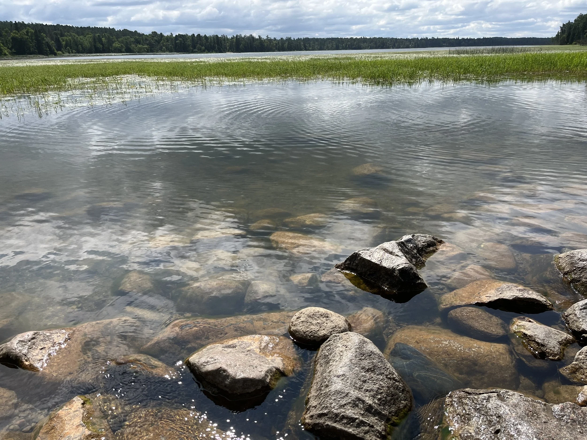
Today the precise location where the river begins is a small rock dam on Lake Itasca. After parking we followed a short trail to the dam which is surrounded by a few tamarack trees. Further from the riverbank are old growth red and white pines. The larger area surrounding the park is home to wolves, loons, red-necked grebe, and trumpeter swans. Nearly a half million people visit Itasca State Park every year to see the river’s headwaters with many wading between its banks so they can proclaim, “I walked across the Mississippi River.” According to a local legend, people who cross the river at this place will live a long and happy life.
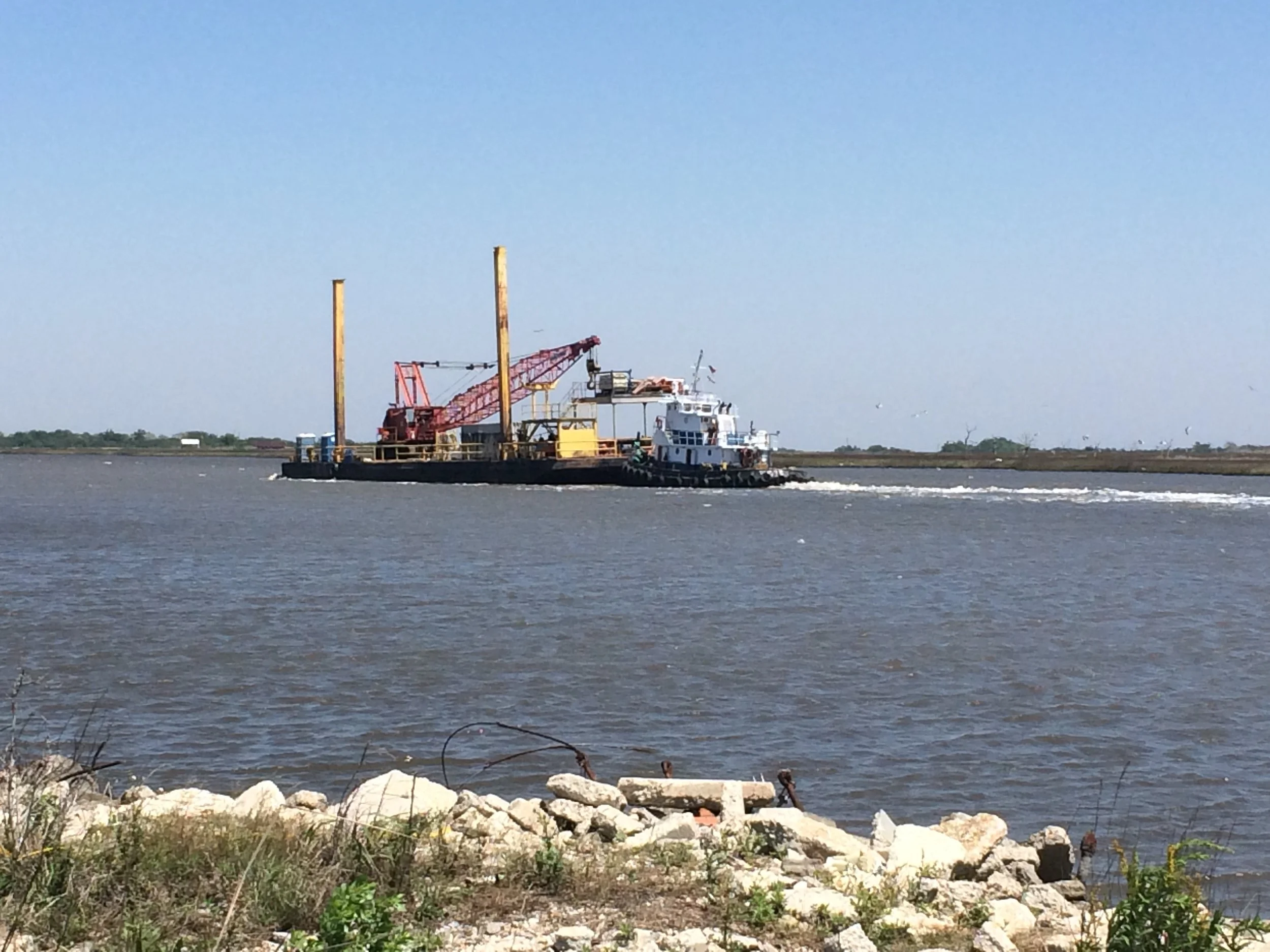
Nearly 3,800 kilometers downstream is the river’s delta where 6,000 to 20,000 cubic meters per second of freshwater is discharged into the Gulf of Mexico, south of New Orleans. Believed to be 4,500 years old, the delta was created where the velocity of river water slows as it enters the Gulf and is no longer able to carry silt and clay in suspension. As sediments accumulate, they form into finger-like piles that are shaped and reshaped by the river. The Mississippi’s delta was discovered by Alvarez de Pineda of Spain in 1519. In 1682, Robert Cavelier de la Salle claimed land around the delta for France and in 1699 the French built a fort nearby. From the air, the delta looks like a bird’s foot with lobes of sediment that are eventually abandoned as moving water creates new pathways.
Covering 12,000 square kilometers, the delta extends east from the Chandeleur Islands to Vermillion Bay, making it among the largest coastal wetlands in the U.S. Over the years, the quantity of suspended sediment carried by the river has decreased substantially because of engineering projects such as levees and dams that trap sediment. This has led to the delta basin losing about 70% of its land area since 1932.
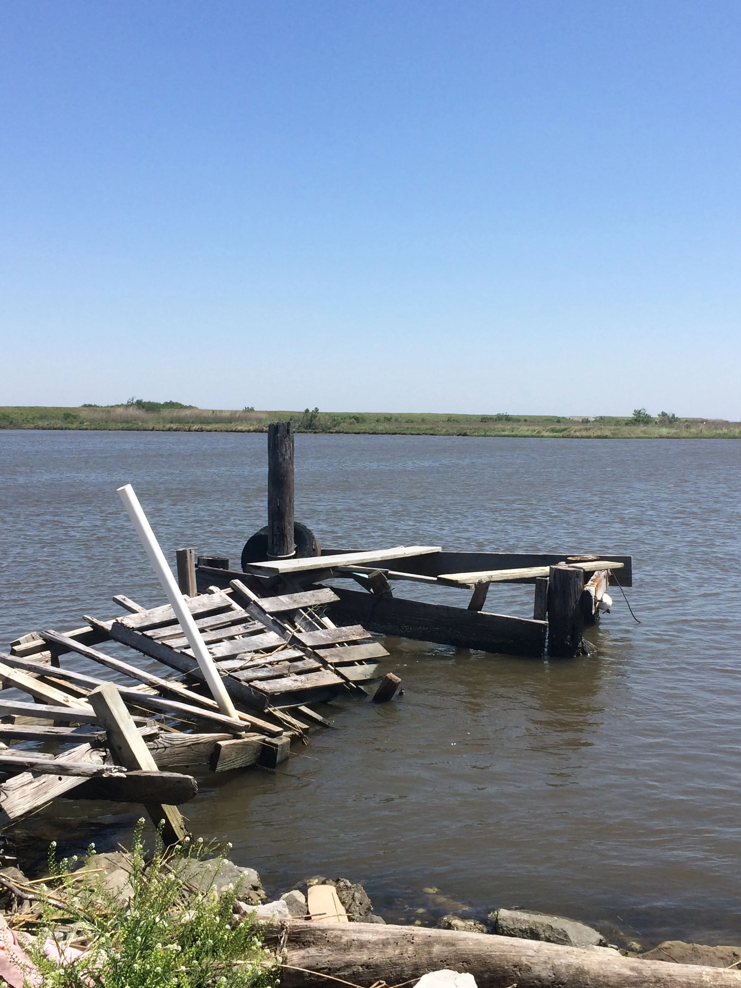
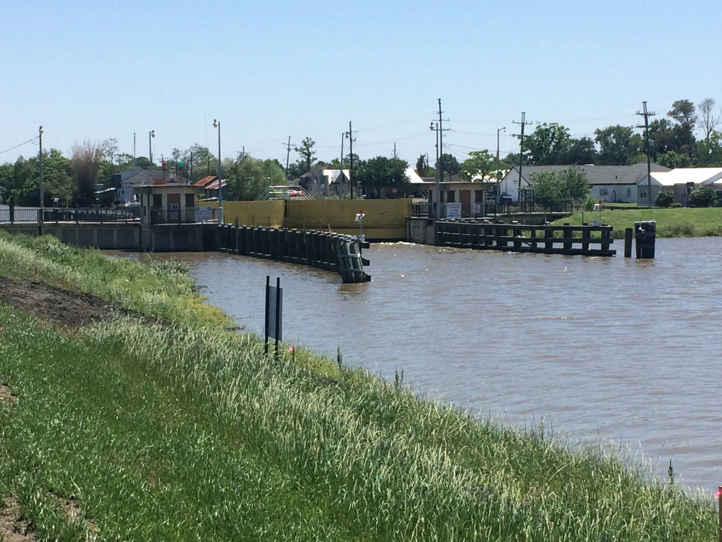
From New Orleans we took Highway 23 south to Belle Chasse. From there the highway follows the river past the towns of Alliance, Port Sulphur, and Triumph before reaching Venice. Continuing southwest, we took Tidewater Drive into an area of canals. From this turnoff the Mississippi’s main channel continues southwest. Located along the Mississippi Flyway, the larger area is part of Delta National Wildlife Refuge. Animal life found within the refuge includes bald eagles, red bats, wild turkeys, and southern flying squirrels. There are also neotropical migrant birds such as warblers, tanagers, and cuckoos and fish that range from sunfish to spoonbill, and garfish.