New Zealand. Pristine Beaches of the North Island
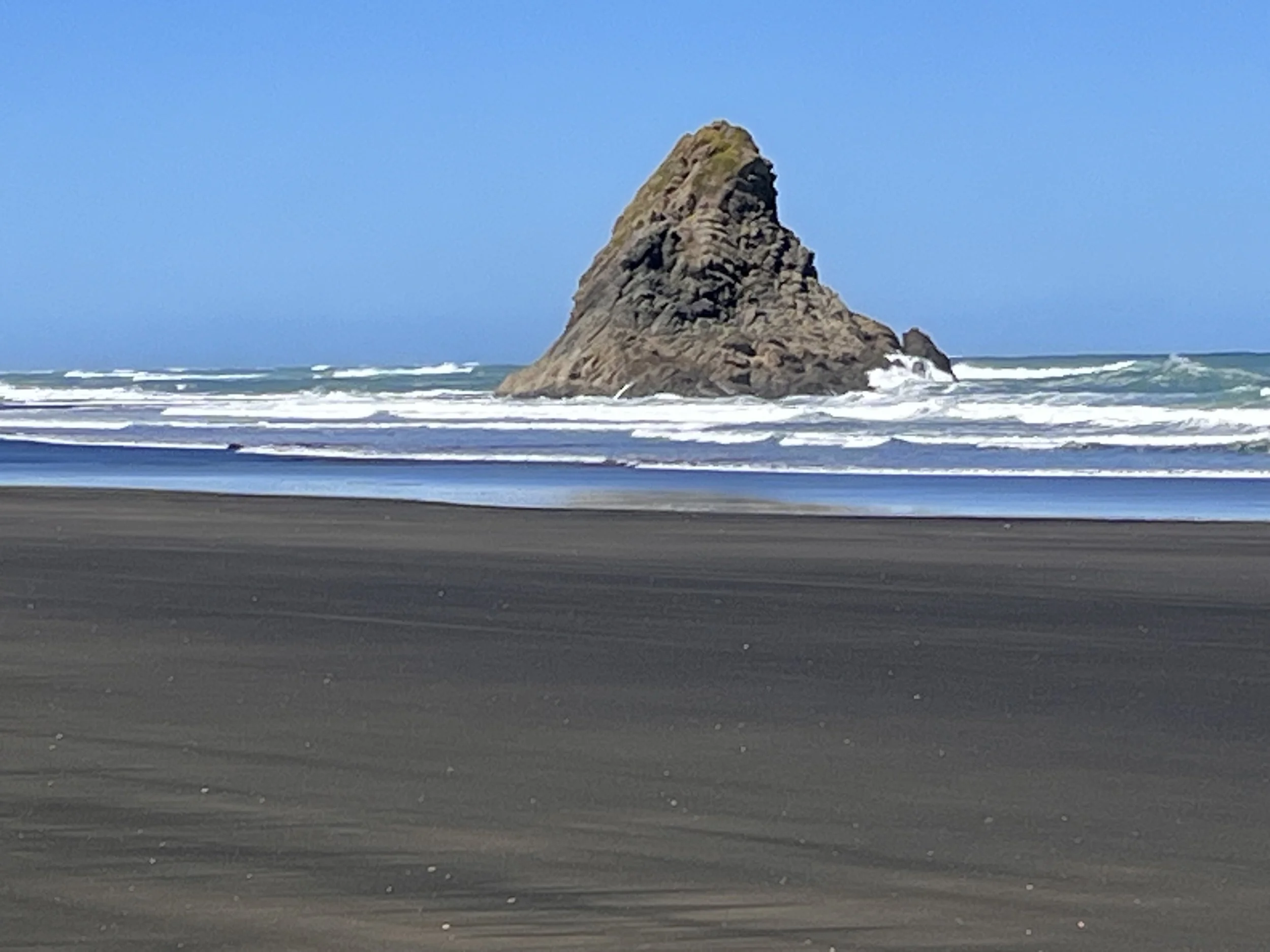
If you visit New Zealand, be sure to reserve time to see the North Island’s picturesque and untrammeled beaches. The North Island’s diverse coastal landscapes are places of serenity, reflection, relaxation, and exploration. North Island (aka Te Ika-a-Māui or “fish of Māui”) is the second largest of New Zealand’s 600 islands. It is geographically smaller but more populated (four million) than South Island (1.2 million). A Māori legend says that a demigod named Māui used a fishhook made from his grandmother’s jaw to catch a fish that became North Island. British Captain James Cook was the first European to circumnavigate North Island between 1769 and 1770. Located thirty-five kilometers southwest of Auckland on the island’s west coast, are the black sands of Karekare Beach. Karekare is a Māori word meaning “wild and turbulent waters.” The beach’s soft, dark sands come from volcanic rock originating from nearby Mount Taranaki. Karekare is part of Waitākere Ranges Regional Park. Adjacent to the beach is a rainforest where native Ngaoho peoples lived between the 13th and 17th centuries.
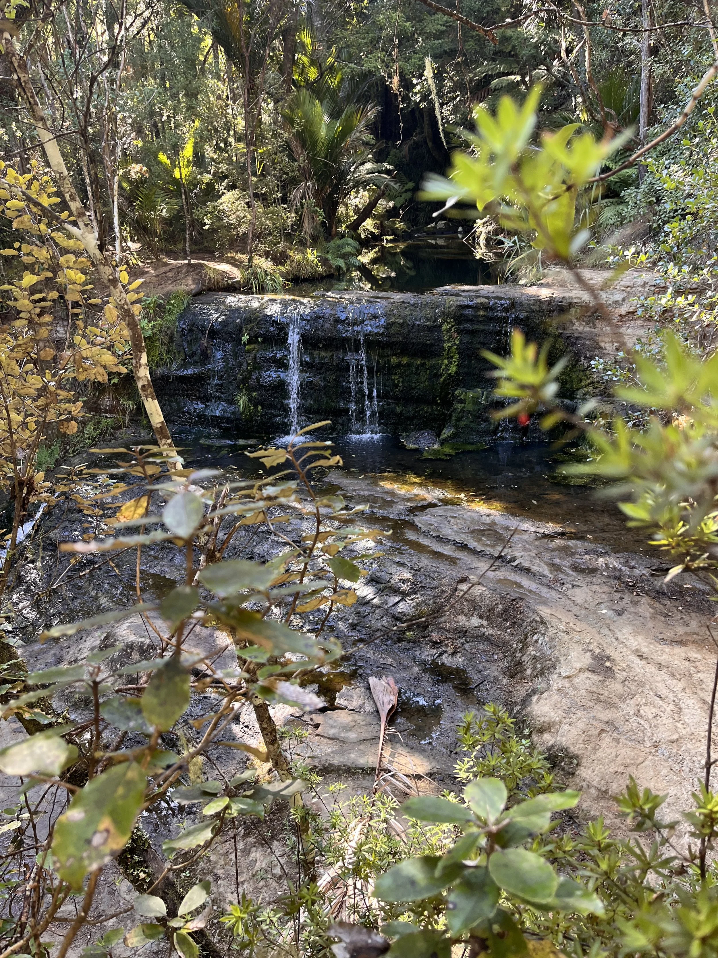
Traveling northeast, we continued to Omeru Scenic Reserve, located on the Kaipara Coast Highway east of Kaipara Harbor. Surrounded by a thick forest dominated by kauri trees, ferns, palms, and other plants, Omeru Falls can be reached by taking a short hike. The trail took us down a hill and across a footbridge. Located in a shaded spot, water from the falls drops about five meters.
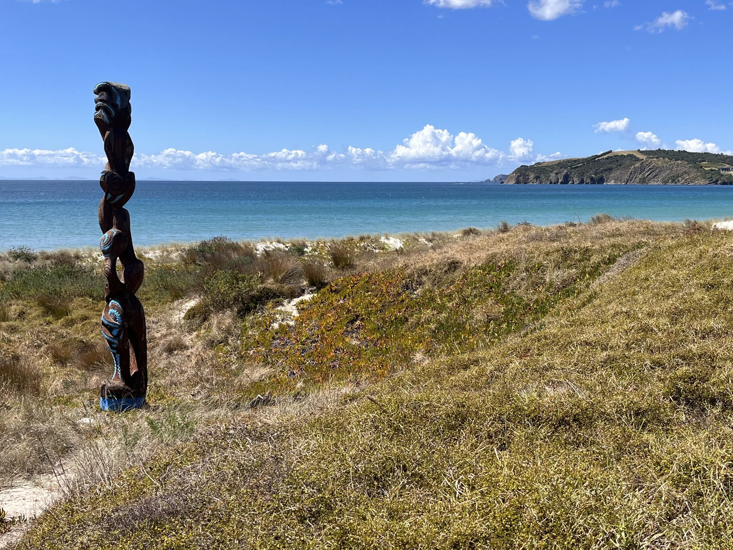
Our next stop was Ōmaha Beach, located on North Island’s east coast and about seventy-five kilometers north of Auckland. Positioned on a sandspit formed during the last glacial period (5,000-6,000 years ago), the beach’s name means “bountiful food.” Just inland of the high tide mark and within a vegetation-covered dune area are tall wood carvings that randomly protrude from the sand. A traditional Māori carving representing an ancestor, tekoteko are created to ward off evil spirits and are frequently found guarding Māori meeting houses. With deeply carved faces, facial tattoos, and protruding tongues, tekoteko are made by master woodcarvers.
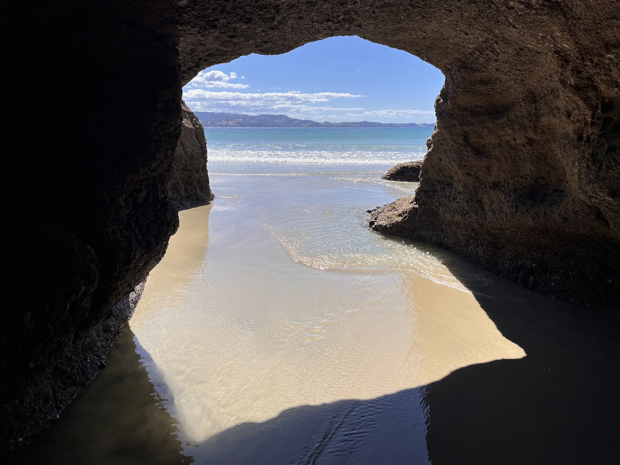
Driving southeast, we set out for Tawharanui Regional Park, located on the eastern side of the Tokatu Peninsula. The park has white sandy beaches, wetlands, rolling pastures, and native coastal forest. Long ago the Māori built five pā (fortifications) within the present-day park. Archaeologists have also found middens (trash dumps), food storage pits, burial sites, and hillside terraces used for houses. Prior to its acquisition by the government, the 593-hectare park was a private farm operated by three families. Today the beach is surrounded by Pohutukawa trees. After reaching the beach we walked through a shallow coastal sea cave. During the 1990s, park officials transformed a portion of the area into a sanctuary for native birds with predator-proof fences to protect nesting areas. Birdlife includes korimako (aka bell birds), native robins, and dotterels. During early evening hours it may be possible to spot shy kiwis in the brush.
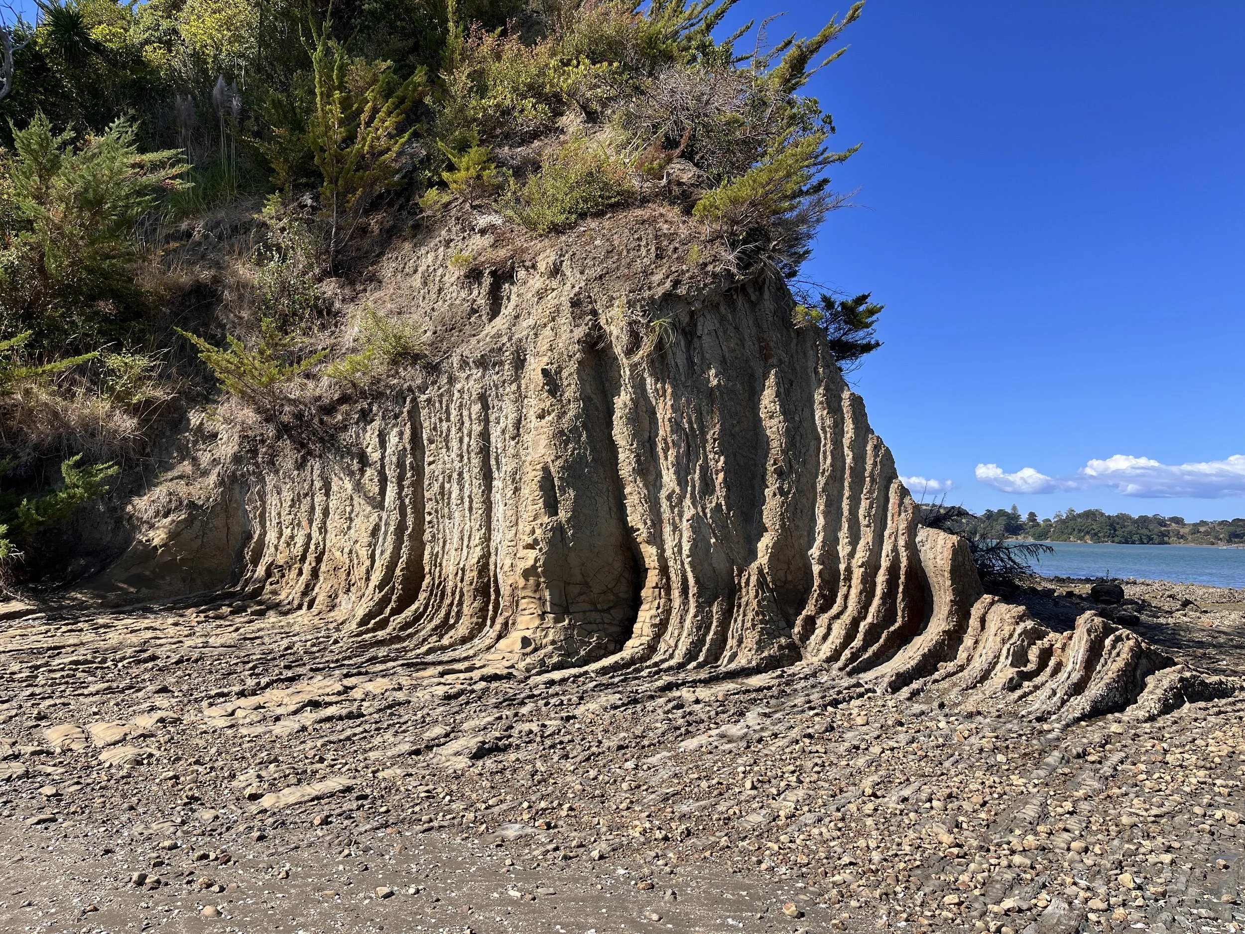
On our return to Auckland, we made a stop at Scott Point in Mahurangi Regional Park. The park features pastures, ocean bays, and historical sites including a homestead built by Thomas Scott, Sr. Scott purchased land there in 1852 and over the next twenty-three years he and his sons built a dozen ships, mostly cutters and schooners. In 1863 the Scott family opened the Mahurangi Hotel. Scott’s sons continued to live on the property until early in the 20th century. Renovated in 1877, The Scott family’s well-maintained two-story house has an inviting porch. We continued down a rocky beach and pathway at the base of a wave-cut platform of limestone, greywacke, and other marine sediments. The bay was at low tide, so we walked through tide pools to Casnell Island.
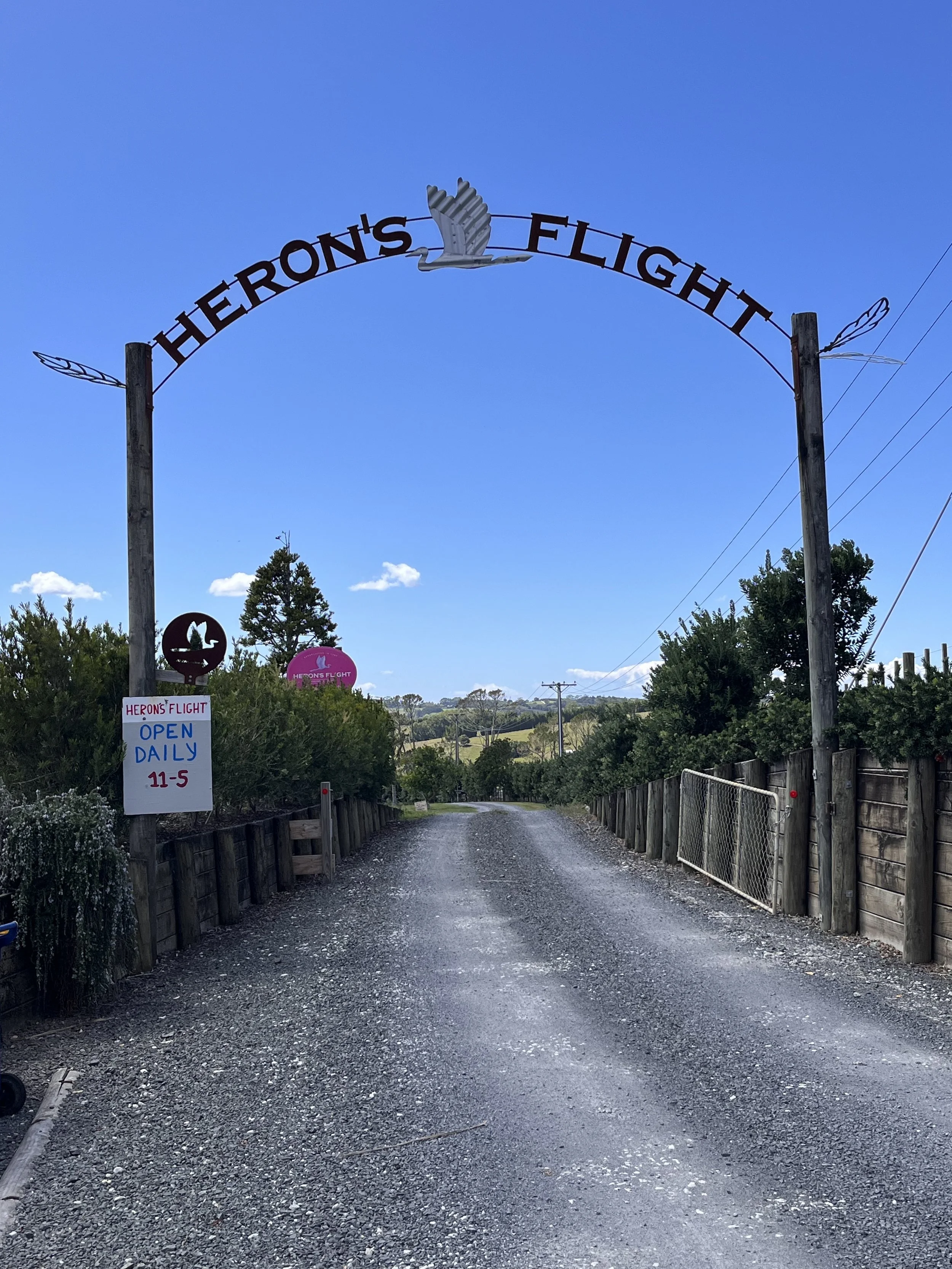
An accidental detour near the town of Matakana brought us past a road sign advertising a local winery called Heron’s Flight. Intrigued, we followed a narrow driveway to a small parking area. David, the owner, and his dog were on hand to welcome us in a modest-sized wooden building with an attached porch. We shared a wine flight (sample) that included an Amphora Sangiovese, a Volare Sangiovese, and a light-red tinted Dolcetto Rosato. David explained that he and his wife launched the winery in 1987. Inspiration for the winery’s name came from a heron that lived in a wetland area adjacent to the vineyard. After producing French varietals such as Bordeaux and Cabernet Sauvignon, David and his wife switched to Italian grapes. Today, Heron’s Flight is the only New Zealand winery exclusively focused on producing Dolcetto and Sangiovese grapes. After returning to the U.S., we ordered a case of Heron’s Flight wine.