Morocco. Aït ben Haddou, City-Fortress on the Road of a Thousand Kasbahs
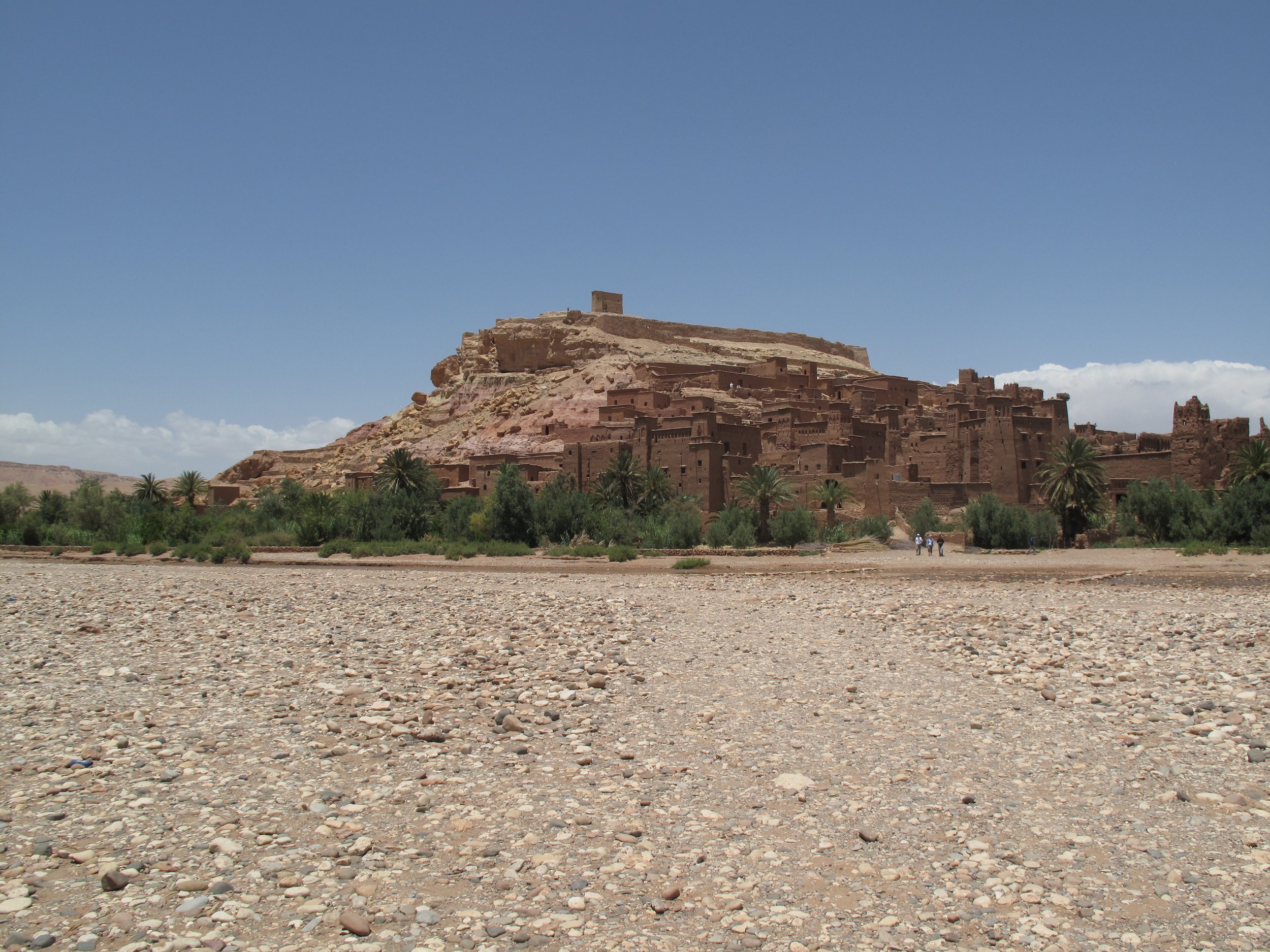
Viewed from a distance, the ksar of Aït ben Haddou looks like an enormous castle rising from the desert. In North Africa, ksars are groups of adobe buildings with high defensive walls. Serving as a desert fortress on the “Road of a Thousand Casbahs” (a caravan route between Marrakesh and the Sahara), Aït ben Haddou is the most famous ksar in the Ounila Valley. In part because it is so well preserved, Aït ben Haddou has been featured in films such as Lawrence of Arabia (1962) and The Man Who Would be King (1975).
The name “Aït ben Haddou” represents a tribal group known as the Aït and the family group of Ben Haddou. In Arabic “ben” means “sons” so the ksar was built by the sons of a leader named Haddou. Aït ben Haddou was founded as a fondouk (aka caravanserai) that offered food and lodging for traders and merchants. Fondouks were like roadside inns where weary travelers could eat, sleep, and rest. Crowded closely together, fortified houses in a ksar are known as casbahs. Protected by corner towers, casbahs have shared walls and can be modest in size or large and ornate. Each of Aït ben Haddou’s six casbah’s was established by an extended family.

In contrast to other types of historic buildings, ksars are living structures that must be constantly repaired and/or rebuilt because of damage from rain and blowing wind. The ksar’s current buildings replicate older ones, so it can be challenging to assign a specific age to any of its casbahs. Although people have lived on the site since the eleventh century, the oldest structures date to the seventeenth century. Aït ben Haddou experienced a slow decline beginning in the nineteenth century as caravan routes were replaced by more efficient methods of transporting goods such as ships. With fewer travelers passing through the area, the ksar fell into disrepair. Recognizing its importance, the government of Morocco helped restore the ksar and since 1980, Aït ben Haddou has been a UNESCO World Heritage Site. About five kilometers away is another ksar known as Tamdaght that has not been restored and is slowly falling apart.

Our journey to Aït ben Haddou began in Marrakesh, 180 kilometers to the northwest. The four-hour drive took us through mountain passes and across sparsely vegetated terrain. As we approached from a distance, Aït ben Haddou looked like many apartments of assorted sizes, squeezed together on one side of a low hill.

After parking, we followed steppingstones across the shallow Ounila River that is flanked by date palms. No fee was required to enter the ksar. Inside the main wall are stables where travelers once boarded camels and donkeys for the night. The ksar’s walls are made from adobe bricks and straw. For added strength, taller structures were constructed using rammed earth. With thick walls and small windows, the ksar was designed to maintain cool interior temperatures during hotter months. A few of the buildings we saw were marked with Amazigh symbols such as circles, stars, and triangles. We followed twisting alleys and climbed staircases that led to courtyards, patios, and private residences. In a few places we were greeted by current residents who make their income selling jewelry, textiles, and other souvenirs.

The population of the ksar has declined over the last eighty-five years. Whereas in 1940 there were ninety families living there, today there are only five. Most others moved to a modern village on the other side of the Ounila River. Before departing we walked to the top of the hill for a panoramic view of the landscape. At the summit is a small building called an agadir that served as a fortified granary.
