New Mexico. Gnarled Rock Formations of the Zuni-Bandera Volcanic Field
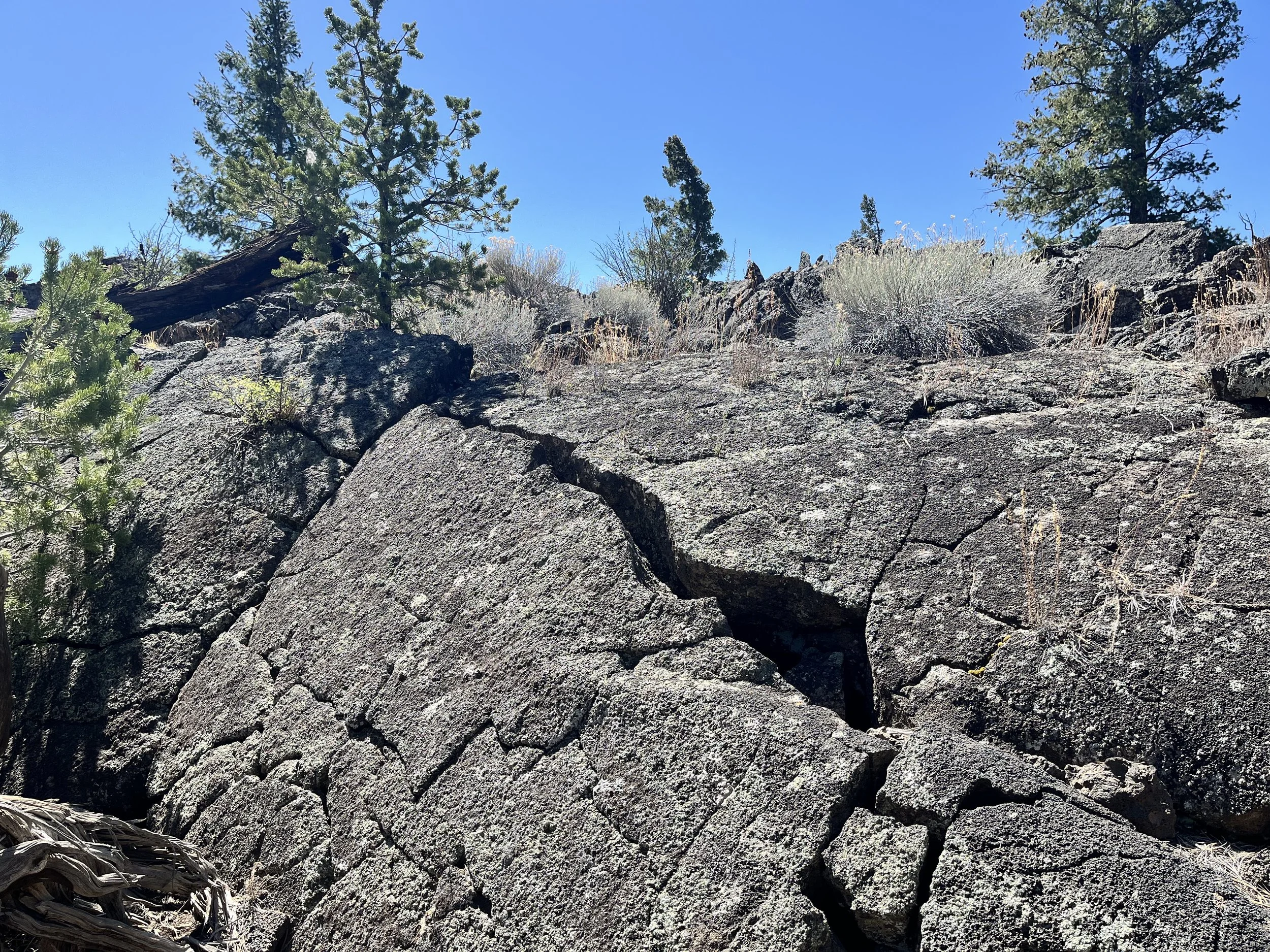
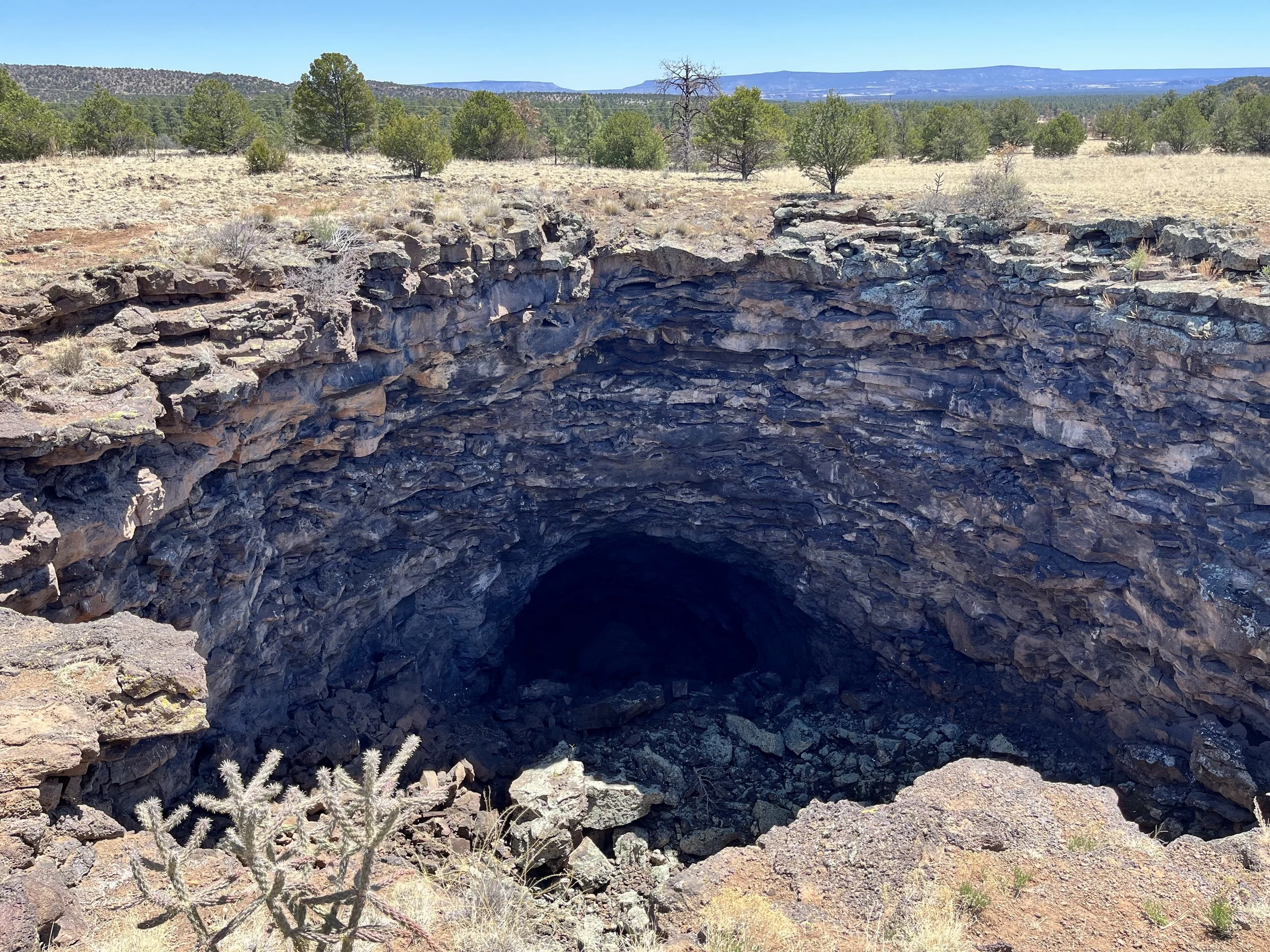
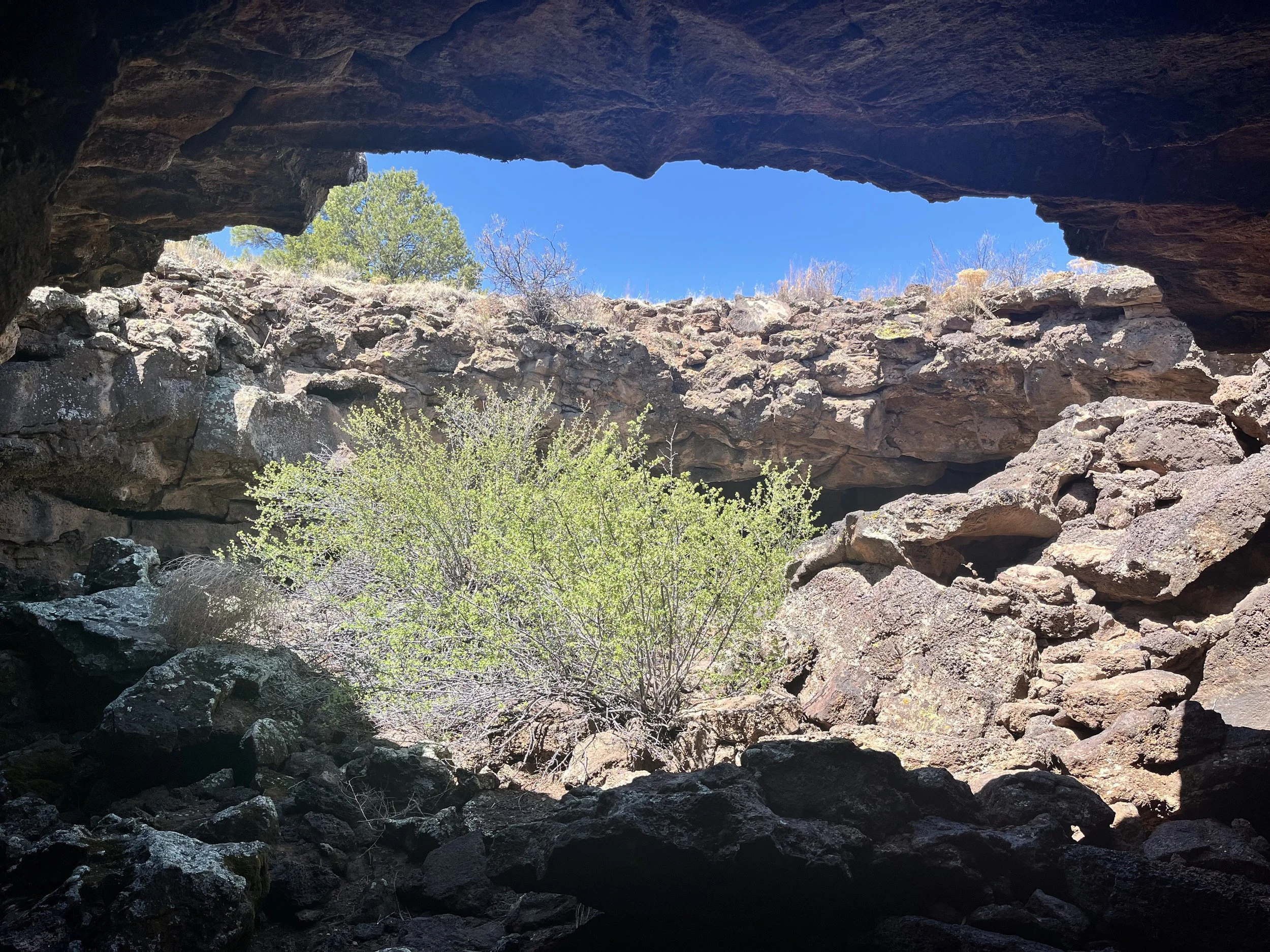
Southwest of Albuquerque is a unique volcanic landscape with low, symmetrical cinder cones, gnarled lava flows, rocky caves, wide fissures, and shallow maars (volcanic craters filled with water). El Malpais (pronounced el MAHL-pah-ees) National Monument preserves a unique 700,000-year-old volcanic landscape. El Malpais is considered a monogenetic field meaning that it has experienced multiple volcanic events with newer eruptions covering older ones. Geographically speaking, the twisted landscape is located within a much larger multistate region called the Colorado Plateau. Four separate flows of basaltic lava have blanketed 344 square kilometers in succession: the Zuni Canyon Flow, Laguna Flow, McCarty Flow, and Bluewater Flow. Among these, the McCarty Flow impacted the largest area. In a few places are kipukas, areas encircled but never covered by lava. Other volcanic features include ice caves and spatter cones. Along with surface features, the monument protects a system of belowground lava tubes, twenty-seven kilometers long. The region’s eruptions were similar to those that shaped the Hawaiian Islands with slow moving flows and minimal volcanic ash. Elevations within the monument range from 1,950 to 2,600 meters with annual rainfall, a modest 254mm.
Established in 1987, the monument includes 1,521 square kilometers controlled by the U.S. Bureau of Land Management and 462 square kilometers managed by the National Park Service. In addition to the main area are smaller units that include sandstone bluffs adjacent to Highway 117 and Highways 109 and 53. The monument has a wide range of flora including some of the oldest Douglas fir trees on earth. There is also alligator juniper, pinyon pine, ponderosa pine, sagebrush and prickly pear cactus. Antelope and deer are found within the monument along with more than 190 species of birds including the Peregrine falcon.
The area’s first inhabitants were Paleo-Indians who came sometime between 10,000 and 5,500 BC. During the Archaic Period (5,500 BC to 400 AD), the area’s residents shifted from a hunter-gatherer lifestyle to raising crops. The Navajo arrived in the 12th century. According to a Navajo creation myth, a monster called Yé’iitsoh (meaning big god) was slain by twin war gods. It was Yé’iitsoh’s blood that flowed down Mt. Taylor and hardened into the black lava flows. The lava fields are also home to Laguna, Acoma, and Zuni peoples. Early Spanish explorers who passed through named the area “El Malpais” meaning “the badlands.” The area experienced an influx of settlers following the arrival of the railroad in 1881. Regrettably, the unique volcanic terrain hasn’t always been treated with care and respect. For ten months in 1943, twenty-three square kilometers of the lava field was used for practice bombing runs by U.S. military aircraft. The lava fields were also considered as a potential location for testing the first atomic bomb.
We saw examples of both ropy pahoehoe (pronounced pah-HOY-hoy) and chunky ʻaʻā (pronounced AH-ah) lava that filled a large basin created by faults associated with the Rio Grande Rift. Pahoehoe lava is extremely hot and has a low viscosity. In contrast, ʻaʻā lava has a high viscosity, lower temperature, and roughness caused by rapid cooling. West of the monument we could see distant cinder cones along a north-south running line. El Malpais’ lava flows have created a “mesic island” meaning that its lava rock is filled with moisture useful for trees and plants.
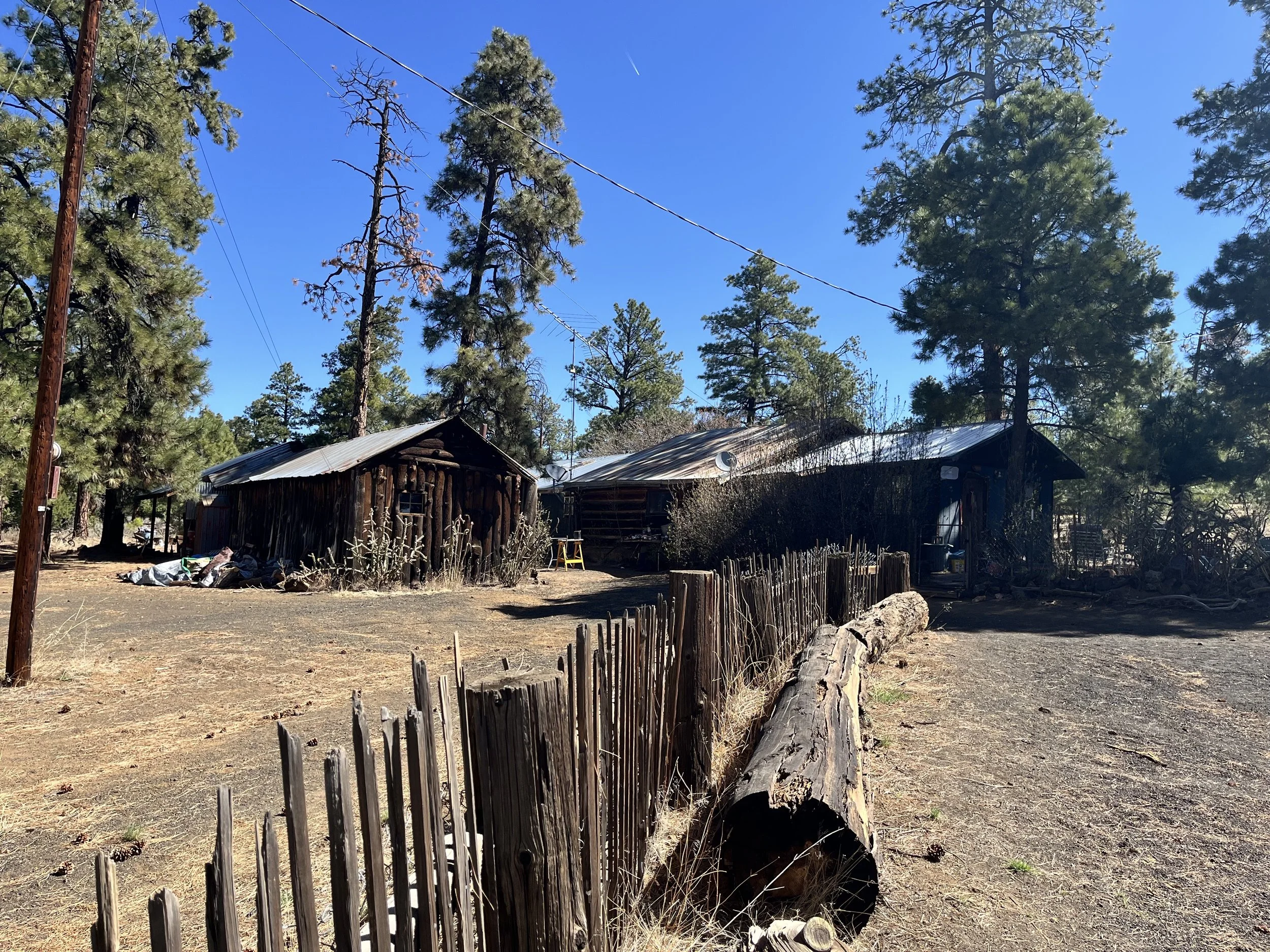
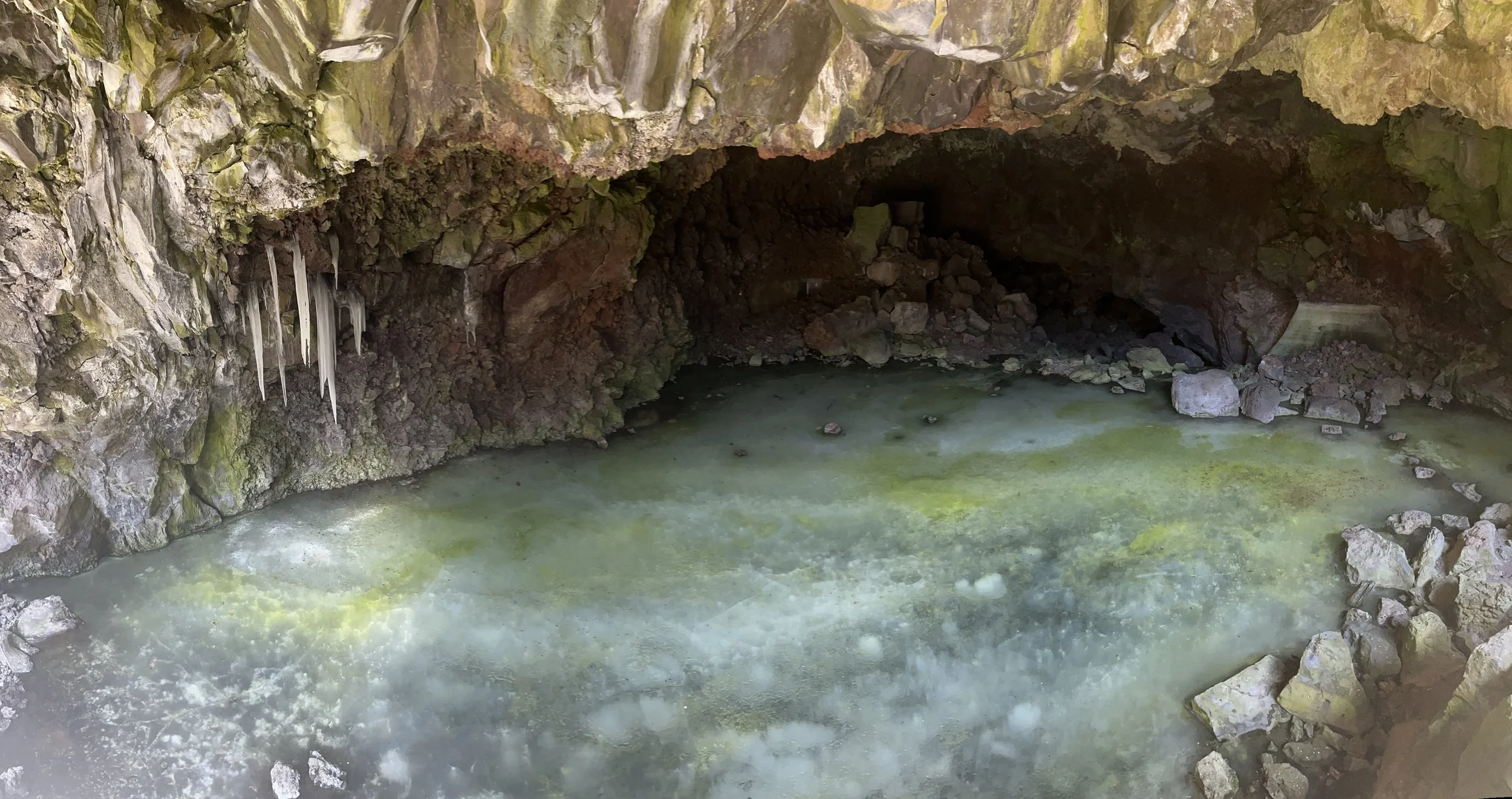
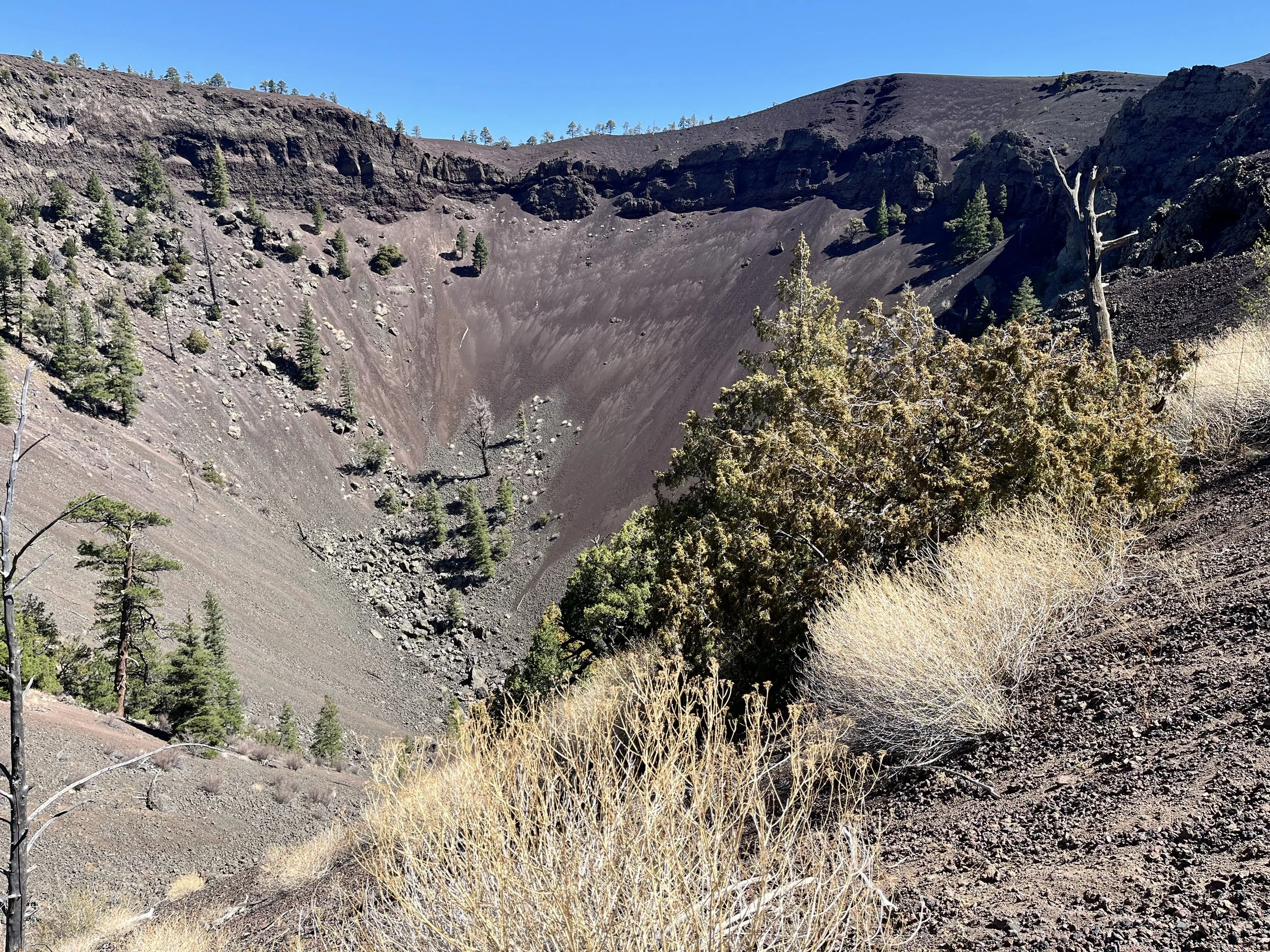
Although the federal government protects the core, some of the region’s volcanic landscapes are on private property. One of these is the impressive Bandera Ice Cave. The Bandera Cave (aka Zuni Ice Cave) is located on Highway 53, about 64 kilometers south of Grants. After paying an entrance fee, we were given an orientation to the self-guided walk that departed from the cave’s historic trading post. Passing through Ponderosa pine, juniper, and Douglas fir, we followed a trail to the edge of the dormant Bandera Volcano. Positioned on the U.S. Continental Divide, the volcano’s most recent eruption was about 10,000 years ago. A spur of the trail extended upward to an overlook where we could look into the large crater. During its eruption the pressure of flowing lava breached the south side of the crater, forming a 37-kilometer-long river of hot, smoldering rock. Visible from the trail we could see collapsed lava tubes within this former channel.
Our next stop was the ice cave. Defying logic, a thick layer of ice persists year-round, assisted by cool air trapped in the cave’s opening and the insulating effect of the cave’s rock walls. The temperature remains a constant -0.5°C, even in warmer months. The cave was once used to harvest ice needed for keeping food and beverages cold. Today, visitors are no longer allowed to walk to the back of the cave. We followed a staircase down to a viewing platform at the cave’s mouth where we could see milky ice and patchy areas of green algae.