California. The Lowest, Hottest, and Driest Place in North America
Located in southeastern California and southwestern Nevada, the Mojave Desert’s Death Valley has the lowest land elevation in North America (86 meters below sea level). Extending from the Panamint Range in the west to the Amargosa Range to the east, the valley is just 136 kilometers from Mt. Whitney, the highest peak (4,421m) in the contiguous U.S. Among other records, Death Valley experienced the hottest temperature ever recorded: 56.7°C (134°F) on July 10, 1913. Geologically, the valley is a graben, a downthrown block between two mountain ranges that contains several faults including the Death Valley, Furnace Creek, and Garlock Faults. During a wetter climatic period 10,000 to 12,000 years ago, the valley was partially filled with a 160-square kilometer lake to depths of up to 180 meters. Death Valley falls within a rain shadow of the Sierra Nevada and Panamint Mountain Ranges. Its climate is classified as Köppen BWh, hot desert, with warm summers and winters and limited rainfall. At just 38mm per year it is the driest place in North America and one of the most arid locations on the planet. The valley is covered by wide alluvial fans containing sediments left behind by water that passed through narrow mountain canyons. Wildlife within the valley includes Bighorn sheep, hawks, and wild donkeys. Describing Death Valley, photographer Ansel Adams once noted, “In the heart of adversity, Death Valley showcases the strength of life’s tenacity.” Indeed, during spring months, parts of the valley are covered by wildflowers. The valley’s vegetative zones feature mesquite, desert holly, and creosote bush at lower elevations and pinyon-Juniper, limber pine, and bristlecone pine at higher altitudes.
The valley was once home to the Panamint Shoshone (aka Timbisha) whose villages were located at Furnace Creek and a canyon near Scotty’s Castle. Death Valley received its name from settlers who got lost there in 1849 while attempting to reach California’s gold fields. Between 1883 and 1907 the valley was the site of several borax mines. Other minerals mined there were lead, zinc, tungsten, gold, and silver. The first tourists to Death Valley began arriving in the 1920s and in February 1933, U.S. President Herbert Hoover signed an executive order creating Death Valley National Monument. From 1933 to 1942, twelve Civilian Conservation Corps (CCC) camps operated in Death Valley with a mission to build roads, trails, and campsites. In 1994, the valley was redesignated as a national park. Today Death Valley is the fifth largest U.S. national park and the biggest (13,848 km2) in the 48 contiguous states, exceeding the combined area of the states of Delaware and Rhode Island. Several movies have been filmed in Death Valley including Star Wars (1977) and Raiders of the Lost Ark (1981). In addition to paved highways and roads there are more than 550 kilometers of unpaved roads and four-wheel drive paths.
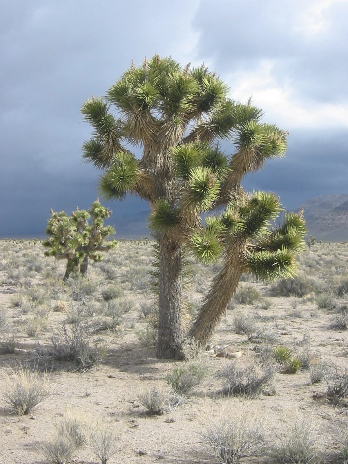
From Las Vegas, Nevada we took U.S. Highway 95 through the Amargosa Valley towards Beatty and the junction with Highway 374. From there we drove through Daylight Pass and south on Highway 190 to Furnace Creek. Continuing southward, we followed a dirt road to Artist’s Palette, and Badwater. Along the way we stopped to photograph a few Joshua trees (aka yucca brevifolia). Joshua trees are monocots that belong to the genius yucca. They were named by Mormon settlers who crossed the Mojave Desert during the 19th century. Appearing top-heavy because of thick branches, the plants live for hundreds of years and may reach heights of up to fifteen meters.
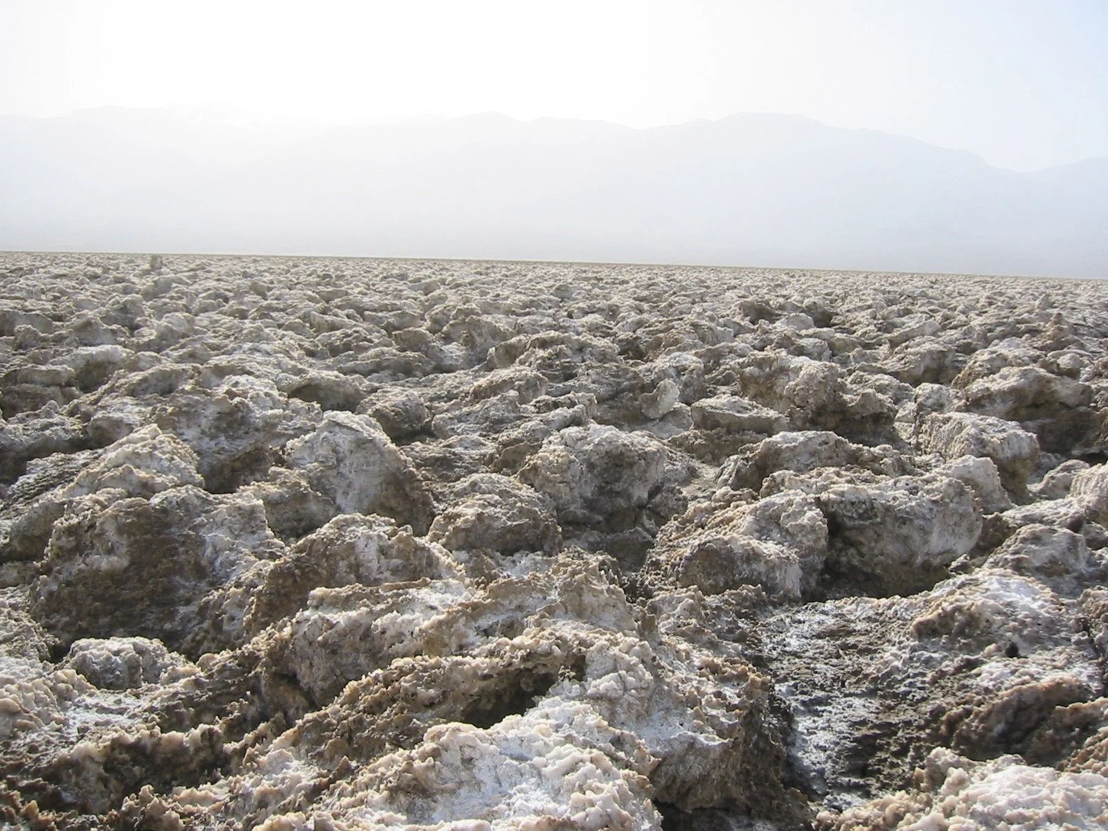
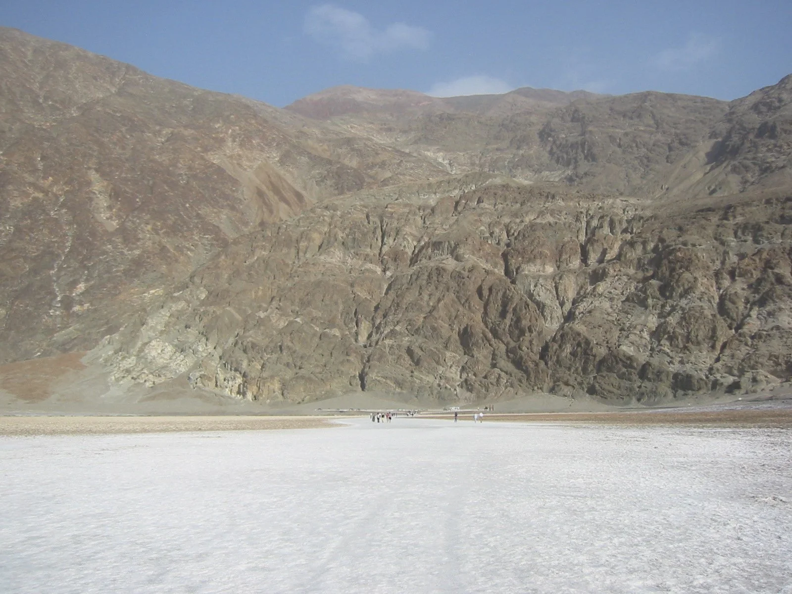
Another stop was the salt flats at Badwater Basin which occupies a portion of former Lake Manly. Covering an area of more than 500 square kilometers, the flats are a crusty surface of sodium chloride (salt), borax, and gypsum. The name “Badwater” is believed to have originated with an early explorer who refused to drink from a nearby spring-fed pool. A prominent feature within the flats is Devil’s Golf Course, a dissected surface of irregularly shaped polygons embedded with salt crystals. Its name comes from a 1930s guidebook that noted, “only the Devil could play golf on such a surface.”
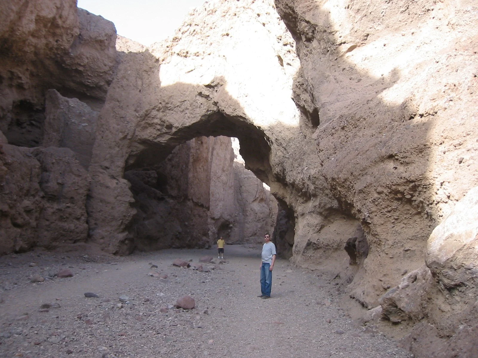
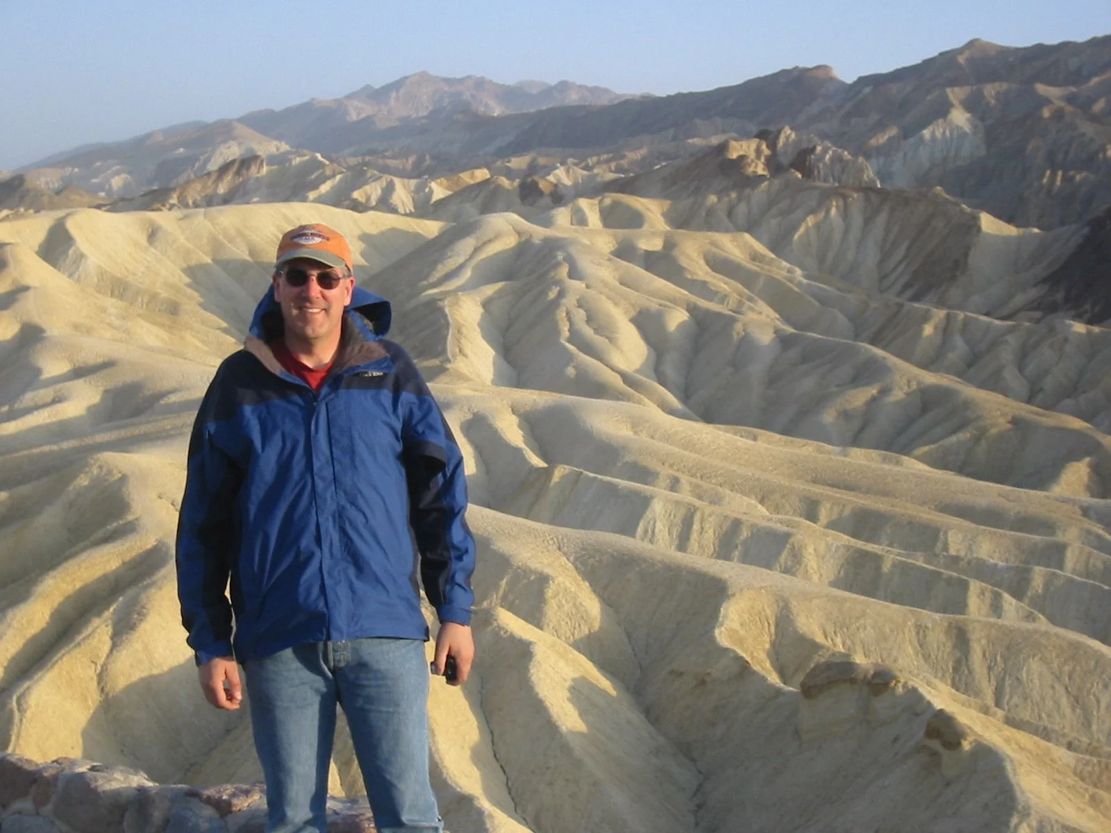
On our return leg to Las Vegas we stopped at Zabriskie Point, named for borax mining executive Christian Zabriskie. Today it is among the most photographed locations in Death Valley. Below us were badlands of yellow and grey hills formed by running water and completely devoid of vegetation. We followed a short trail from a parking lot to a natural bridge that rises eleven meters above the canyon floor. Created by a series of flash floods, the bridge is made from rough alluvial gravel that forms a contrast to smooth sandstone we saw elsewhere.
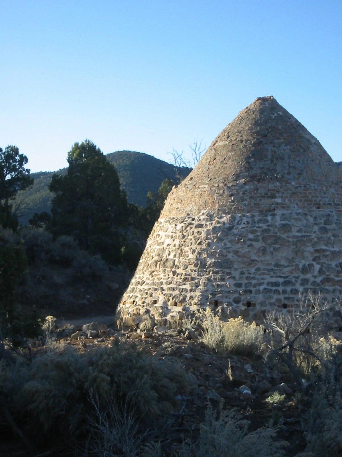
Another stop was the Wildrose Charcoal Kilns. To reach the kilns we drove south on Highway 190 to the town of Emigrant and turned to follow Emigrant Canyon Road. Used until 1879, the kilns were built to supply charcoal for the nearby Modoc Mines. They are constructed from stones held together by mortar. Wood, mostly pinyon pine, was cut from the surrounding hills and burned to create charcoal. Ten beehive shaped kilns form a single row.