Colorado. Canyon of Sheerness, Narrowness, Darkness, and Dread
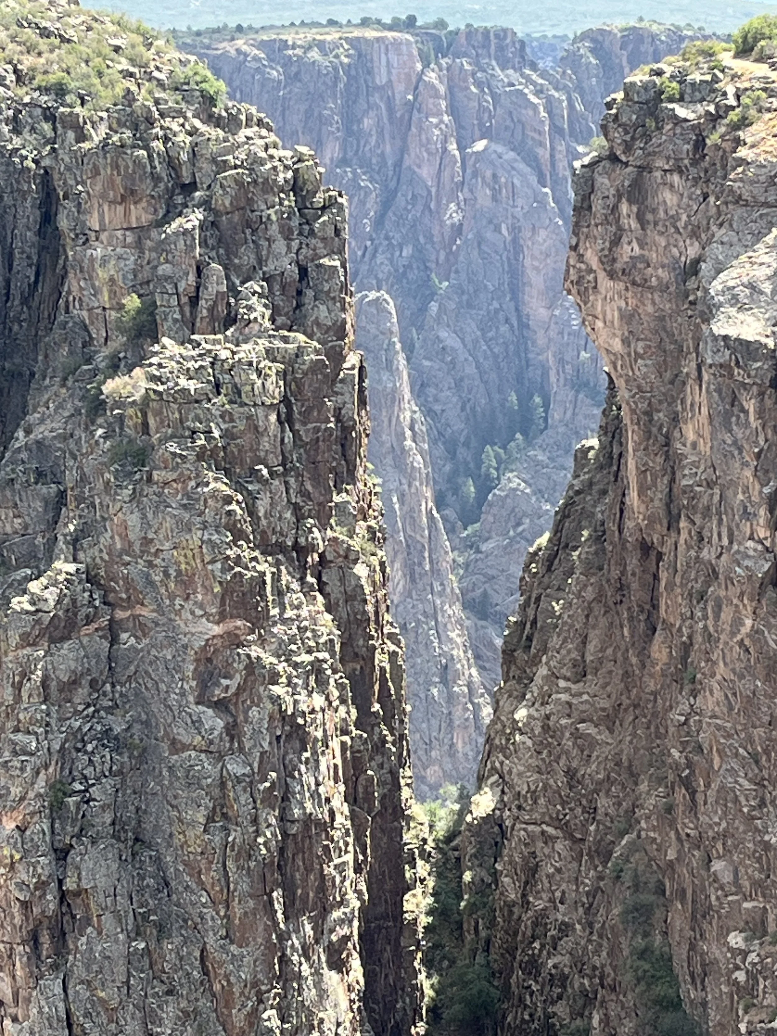
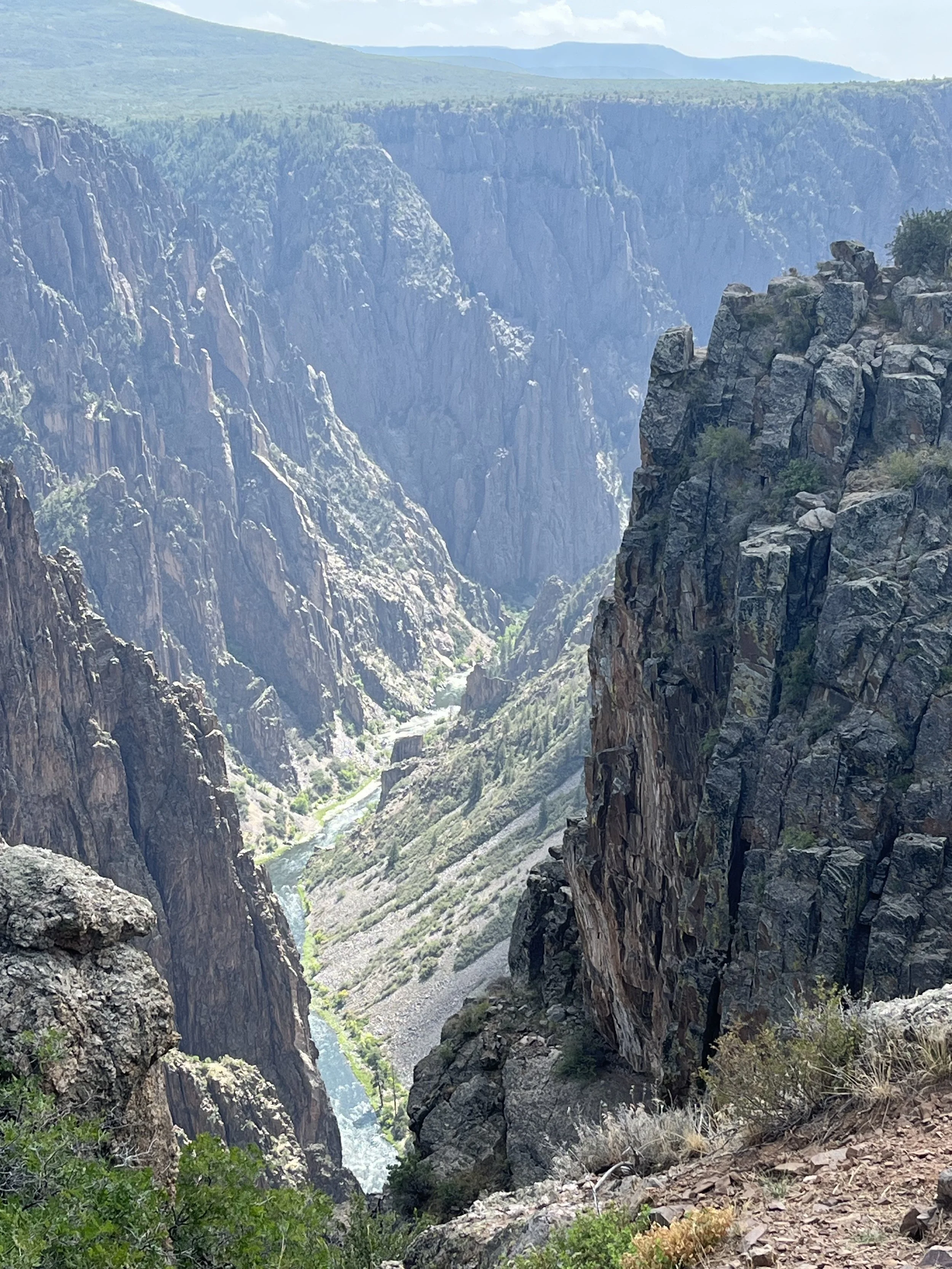
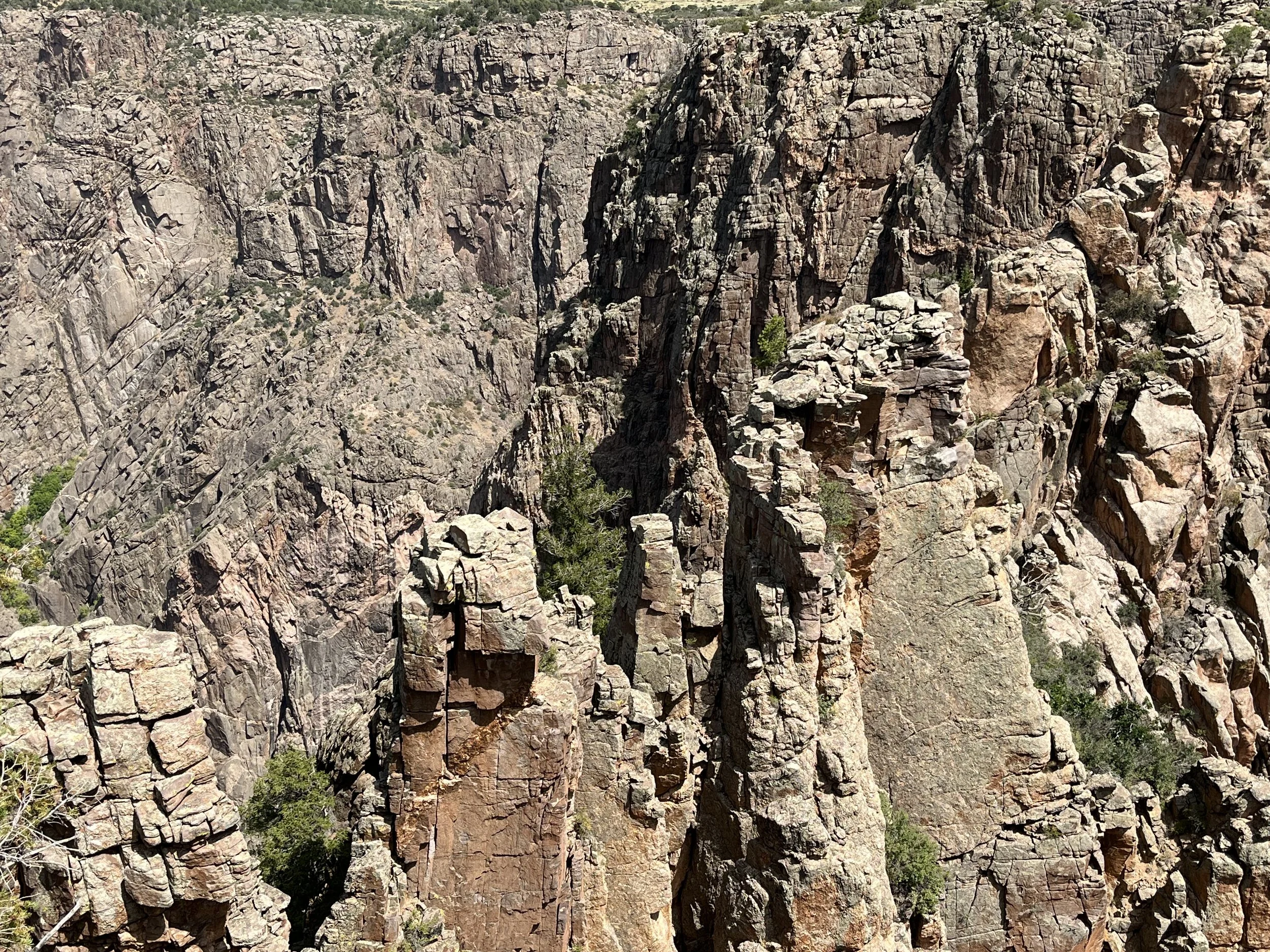
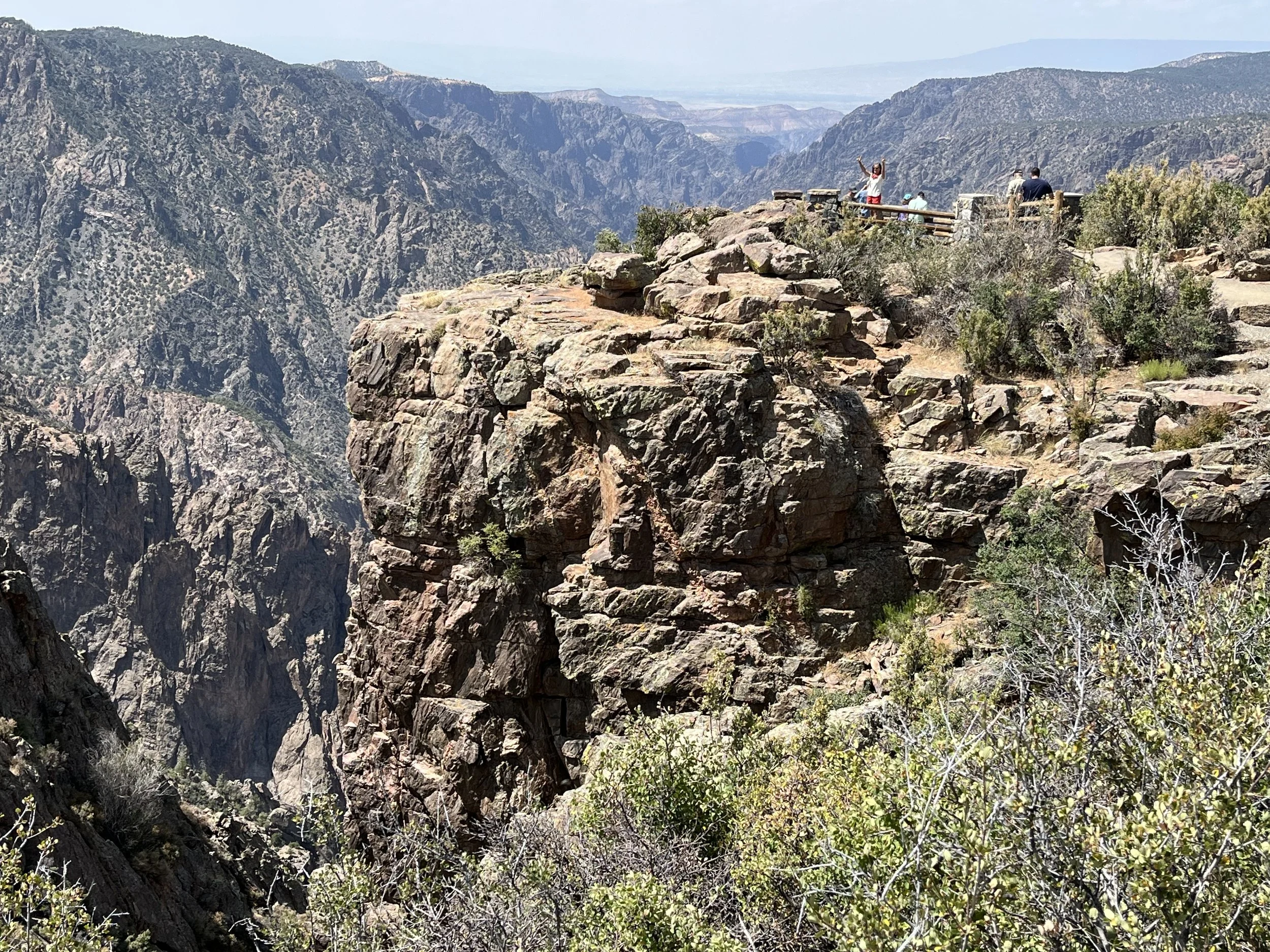
Named for its steep sides that prevent sunlight from reaching lower levels, Black Canyon of the Gunnison is among Colorado’s most impressive natural features. The canyon’s towering walls are comprised of folded gneiss and schist. As Duane Vandenbusche notes, “Several canyons of the American West are longer and some deeper, but none combines the depth, sheerness, narrowness, darkness, and dread of the Black Canyon.” Indeed, the Gunnison River’s 6.4 meters per kilometer drop makes it the fifth steepest canyon descent in North America and six times greater than the Colorado River’s descent in Arizona’s Grand Canyon National Park. I’ve visited the canyon a few times and most recently with a friend on a two-week trip through the U.S. Southwest.
Traveling through the canyon in 1901, civil engineer Abraham Lincoln Fellows observed, “The roaring of the river reverberated and echoed like demons howling over their prey.” Preferring to keep their distance out of superstition, the Ute called the canyon, “much rocks, big water.” It is believed that two Spanish expeditions passed within sight of the canyon before 1776. The first documented account of Black Canyon was submitted by Captain John W. Gunnison who passed through the area in 1853 while surveying a route between St. Louis and San Francisco. The river was later named in his honor.
In 1881, a section of the Denver and Rio Grande Railroad was completed between Denver and Gunnison and a year later the first train passengers traveled through a portion of the canyon. Although the plan called for tracks to follow the entire length of the canyon, the project was abandoned in the early 1950s. In 1933, Black Canyon of the Gunnison was designated a National Monument, the same year that the Civilian Conservation Corps constructed the North Rim Road. About 50% of the park’s 63 square kilometers were designated as federal wilderness in 1976. In 1999, the canyon was redesignated as a national park.
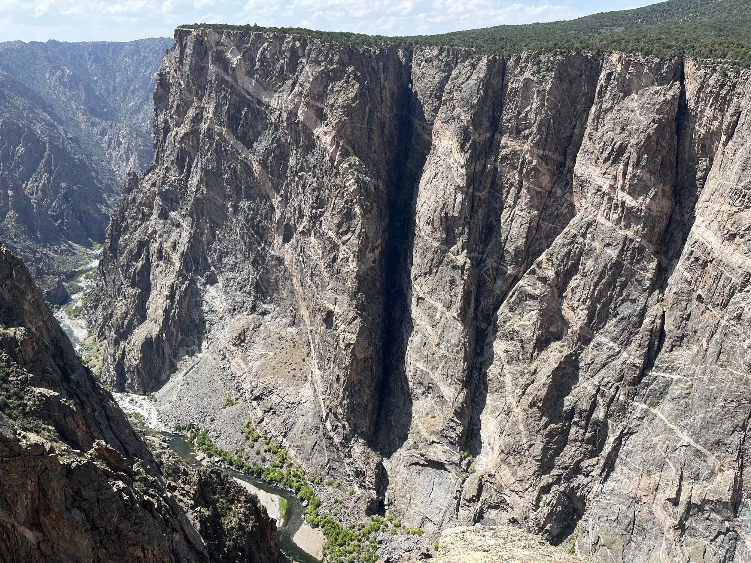
Black Canyon of the Gunnison has a unique geological story. About 60 million years ago the region surrounding the Gunnison River experienced a period of uplift and about 30 million years ago volcanos buried the landscape. Black Canyon was created by the Gunnison River over a period of two to three million years. Downward cutting was initially rapid through overlying volcanic rock. However, the rate of downcutting slowed when the river came into contact with harder Precambrian schist and gneiss that was formed 1.6 billion years ago. It is estimated that just 25mm of the older metamorphic rock was being removed every hundred years. Across a larger area gradual tilting of the land surface caused surface rivers to change direction but not the Gunnison since it was a captive of its well-entrenched canyon. Black Canyon reaches a maximum depth of 829 meters, and at its narrowest point, the canyon is just 12 meters wide.
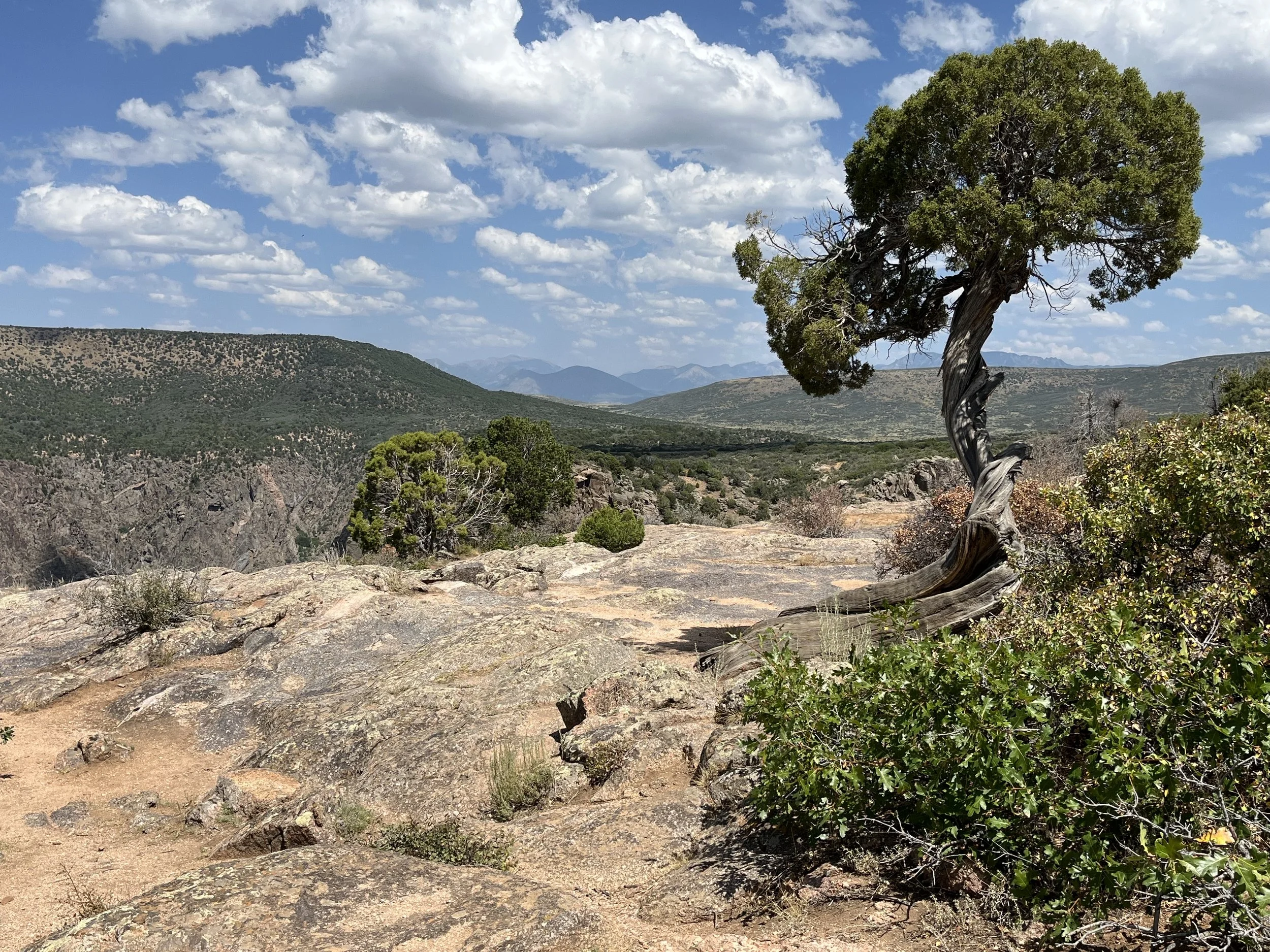
The park has two entrances: the South Rim located 24 kilometers east of Montrose and the North Rim that is 18 kilometers south of Crawford. Black Canyon has a rich assemblage of animal life that includes 174 species of birds, 59 species of mammals, and 11 reptile species. Mammals include black bear, elk, bighorn sheep, deer, bobcat, and badger. The national park is also home to Peregrine falcon, considered the world’s fastest animal (300 kilometers per hour). Compared to nearby national park units such as Rocky Mountain National Park (4.3 million annual visitors), Black Canyon of the Gunnison’s annual visitation (300,000 per year) is modest.
We drove the 11-kilometer South Rim Drive which began near Warner Point. From there we made stops at Gunnison Point, Devil’s Lookout, Chasm View, Cedar Point, and Sunset View. Taller than the Eiffel Tower and the Great Pyramid of Giza, Painted Wall is 685 meters high. It is named for cliffs that are often covered by shadows that make its walls look dark.